Little Oak Mountain
- 2,017 ft
- summit
- 1
- way up
- Apr, Jun–Nov
- best months
Is Little Oak Mountain open right now?
Closure in the area
There's a closure order in Cherokee National Forest. It doesn't name Little Oak Mountain, so check the source for the area it covers (2 listed).
Ocoee River Flooding Damage - Nov 5
Agency closure covering Cherokee National Forest · USFS · Cherokee National Forest
Campsite limitations
Agency closure covering Cherokee National Forest · Order 08-04-00-22-180 · USFS · Cherokee National Forest
Emergency road closures due to storm damage
Agency alert covering Cherokee National Forest · USFS · Cherokee National Forest
Roan Mountain Fire Restrictions
Agency alert covering Watauga Ranger District · Order 08-04-06-25-001 · USFS · Watauga Ranger District
As of · Source: USFS · Cherokee National Forest. Agencies don't list every closure — check before you go.
Little Oak Mountain is a summit of 2,017 feet in Tennessee's Cherokee National Forest, within the Watauga Ranger District. The nearest town is Bristol, Virginia, about 9 miles away. The Little Oak Mountain Trail starts just 0.1 mile from the summit, and Little Oak Campground sits about 0.4 mile away, making the mountain an easy pairing with an overnight stay. The Josiah Horse Trail and Josiah Hiking Trail are both within about a mile and a quarter. For comfortable weather, aim for late spring or early fall. Typical averages from a nearby weather station in Abingdon, Virginia, show May highs around 75°F and October highs near 69°F, with September and October seeing the fewest wet days of the year. South Holston Lake and the South Fork Holston River are both within about 2 miles, and Jacobs Creek Campground is about 4 miles away.
Conditions and forecast
Daily highs and lows, wind and the chance of precipitation at the summit and route start for the next 7 days, from the Open-Meteo model.
- Summit elevation
- 2,017 ft
Elevation from USGS 3D Elevation Program terrain data (about 10 m resolution).
Map © Mapbox © OpenStreetMap contributors Questions about Little Oak Mountain
How tall is Little Oak Mountain?
2,017 ft (615 m).
How many routes go to the summit of Little Oak Mountain?
One: LITTLE OAK MOUNTAIN TRAIL.
- Locust Knob4,034 ft · Tennessee1 route4.4 mi away
- McQueen Knob3,883 ft · Tennessee1 route8.4 mi away
- Grindstone Knob4,236 ft · Tennessee2 routes9.7 mi away
- Beaver Creek Knobs2,116 ft · Tennessee5 routes9.9 mi away
- Curtis Mountain2,687 ft · Tennessee1 route12 mi away
- Little Pond Mountain3,603 ft · Tennessee1 route15 mi away
- LITTLE OAK MOUNTAIN TRAILHiking0.1 mi
- Little Oak CampgroundCamping0.4 mi
- JOSIAH HORSE TRAILHiking1.1 mi
- JOSIAH HIKING TRAILHiking1.2 mi
- South Fork Holston RiverRiver fishing1.7 mi
- South Holston LakeLake fishing1.8 mi
- Holston Mountain AreaLake fishing2.1 mi
- Jacobs Creek CampgroundCamping4.1 mi
Source: Roamze catalog (indexable pages within 10 miles, PostGIS distance)
 Beech MountainSummit · ~43 min drivePhoto: Thomson200, CC0 (via Wikimedia Commons)
 Three Top MountainSummit · ~47 min drivePhoto: James St. John, CC BY 2.0 (via Wikimedia Commons)
 Big Yellow MountainSummit · ~49 min drivePhoto: Thomson200, CC0 (via Wikimedia Commons)
 Hanging RockSummit · ~49 min drivePhoto: Thomson200, CC0 (via Wikimedia Commons)
 Grassy Ridge BaldSummit · ~50 min drivePhoto: Thomson200, CC0 (via Wikimedia Commons)
 Sugar MountainSummit · ~50 min drivePhoto: Mark Clifton, CC BY-SA 2.0 (via Wikimedia Commons)
 Howard KnobSummit · ~50 min drivePhoto: Bigmacthealmanac, CC BY-SA 4.0 (via Wikimedia Commons)
 Peak MountainSummit · ~51 min drivePhoto: Mark Clifton, CC BY-SA 2.0 (via Wikimedia Commons)
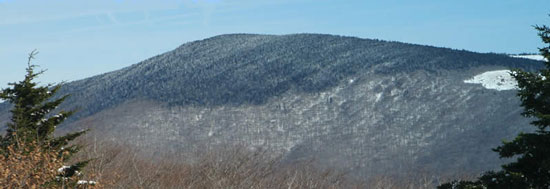 Mount RogersSummit · ~52 min drivePhoto: USDA-FS, Public domain (via Wikimedia Commons)
 Flattop MountainSummit · ~52 min drivePhoto: Mark Clifton, CC BY-SA 2.0 (via Wikimedia Commons)
Best time to visit Little Oak Mountain
Best months: April and June–November. Best months have typical highs of 55–85 °F, lows of 30 °F or warmer (32 °F where the station doesn't record snow), at most one snowy day and no more than 12 wet days.
Jan
45° / 24°
13 wet
Feb
48° / 27°
12 wet
Mar
57° / 33°
13 wet
Apr
68° / 41°
12 wet
May
75° / 50°
13 wet
Jun
82° / 59°
12 wet
Jul
85° / 62°
12 wet
Aug
84° / 61°
11 wet
Sep
79° / 55°
8 wet
Oct
69° / 43°
9 wet
Nov
57° / 33°
10 wet
Dec
48° / 27°
13 wet
Typical high / low (°F) and days with rain or snow, 1991–2020. Measured at Abingdon 3s, VA, 11.4 mi away at 1,925 ft. This station doesn't record snowfall. Source: NOAA NCEI U.S. Climate Normals 1991–2020.
