River Loop
- 1.4 mi
- loop
- 998 ft
- climb
- 2,091 ft
- high point
- Loop
- route
- Apr, Aug–Nov
- best months
Is River Loop open right now?
Closure in the area
There's a closure order in Cherokee National Forest. It doesn't name River Loop, so check the source for the area it covers (2 listed).
Ocoee River Flooding Damage - Nov 5
Agency closure covering Cherokee National Forest · USFS · Cherokee National Forest
Campsite limitations
Agency closure covering Cherokee National Forest · Order 08-04-00-22-180 · USFS · Cherokee National Forest
Emergency road closures due to storm damage
Agency alert covering Cherokee National Forest · USFS · Cherokee National Forest
Roan Mountain Fire Restrictions
Agency alert covering Watauga Ranger District · Order 08-04-06-25-001 · USFS · Watauga Ranger District
As of · Source: USFS · Cherokee National Forest. Agencies don't list every closure — check before you go.
River Loop is a 1.4-mile loop hike in Tennessee, set on city land within the Watauga Ranger District of Cherokee National Forest and the City of Elizabethton. The route rises from about 1,900 feet to a high point of 2,091 feet, with a total elevation gain of 998 feet, and the climb is rolling rather than steep. The steepest stretch comes early, at about 0.18 miles in, with a grade of 15 percent. The most comfortable months for a visit are typically October and May, when typical averages from a nearby weather station in Elizabethton run to highs around 70°F and 77°F, with fewer wet days than the rest of the year. That station sits roughly 600 feet lower than the loop's high point, so temperatures on the trail run cooler. The hike takes about an hour to complete. Pines Loop is just 0.3 miles away, and the Hampton Blueline Trail and the Appalachian Trail are both within about 2 miles. For an overnight stay, Dennis Cove Campground is about 3.6 miles off.
Local outfitters
- Price Lake Boat Rentals26 mi away
- The Speckled Trout Outfitters29 mi away
Not on Roamze yet. Their page has how to reach them.
- Pines LoopHiking0.3 mi
- Hampton Blueline TrailHiking1.2 mi
- Appalachian TrailHiking1.8 mi
- Little Doe RiverCanoeing2 mi
- Rat Branch Boat LaunchPier fishing3.5 mi
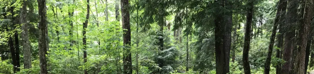 Dennis Cove CampgroundCampingPhoto: Recreation.gov (RIDB) / public domain3.6 mi
- Cardens Bluff CgCamping3.8 mi
- Rail cut #3 - Tweetsie TrailRock climbing7.1 mi
Source: Roamze catalog (indexable pages within 10 miles, PostGIS distance)
 Peg Leg Mine TrailHiking · ~15 min drivePhoto: Idawriter, CC BY-SA 3.0 (via Wikimedia Commons)
- Appalachian TrailHiking · ~5 min drive
- Coon Den Falls TrailHiking · ~5 min drive
- LACY TRAP TRAILHiking · ~9 min drive
- Cloudland TrailHiking · ~15 min drivePhoto: Idawriter, CC BY-SA 3.0 (via Wikimedia Commons)
- POND MOUNTAIN WILDERNESS TRAILHiking · ~10 min drive
- COON DEN FALLSHiking · ~6 min drive
- LITTLE POND MOUNTAINHiking · ~11 min drive
- Hampton Blueline TrailHiking · ~2 min drive
- Appalachian TrailHiking · ~13 min drive
Best time to visit River Loop
Best months: April and August–November. Best months have typical highs of 55–85 °F, lows of 30 °F or warmer (32 °F where the station doesn't record snow), at most one snowy day and no more than 12 wet days.
Jan
46° / 26°
12 wet · 1 snow
Feb
50° / 28°
12 wet · 1 snow
Mar
59° / 34°
13 wet
Apr
69° / 42°
12 wet
May
77° / 52°
13 wet
Jun
83° / 60°
13 wet
Jul
85° / 64°
13 wet
Aug
85° / 62°
12 wet
Sep
80° / 56°
9 wet
Oct
70° / 44°
9 wet
Nov
59° / 33°
11 wet
Dec
50° / 29°
13 wet · 1 snow
Typical high / low (°F) and days with rain or snow, 1991–2020. Measured at Elizabethton, TN, 6.9 mi away at 1,487 ft. The station sits about 600 ft lower than this place, so expect it a little cooler here. Source: NOAA NCEI U.S. Climate Normals 1991–2020.
Map and trail data © OpenStreetMap contributors
