Big Creek
- 4.0 mi
- round trip
- 2,930 ft
- climb
- 3,641 ft
- high point
- Out and back
- route
Caution today
Agency alerts are in effect for this area; weather is good · USFS, OpenWeather · checked 1 h ago
Is Big Creek open right now?
Closure in the area
There's a closure order in Cherokee National Forest. It doesn't name Big Creek, so check the source for the area it covers.
Campsite limitations
Agency closure covering Cherokee National Forest · Order 08-04-00-22-180 · USFS · Cherokee National Forest
Emergency road closures due to storm damage
Agency alert covering Cherokee National Forest · USFS · Cherokee National Forest
As of · Source: USFS · Cherokee National Forest. Agencies don't list every closure — check before you go.
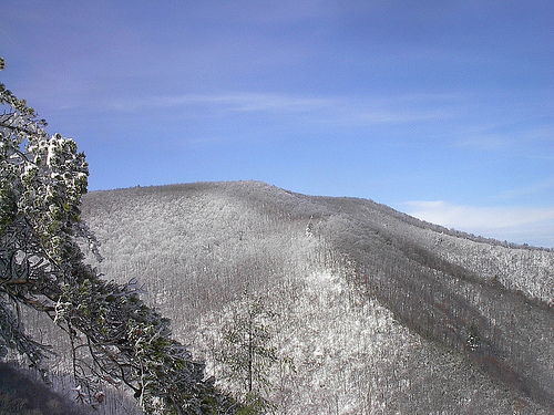
Big Creek is a hard hike in the Big Frog Wilderness, part of the Ocoee Ranger District of Cherokee National Forest in Tennessee. The trail is an out-and-back that reaches 3,641 feet, rising about 1,380 feet from the starting point at 2,348 feet, with a total gain and loss of about 2,930 feet over the full round trip. The route's length is 8 miles, and it takes about 4 hours to complete. The Forest Service manages the land, and the hike lies within designated wilderness. The surrounding area offers several other trails within about a mile of the start, including Big Frog Trail No. 64, Grassy Gap and Yellow Stand Lead Trail No. 78. Thunder Rock Campground sits about 4.4 miles away, and the Ocoee River is about 4.5 miles off.
Keep exploring — more trails worth the drive
 Photo: Ken Lund, CC BY-SA 4.0 (via Wikimedia Commons)
Quartz Loop
~6 min drive
1.69-mile loop in Tennessee with 409 ft gain and 395 ft loss.
Photo: Ken Lund, CC BY-SA 4.0 (via Wikimedia Commons)BOYD GAP BIKE TRAIL
~8 min drive
1.44-mile out-and-back bike trail in Tennessee with 1,059 ft elevation gain.
HIKE
Yellow Stand Lead Trail No. 78
~2 min drive
4.66-mile out-and-back trail in Tennessee with 1,743 ft elevation gain/loss.
HIKE
Licklog Ridge
~4 min drive
5.16-mile out-and-back trail in Tennessee with 6,517 ft elevation gain.
Photo: Ken Lund, CC BY-SA 4.0 (via Wikimedia Commons)RIVERVIEW BIKE TRAIL
~7 min drive
3.33-mile loop bike trail in Tennessee with 958 ft elevation gain.
HIKE
Big Frog Trail No. 64
~2 min drive
3.69-mile out-and-back hike in Tennessee with 1,633 ft gain.
HIKE
Wolf Ridge
~3 min drive
Wolf Ridge is a 2.30-mile point-to-point trail in Tennessee with 910 feet of elevation gain.
HIKE
SYLCO LOOP
~7 min drive
23.02-mile out-and-back trail in Tennessee with 3,605 ft elevation gain
 Photo: Nicolas Raymond from Bethesda, Maryland, USA, CC BY 2.0 (via Wikimedia Commons)
Clemmer Spur Trail
~12 min drive
A 2-mile point-to-point trail offering easy access to Tennessee's natural scenery.
HIKE
Hemp Top
~3 min drive
Hemp Top is a 3.60-mile point-to-point trail in Tennessee with 6,809 ft of elevation gain.

Map and trail data © OpenStreetMap contributors
