
Thunder Rock Campground
Free — you'll pick up right here.
Watch this water
Sign up to watch it — saving subscribes you to gate, closure and report changes.
Tennessee
Thunder Rock Campground
No verdict for this water
We won't guess. Here is exactly what we do and don't know.
What we do know
Inside Cherokee National Forest
2 managing-area boundaries mapped — agency alerts for them feed this page automatically.
Boundary data
What's missing
No access route mapped
We don't yet know which road reaches this trailhead, so we can't tell you if it's gated.
Nobody's filed a report here yet — be the first.
Here's your day on the water, mapped
Thunder Rock Campground
AI-suggested draft · review before you go
Building your full AI plan…
More about this water ↓
Photos
Directions & GPX
Permits & access
- Managing agency
- Forest Service
- Fee
- Standard Electric site fee = $20 per night (or $15 per night with a discount pass)
About this water
Overview Thunder Rock Campground is located 1.8 miles northwest of the Ocoee Whitewater Center, just behind TVA Ocoee Powerhouse Number 3. Nestled alongside the Ocoee River, this facility provides 37 regular campsites for popups and RVs less than 20 feet with no elctricity , ONLY site 9 is an electric site for less than 20 feet at 30 amp, and one group campsite. Thunder Rock is a popular destination for both whitewater and trail enthusiasts. Recreation Trailhead parking is available for the nearby Tanasi trail system, which includes approximately 30 miles of hiking and mountain biking trails. This system can be reached via Thunder Rock Express, Dry Pond Lead, or the Rhododendron Trail. Thunder Rock also provides access to the Benton-McKaye Trail.Facilities Picnic tables, grills, and lantern posts are located at each campsite. Water hydrants are located throughout the campground. Bathhouses provide flush toilets and warm showers. The campground host is located at the campground entrance next to the main bathhouse. Thunder Rock Campground Map and Guide Natural Features The Cherokee National Forest is located in eastern Tennessee and stretches from Chattanooga to Bristol along the North Carolina border. The 650,000-acre swath of land is Tennessee's only national forest. It lies in the heart of the Southern Appalachians and is home to more than 20,000 species of plants and animals, as well as many rivers, creeks and lakes. Nearby Attractions The nearby Ocoee River put-in and Ocoee Whitewater Center, home of the 1996 Olympic Canoe/Kayak-Slalom Competition, makes this an ideal location for rafters and kayakers alike. Charges & Cancellations All sites have a $18.00 cancellation and reservation fee.
Add to a trip & share
Keep exploring — more water worth the drive
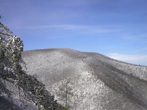
 Photo: Thomson200, CC0 (via Wikimedia Commons)
Toccoa River
~58 min drive
Toccoa River is a 2.3-mile paddling stretch near Suches, Georgia. It flows year-round. USGS models an average flow of about 567 cfs and a gradient of about 72.1 feet per mile. Land along it is managed by the U.S. Forest Service.
Ocoee River Area
~6 min drive
A worthwhile stop near Tennessee.
Apalachia Powerhouse Boat Launch
~13 min drive
Apalachia Powerhouse Boat Launch is a boat launch in Tennessee.
South Chestuee Creek
~26 min drive
South Chestuee Creek is a 7.8-mile paddling stretch near Cleveland, Tennessee. It flows year-round. USGS models an average flow of about 49 cfs and a gradient of about 9.3 feet per mile.
Parksville Lake Rv Campground
~10 min drive
A worthwhile stop near Tennessee.
Hiwassee Ocoee State Park Boat Ramp
~20 min drive
Hiwassee Ocoee State Park Boat Ramp is a boat launch in Tennessee.
Mill Creek
~29 min drive
Mill Creek is a 6.2-mile paddling stretch near Old Fort, Tennessee. It is intermittent and may run dry in some seasons. USGS models an average flow of about 40 cfs and a gradient of about 7.7 feet per mile.
Chilhowee Campground
~15 min drive
A worthwhile stop near Tennessee.
Lakewood Landing Boat Launch
~31 min drive
A worthwhile stop near Georgia.
Ellijay River
~36 min drive
Ellijay River is a 3.3-mile paddling stretch near Ellijay, Georgia. It flows year-round. USGS models an average flow of about 71 cfs and a gradient of about 26.6 feet per mile.
Guided trips nearby
Local operatorsoffering guided trips. You book directly with them — Roamze doesn’t take a cut.
Appalachian Outfitters
Rafting business nearby (~49 mi away) — hasn't claimed their Roamze page yet
