Hemp Top
- 3.6 mi
- one way
- 1,977 ft
- climb
- 4,209 ft
- high point
- Point to point
- route
Is Hemp Top open right now?
Closure in the area
There's a closure order in Cherokee National Forest. It doesn't name Hemp Top, so check the source for the area it covers.
Campsite limitations
Agency closure covering Cherokee National Forest · Order 08-04-00-22-180 · USFS · Cherokee National Forest
Emergency road closures due to storm damage
Agency alert covering Cherokee National Forest · USFS · Cherokee National Forest
As of · Source: USFS · Cherokee National Forest. Agencies don't list every closure — check before you go.
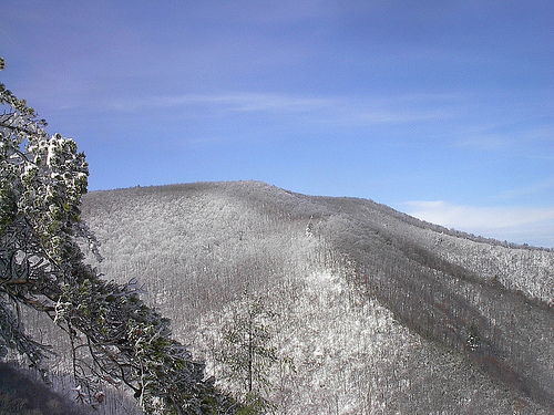
Hemp Top is a 3.6-mile point-to-point hike in Tennessee's Big Frog Wilderness, part of the Ocoee Ranger District of Cherokee National Forest. The route climbs from about 2,200 feet to 4,209 feet, a gain of nearly 2,000 feet, and is rated moderate. The Forest Service manages the land, and the trail is open to both horses and bikes. The hike starts in the wilderness, so plan on a full day. The climb is a steady one, and the high point at 4,209 feet makes this a destination for those looking to reach a significant elevation in the Big Frog. Several other outings sit close by. Big Creek is about 1.6 miles away and Wolf Ridge about 1.9 miles. Grassy Gap is roughly 2.5 miles off, and Thunder Rock Campground, about 5.8 miles away, offers a place to stay.
Keep exploring — more trails worth the drive
 Photo: Ken Lund, CC BY-SA 4.0 (via Wikimedia Commons)
Quartz Loop
~8 min drive
1.69-mile loop in Tennessee with 409 ft gain and 395 ft loss.
Photo: Ken Lund, CC BY-SA 4.0 (via Wikimedia Commons)BOYD GAP BIKE TRAIL
~9 min drive
1.44-mile out-and-back bike trail in Tennessee with 1,059 ft elevation gain.
HIKE
Big Creek
~3 min drive
4-mile out-and-back trail in Tennessee with 1,961 ft elevation gain.
HIKE
Licklog Ridge
~5 min drive
5.16-mile out-and-back trail in Tennessee with 6,517 ft elevation gain.
Photo: Ken Lund, CC BY-SA 4.0 (via Wikimedia Commons)RIVERVIEW BIKE TRAIL
~9 min drive
3.33-mile loop bike trail in Tennessee with 958 ft elevation gain.
HIKE
Rough Ridge
~8 min drive
4.76-mile out-and-back trail in Georgia with 444 ft elevation gain.
HIKE
Wolf Ridge
~3 min drive
Wolf Ridge is a 2.30-mile point-to-point trail in Tennessee with 910 feet of elevation gain.
HIKE
SYLCO LOOP
~8 min drive
23.02-mile out-and-back trail in Tennessee with 3,605 ft elevation gain
HIKE
QUARTZ LOOP BIKE TRAIL
~8 min drive
1.87-mile loop bike trail in Tennessee with 430 ft elevation gain.
HIKE
BLUE RIDGE DIVIDE TRAIL
~8 min drive
5.24-mile out-and-back trail in Tennessee with 1,698 ft elevation gain and loss.

Route details
- Distance
- 3.6 mi
- Climbing
- About 1,977 ft
- Summit
- 3,027 ft
- Difficulty
- Moderate
- Time
- About 4.5 hours
Other routes up Chestnut Mountain
Questions about this route
How long is the Hemp Top on Chestnut Mountain?
About 3.6 mi.
How much elevation gain is on the Hemp Top?
About 1,977 ft of climbing round trip.
How hard is the Hemp Top?
It is rated moderate.
How long does the Hemp Top take?
About 4.5 hours round trip.
How many routes go up Chestnut Mountain?
2: Wolf Ridge and Hemp Top.
Conditions and forecast on Chestnut Mountain
Daily highs and lows, wind and the chance of precipitation at the summit and route start for the next 7 days, from the Open-Meteo model.
Map and trail data © OpenStreetMap contributors
