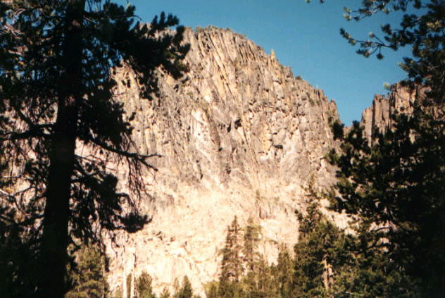
Withers Lake Loop Trail
- 2.0 mi
- loop
- 348 ft
- climb
- 6,531 ft
- high point
- Loop
- route
Is Withers Lake Loop Trail open right now?
No closures listed
The Forest Service lists no closures for Fremont-Winema National Forest.
As of · Source: USFS · Fremont-Winema National Forest. Agencies don't list every closure — check before you go.
Withers Lake Loop Trail is a 2-mile loop hike in Oregon's Fremont-Winema National Forest, within the Paisley Ranger District. The trail is an easy outing with a total climb of 348 feet and a descent of 344 feet over the course of the loop. It sits at about 6,200 feet, with a high point around 6,530 feet, and the steepest stretch comes early in the hike. The trail is natural-surface and not accessible. It stays within the Forest Service's boundaries, and the agency lists no horse or bike access on it. The open season runs from June 1 to October 31, and the hike takes about an hour to complete. Slide Lake Trail lies about 1.6 miles away, and the Hanan-Bear Creek Intertie and Hanan Trail are within about 5 miles. For an overnight base, Marster Spring campground is roughly 6 miles off.
Local outfitters
- Valley View RV Park39 mi away
Not on Roamze yet. Their page has how to reach them.
Keep exploring — more trails worth the drive
 Photo: U.S. Forest Service- Pacific Northwest Region, Public domain (via Wikimedia Commons)
Dead Cow Trail
~16 min drive
3.80-mile out-and-back trail in Oregon with 13 ft gain and 666 ft loss
Photo: U.S. Forest Service- Pacific Northwest Region, Public domain (via Wikimedia Commons)Lakes Loop
~16 min drive
14-mile loop trail in Oregon with 1,412 ft elevation gain.
Photo: U.S. Forest Service- Pacific Northwest Region, Public domain (via Wikimedia Commons)Lakes Loop Tie
~17 min drive
Lakes Loop Tie is a 0.40-mile lollipop trail in Oregon with 149 feet of elevation gain.
HIKE
Dead Horse Rim
~15 min drive
25.26-mile out-and-back trail in Oregon with 2,289 ft elevation gain.
HIKE
Hanan-Bear Creek Intertie
~5 min drive
4.00-mile out-and-back trail in Oregon with 233 ft gain and 898 ft loss.
 Photo: Gary Halvorson, Oregon State Archives, CC BY 4.0 (via Wikimedia Commons)
QUARTZ NORDIC EAST LOOP
~42 min drive
17.4-mile out-and-back trail in Oregon with 2,275 ft elevation gain/loss.
Photo: Gary Halvorson, Oregon State Archives, CC BY 4.0 (via Wikimedia Commons)QUARTZ VALLEY NORDIC LOOP
~42 min drive
3.35-mile loop in Oregon with 467 ft gain and 540 ft loss.
HIKE
Boulder Springs
~29 min drive
4.80-mile out-and-back trail in Oregon with 1,628 ft gain.
HIKE
Spur
~16 min drive
5.36-mile out-and-back trail in Oregon with 706 ft gain
Photo: Gary Halvorson, Oregon State Archives, CC BY 4.0 (via Wikimedia Commons)MAIN TRAIL SOUTH
~43 min drive
27.33-mile point-to-point trail in Oregon with 1,658 ft gain and 6,029 ft max elevation.