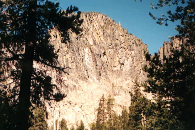
Hanan-Bear Creek Intertie
- 4.0 mi
- round trip
- 1,600 ft
- climb
- 7,398 ft
- high point
- Out and back
- route
Is Hanan-Bear Creek Intertie open right now?
No closures listed
The Forest Service lists no closures for Fremont-Winema National Forest.
As of · Source: USFS · Fremont-Winema National Forest. Agencies don't list every closure — check before you go.
Hanan-Bear Creek Intertie is a 4-mile out-and-back hike in the Paisley Ranger District of the Fremont-Winema National Forest in southern Oregon, managed by the Forest Service. The trail is rated moderate, with a total elevation gain of about 1,600 feet over the round trip. The one-way climb is about 700 feet, and the route reaches a high point of roughly 7,400 feet. The trail is natural-surface and allows horses. It is not an accessible trail. The steepest stretch comes at about 1.2 miles in, where the grade reaches 28 percent. The hike starts near 7,390 feet and ends at a similar elevation, so the climb is roughly balanced with the descent. Nearby, the Hanan Trail lies about 2.7 miles away and the Withers Lake Loop Trail about 3 miles. Slide Lake Trail and Bald Butte Lookout are both about 3.8 miles off.
Local outfitters
- Valley View RV Park41 mi away
Not on Roamze yet. Their page has how to reach them.
Keep exploring — more trails worth the drive
 Photo: U.S. Forest Service- Pacific Northwest Region, Public domain (via Wikimedia Commons)
Dead Cow Trail
~11 min drive
3.80-mile out-and-back trail in Oregon with 13 ft gain and 666 ft loss
Photo: U.S. Forest Service- Pacific Northwest Region, Public domain (via Wikimedia Commons)Lakes Loop
~11 min drive
14-mile loop trail in Oregon with 1,412 ft elevation gain.
Photo: U.S. Forest Service- Pacific Northwest Region, Public domain (via Wikimedia Commons)Lakes Loop Tie
~12 min drive
Lakes Loop Tie is a 0.40-mile lollipop trail in Oregon with 149 feet of elevation gain.
HIKE
Dead Horse Rim
~11 min drive
25.26-mile out-and-back trail in Oregon with 2,289 ft elevation gain.
HIKE
Spur
~11 min drive
5.36-mile out-and-back trail in Oregon with 706 ft gain
 Photo: Gary Halvorson, Oregon State Archives, CC BY 4.0 (via Wikimedia Commons)
QUARTZ NORDIC EAST LOOP
~37 min drive
17.4-mile out-and-back trail in Oregon with 2,275 ft elevation gain/loss.
Photo: Gary Halvorson, Oregon State Archives, CC BY 4.0 (via Wikimedia Commons)QUARTZ VALLEY NORDIC LOOP
~37 min drive
3.35-mile loop in Oregon with 467 ft gain and 540 ft loss.
HIKE
Boulder Springs
~24 min drive
4.80-mile out-and-back trail in Oregon with 1,628 ft gain.
HIKE
QUARTZ NORDIC NORTH LOOP
~38 min drive
9.56-mile out-and-back trail in Oregon with 1,366 ft elevation gain and loss.
Photo: Gary Halvorson, Oregon State Archives, CC BY 4.0 (via Wikimedia Commons)MAIN TRAIL SOUTH
~38 min drive
27.33-mile point-to-point trail in Oregon with 1,658 ft gain and 6,029 ft max elevation.