South Ridge
- 0.5 mi
- round trip
- 331 ft
- climb
- 3,465 ft
- high point
- Out and back
- route
- Apr–Jun, Sep–Oct
- best months
South Ridge is a short, easy out-and-back hike in central Oregon, about 1.5 miles from the town of Prineville. The trail is just under a mile long, with a total elevation gain of about 330 feet, and it reaches a high point of 3,465 feet. The climb is front-loaded, with the steepest stretch coming within the first 0.14 miles at a grade of about 21 percent. The most comfortable months for a visit are typically late spring and early fall. Typical averages from a nearby weather station in Prineville show May highs around 69°F and September highs around 79°F, while July and August average in the mid-80s. That station sits roughly 600 feet lower than the trail's high point, so temperatures on the ridge run a little cooler. The hike takes about half an hour to complete. Barnes Butte, a climbing area, is just 0.2 miles away, and the Wetlands Trail is about a mile off. The Grade Trail and Green Mountain Trail are both within 10 miles.
Local outfitters
- Nighthawk Naturalist School30 mi away
- ULLR Backcountry30 mi away
Not on Roamze yet. Their page has how to reach them.
- Barnes ButteRock climbing0.2 mi
- Wetlands TrailHiking1 mi
- The Grade TrailHiking2.5 mi
- Green Mountain TrailHiking7.8 mi
Source: Roamze catalog (indexable pages within 10 miles, PostGIS distance)
 Steins PillarHiking · ~19 min drivePhoto: U.S. Forest Service- Pacific Northwest Region, Public domain (via Wikimedia Commons)
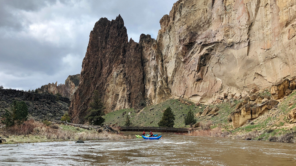 Homestead TrailHiking · ~28 min drivePhoto: Northwest Rafting Company, CC BY 2.0 (via Flickr)
- Giddy-Up-GoHiking · ~18 min drivePhoto: U.S. Forest Service- Pacific Northwest Region, Public domain (via Wikimedia Commons)
- Green Mountain TrailHiking · ~13 min drive
 Jasper Point TrailHiking · ~24 min drivePhoto: Erin from Oregon City, OR, CC BY 2.0 (via Wikimedia Commons)
 Rope-de-Dope TrailHiking · ~28 min drivePhoto: Kris Arnold from New York, USA, CC BY-SA 2.0 (via Wikimedia Commons)
- Cole Loop Trail #854Hiking · ~27 min drive
- Cole Loop Trail #854Hiking · ~27 min drive
 Grey Butte TrailHiking · ~26 min drivePhoto: Robert Ashworth from Bellingham, WA., USA, CC BY 2.0 (via Wikimedia Commons)
- Wolf Tree TrailHiking · ~28 min drivePhoto: Robert Ashworth from Bellingham, WA., USA, CC BY 2.0 (via Wikimedia Commons)
Also worth it near here
- Lower Crooked River Back Country BywayScenic drive · ~3 min drive
 Ochoco CreekCanoeing · ~18 min drivePhoto: Finetooth, CC BY-SA 3.0 (via Wikimedia Commons)
- Grizzly MountainSummit · ~18 min drive
 Steins OverlookRock climbing · ~20 min drivePhoto: U.S. Forest Service- Pacific Northwest Region, Public domain (via Wikimedia Commons)
Best time to visit South Ridge
Best months: April–June and September–October. Best months have typical highs of 55–85 °F, lows of 30 °F or warmer (32 °F where the station doesn't record snow), at most one snowy day and no more than 12 wet days.
Jan
43° / 25°
9 wet
Feb
48° / 26°
7 wet
Mar
55° / 29°
8 wet
Apr
60° / 33°
8 wet
May
69° / 40°
7 wet
Jun
76° / 45°
5 wet
Jul
87° / 49°
3 wet
Aug
86° / 48°
2 wet
Sep
79° / 42°
3 wet
Oct
65° / 34°
6 wet
Nov
51° / 29°
8 wet
Dec
42° / 24°
8 wet
Typical high / low (°F) and days with rain or snow, 1991–2020. Measured at Prineville, OR, 1.7 mi away at 2,876 ft. The station sits about 600 ft lower than this place, so expect it a little cooler here. This station doesn't record snowfall. Source: NOAA NCEI U.S. Climate Normals 1991–2020.
Map and trail data © OpenStreetMap contributors
