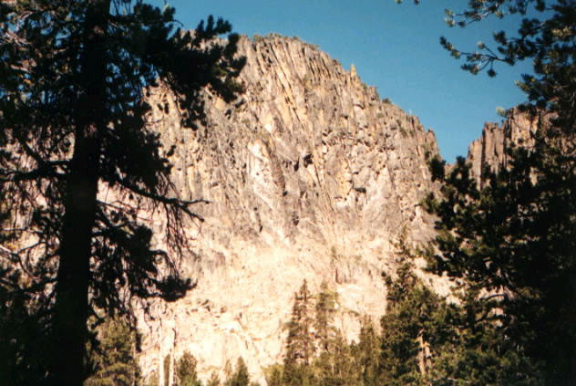
Slide Lake Trail
- 0.6 mi
- round trip
- 136 ft
- climb
- 5,976 ft
- high point
- Out and back
- route
- May–Oct
- best months
Is Slide Lake Trail open right now?
No closures listed
The Forest Service lists no closures for Fremont-Winema National Forest.
As of · Source: USFS · Fremont-Winema National Forest. Agencies don't list every closure — check before you go.
Slide Lake Trail is a short, easy out-and-back hike in the Paisley Ranger District of Oregon's Fremont-Winema National Forest, about 0.6 miles long with a total elevation gain of 136 feet. The trailhead is named Slide Lake Trailhead, and the Forest Service manages the land. The route is front-loaded, with the steepest stretch at about 0.23 miles in, where the grade reaches 10 percent. The high point is 5976 feet, and the trail starts at 5929 feet. The natural-surface trail is open from June 1 to October 31, and the trip takes about half an hour. The trail is accessible to horses and bikes. It is not an accessible trail, according to the Forest Service's accessibility status. Summer is the most comfortable time to go. Typical averages from a nearby weather station in Paisley, which sits about 1,600 feet lower, show July highs around 85°F and lows near 49°F. Winter is cold, with January highs around 43°F and lows near 22°F. Withers Lake Loop Trail is about 1.6 miles away, and Hanan-Bear Creek Intertie is about 3.8 miles away. For an overnight stay, Bald Butte Lookout is about 6.6 miles away, and Chewaucan Crossing is about 8.2 miles away.
Local outfitters
- Valley View RV Park37 mi away
Not on Roamze yet. Their page has how to reach them.
Best time to go · May–Oct
Best time to visit Slide Lake Trail
Best months: May–October. Best months have typical highs of 55–85 °F, lows of 30 °F or warmer (32 °F where the station doesn't record snow), at most one snowy day and no more than 12 wet days.
Jan
43° / 22°
Feb
46° / 25°
Mar
52° / 28°
Apr
58° / 31°
May
67° / 39°
Jun
75° / 44°
Jul
85° / 49°
Aug
84° / 47°
Sep
77° / 40°
Oct
64° / 32°
Nov
49° / 26°
Dec
40° / 21°
Typical high / low (°F) and days with rain or snow, 1991–2020. Measured at Paisley, OR, 9.4 mi away at 4,360 ft. The station sits about 1,600 ft lower than this place, so expect it a little cooler here. This station doesn't record snowfall. Source: NOAA NCEI U.S. Climate Normals 1991–2020.
Keep exploring — more trails worth the drive
 Photo: U.S. Forest Service- Pacific Northwest Region, Public domain (via Wikimedia Commons)
Lakes Loop
~17 min drive
14-mile loop trail in Oregon with 1,412 ft elevation gain.
Photo: U.S. Forest Service- Pacific Northwest Region, Public domain (via Wikimedia Commons)Lakes Loop Tie
~18 min drive
Lakes Loop Tie is a 0.40-mile lollipop trail in Oregon with 149 feet of elevation gain.
Photo: U.S. Forest Service- Pacific Northwest Region, Public domain (via Wikimedia Commons)Dead Cow Trail
~17 min drive
3.80-mile out-and-back trail in Oregon with 13 ft gain and 666 ft loss
HIKE
Dead Horse Rim
~16 min drive
25.26-mile out-and-back trail in Oregon with 2,289 ft elevation gain.
 Photo: Gary Halvorson, Oregon State Archives, CC BY 4.0 (via Wikimedia Commons)
QUARTZ NORDIC EAST LOOP
~44 min drive
17.4-mile out-and-back trail in Oregon with 2,275 ft elevation gain/loss.
Photo: Gary Halvorson, Oregon State Archives, CC BY 4.0 (via Wikimedia Commons)QUARTZ VALLEY NORDIC LOOP
~43 min drive
3.35-mile loop in Oregon with 467 ft gain and 540 ft loss.
HIKE
Hanan-Bear Creek Intertie
~6 min drive
4.00-mile out-and-back trail in Oregon with 233 ft gain and 898 ft loss.
HIKE
Boulder Springs
~30 min drive
4.80-mile out-and-back trail in Oregon with 1,628 ft gain.
Photo: Gary Halvorson, Oregon State Archives, CC BY 4.0 (via Wikimedia Commons)MAIN TRAIL SOUTH
~45 min drive
27.33-mile point-to-point trail in Oregon with 1,658 ft gain and 6,029 ft max elevation.
 Photo: ex_magician, CC BY 2.0 (via Flickr)
Sprague River Trail
~44 min drive
0.86-mile out-and-back hike along the Sprague River in Oregon.