Crooked River Ranch RV Park
Campground
Campground · 3.6 mi from the trail
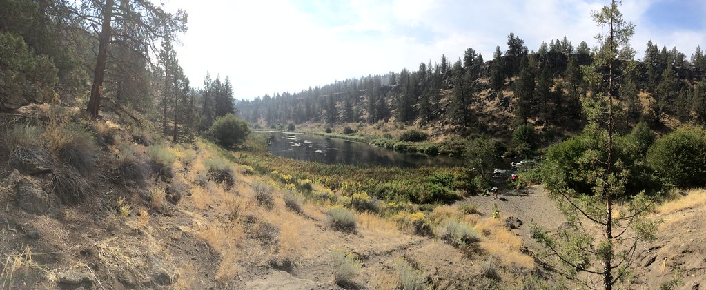 Photo: BLM Oregon & Washington, CC BY 2.0 (via Flickr)
Caution at last check
Agency alerts are in effect for this area; weather is good · USFS, OpenWeather · checked 14 h ago
Closure in the area
There's a closure order in Ochoco National Forest. It doesn't name Shelf Trail, so check the source for the area it covers.
Rowe Creek Complex Emergency Closure Order
Agency closure covering Ochoco National Forest · Order 06-07-26-04 · USFS · Ochoco National Forest
Blue-Green Algae Information
Agency alert covering Ochoco National Forest · USFS · Ochoco National Forest
Prescribed Fire information
Agency alert covering Ochoco National Forest · USFS · Ochoco National Forest
As of · Source: USFS · Ochoco National Forest. Agencies don't list every closure — check before you go.
Shelf Trail is a short, easy hike on Bureau of Land Management land in central Oregon, about 0.66 miles long. It lies within the Crooked River National Grassland and Ochoco National Forest, on the Prineville Deschutes Field Office of the BLM. The trail is an out-and-back with a total climb of 410 feet, reaching about 2,573 feet. The steepest part comes at about 0.6 miles, where the grade reaches 26 percent. The trail has a natural surface, and bikes and horses are not allowed. For comfortable weather, aim for late spring or early fall. Typical averages from a nearby weather station show May highs around 69°F and September highs around 79°F, with July and August climbing into the upper 80s. Nearby, Steelhead Falls - Trail System is about 1.5 miles away and Folley Waters Trail about 2 miles. For an overnight, Whychus Crossing campground is about 10 miles away.
Crooked River Ranch RV Park
Campground
Sisters Museum
Museum
Places © OpenStreetMap contributors
More in SistersNot on Roamze yet. Their page has how to reach them.
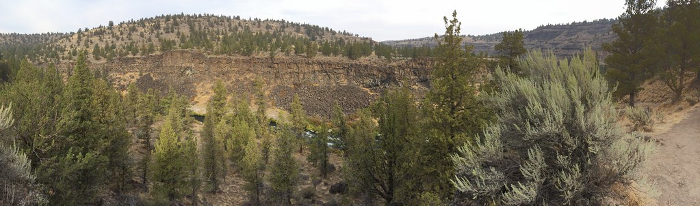 Steelhead Falls - Trail SystemHikingPhoto: BLM Oregon & Washington, CC BY 2.0 (via Flickr)1.5 mi
 Folley Waters TrailHikingPhoto: BLM Oregon & Washington, CC BY 2.0 (via Flickr)2 mi
 South Shore Group CampgroundCampingPhoto: Recreation.gov (RIDB) / public domain9.1 mi
 (t) Kiss of the Lepers ButtressRock climbingPhoto: Jordan Beard, CC BY-SA 4.0 (via Wikimedia Commons)9.2 mi
 (n) Snake RockRock climbingPhoto: Theoweesnerpdx, CC BY-SA 4.0 (via Wikimedia Commons)9.2 mi
Source: Roamze catalog (indexable pages within 10 miles, PostGIS distance)
Steelhead Falls - Trail SystemHiking · ~3 min drivePhoto: BLM Oregon & Washington, CC BY 2.0 (via Flickr) Tam-A-LauHiking · ~12 min drivePhoto: Ian Poellet, CC BY-SA 3.0 (via Wikimedia Commons)Crooked River Rim TrailHiking · ~14 min drivePhoto: Ian Poellet, CC BY-SA 3.0 (via Wikimedia Commons)Folley Waters TrailHiking · ~3 min drivePhoto: BLM Oregon & Washington, CC BY 2.0 (via Flickr)
 Mesa Verde TrailHiking · ~16 min drivePhoto: lamblukas, CC BY 2.0 (via Flickr)
 Summit TrailHiking · ~15 min drivePhoto: Robert Ashworth from Bellingham, WA., USA, CC BY 2.0 (via Wikimedia Commons)
Also worth it near here
 Steelhead Falls TrailMountain biking · ~3 min drivePhoto: Michael Campbell; Bureau of Land Management Oregon and Washington, Public domain (via Wikimedia Commons)(t) Kiss of the Lepers ButtressRock climbing · ~16 min drivePhoto: Jordan Beard, CC BY-SA 4.0 (via Wikimedia Commons)
Best months: May–June and September–October. Best months have typical highs of 55–85 °F, lows of 30 °F or warmer (32 °F where the station doesn't record snow), at most one snowy day and no more than 12 wet days.
Jan
44° / 25°
9 wet
Feb
48° / 25°
7 wet
Mar
55° / 28°
8 wet
Apr
60° / 31°
8 wet
May
69° / 38°
8 wet
Jun
77° / 43°
5 wet
Jul
88° / 48°
3 wet
Aug
87° / 47°
3 wet
Sep
79° / 41°
4 wet
Oct
65° / 33°
6 wet
Nov
51° / 28°
8 wet
Dec
42° / 23°
9 wet
Typical high / low (°F) and days with rain or snow, 1991–2020. Measured at Redmond Roberts Fld, OR, 14.7 mi away at 3,043 ft. This station doesn't record snowfall. Source: NOAA NCEI U.S. Climate Normals 1991–2020.
