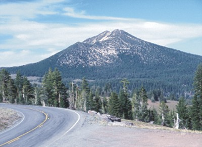
Mount Scott Trail
 Photo: Wsultzbach, Public domain (via Wikimedia Commons)
- 2.2 mi
- round trip
- 1,972 ft
- climb
- 8,922 ft
- high point
- Out and back
- route
Is Mount Scott Trail open right now?
Closure in the area
There's a closure order in Crater Lake National Park. It doesn't name Mount Scott Trail, so check the source for the area it covers (2 listed).
Rim Drive and North Entrance Road are CLOSED for the Season.
Park closure covering Crater Lake National Park · NPS · Crater Lake National Park
Cleetwood Cove Trail is CLOSED for Rehabilitation
Park closure covering Crater Lake National Park · NPS · Crater Lake National Park
As of · Source: NPS · Crater Lake National Park. Agencies don't list every closure — check before you go.
Mount Scott Trail is a moderate hike in Crater Lake National Park in Oregon, managed by the National Park Service. The trail is about 2.2 miles long, with a total elevation gain of 1,236 feet one way. The full out-and-back route is roughly 4.4 miles, and the climb reaches a high point of about 8,922 feet. The steepest part of the trail comes at about the 1-mile mark, where the grade reaches 23%. The trail starts at an elevation of about 7,684 feet and ends at a similar low point of about 7,673 feet, so the round trip adds up to about 1,972 feet of total gain and loss. A fee is charged for the hike, according to the National Park Service. Plaikni Falls Trail is about 2.4 miles away, and Scott Creek is about 3 miles away. Crater Lake Bouldering is about 3.5 miles away, and Cleetwood Cove Trail is about 4.4 miles away.
Local outfitters
- Diamond Lake Resort15 mi away
- Sky Lakes Wilderness Adventures26 mi away
Not on Roamze yet. Their page has how to reach them.
Keep exploring — more trails worth the drive
 Photo: inkknife_2000 (7.5 million views +), CC BY-SA 2.0 (via Wikimedia Commons)
Plaikni Falls Trail
~4 min drive
1.01-mile out-and-back hike to Plaikni Falls in Oregon with 372 ft of elevation gain.
 Photo: Šarūnas Burdulis from USA, CC BY-SA 2.0 (via Wikimedia Commons)
Discovery Point Trail
~10 min drive
2.14-mile out-and-back hike in Oregon with 1,850 ft elevation gain and loss.
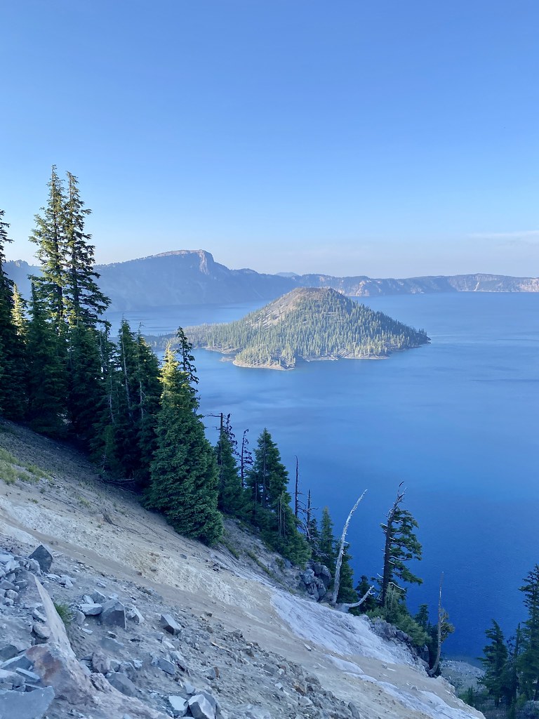 Photo: w_lemay, CC BY-SA 2.0 (via Flickr)
Rim Trail
~12 min drive
8.04-mile out-and-back trail in Oregon with 800 ft gain and 2,655 ft loss.
HIKE
Bald Crater Loop Trail
~22 min drive
13.38-mile out-and-back trail in Oregon with 1,243 ft elevation gain and loss.
 Photo: Greg Willis from Denver, CO, usa, CC BY-SA 2.0 (via Wikimedia Commons)
Sun Notch Trail
~7 min drive
0.67-mile loop trail in Oregon with 317 ft gain.
 Photo: Greg Willis from Denver, CO, usa, CC BY-SA 2.0 (via Wikimedia Commons)
Dutton Creek Trail
~13 min drive
4.76-mile out-and-back hike in Oregon with 1,223 ft elevation gain
HIKE
Pct - Oregon Section D
~20 min drive
59.08-mile point-to-point trail in Oregon with 5,859 ft gain and 6,673 ft loss.
HIKE
Mckie Camp
~25 min drive
11.76-mile out-and-back trail in Oregon with 1,132 ft elevation gain.
 Photo: Greg Willis, CC BY-SA 3.0 (via Wikimedia Commons)
Cleetwood Cove Trail
~8 min drive
0.97-mile point-to-point trail in Oregon with 736 ft elevation gain.
 Photo: Krystal.Hamlin, CC BY 2.0 (via Flickr)
Annie Creek Canyon Trail
~14 min drive
2.14-mile out-and-back hike in Annie Creek Canyon, Oregon with 845 ft gain.

Route details
- Distance
- 2.2 mi round trip
- Climbing
- About 1,972 ft
- Starts at
- Mount Scott Trailhead (about 7,682 ft)
- Summit
- 8,927 ft
- Difficulty
- Moderate
- Time
- About 1.5 hours
Questions about this route
How long is the Mount Scott Trail on Mount Scott?
About 2.2 mi round trip from Mount Scott Trailhead (about 7,682 ft).
How much elevation gain is on the Mount Scott Trail?
About 1,972 ft of climbing round trip.
How hard is the Mount Scott Trail?
It is rated moderate.
Where does the Mount Scott Trail start?
Mount Scott Trailhead (about 7,682 ft).
How long does the Mount Scott Trail take?
About 1.5 hours round trip.
Conditions and forecast on Mount Scott
Daily highs and lows, wind and the chance of precipitation at the summit and route start for the next 7 days, from the Open-Meteo model.
Map and trail data © OpenStreetMap contributors
