Jokulhlaup
 Photo: U.S. Forest Service- Pacific Northwest Region, Public domain (via Wikimedia Commons)
- 2.0 mi
- round trip
- 895 ft
- climb
- 534 ft
- high point
- Out and back
- route
- Apr–Oct
- best months
Is Jokulhlaup open right now?
Alert in the area
The Forest Service lists an alert for Columbia River Gorge National Scenic Area.
Eagle Creek Fire Area Closure - CRGNSA and Mt. Hood
Agency alert covering Columbia River Gorge National Scenic Area · Order 06-22-01-26-04 · USFS · Columbia River Gorge National Scenic Area
As of · Source: USFS · Columbia River Gorge National Scenic Area. Agencies don't list every closure — check before you go.
Jokulhlaup is a short, easy hike in the Columbia River Gorge National Scenic Area in Oregon, managed by the Forest Service. The route is about 2 miles long, with a one-way climb of 286 feet from a low point of 264 feet to a high of 534 feet. The steepest stretch comes early, at about 14% grade, but the rest of the trail is gentle. Summer is the most comfortable time to go. Typical averages from a nearby weather station in Cascade Locks show July highs around 80°F and lows near 56°F, while winter highs sit in the low 40s. Pandion Drift and Buteo Drop are both within a third of a mile, and Wyeth Campground is about 2 miles away. Herman Creek, a canoeing spot, is roughly 3 miles off.
Local outfitters
- Bike the Gorge4 mi away
- Horseback Riding Adventures Oregon38 mi away
Not on Roamze yet. Their page has how to reach them.
Best time to go · Apr–Oct
Best time to visit Jokulhlaup
Best months: April–October. Best months have typical highs of 55–85 °F, lows of 30 °F or warmer (32 °F where the station doesn't record snow), at most one snowy day and no more than 12 wet days.
Jan
42° / 33°
Feb
48° / 34°
Mar
54° / 36°
Apr
61° / 41°
May
68° / 47°
Jun
73° / 52°
Jul
80° / 56°
Aug
82° / 57°
Sep
76° / 51°
Oct
63° / 45°
Nov
50° / 39°
Dec
43° / 33°
Typical high / low (°F) and days with rain or snow, 1991–2020. Measured at Cascade Locks, OR, 2.9 mi away at 142 ft. This station doesn't record snowfall. Source: NOAA NCEI U.S. Climate Normals 1991–2020.
Keep exploring — more trails worth the drive
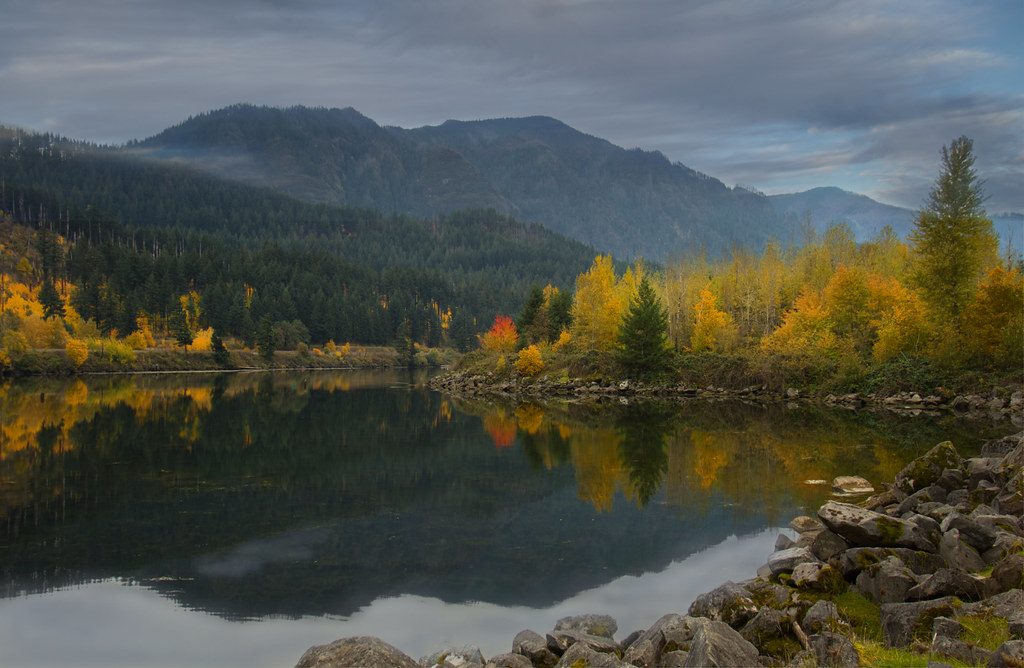 Photo: Bonnie Moreland (free images), Public Domain Mark (via Flickr)
Pandion Drift
Next door
0.72-mile out-and-back trail in Oregon with 122 ft of elevation gain.
Photo: Bonnie Moreland (free images), Public Domain Mark (via Flickr)Talus Ridge
~1 min drive
1.90-mile out-and-back trail in Oregon with 847 ft elevation gain
 Photo: Forest Service Pacific Northwest Region, Public Domain Mark (via Flickr)
Gorton Creek
~2 min drive
8.90-mile out-and-back trail in Oregon with 4,207 ft elevation gain.
 Photo: inkknife_2000 (7.5 million views +), CC BY-SA 2.0 (via Wikimedia Commons)
Pct - Washington Section H
~8 min drive
Pct - Washington Section H is a 144.23-mile point-to-point trail in Oregon.
Photo: Forest Service Pacific Northwest Region, Public Domain Mark (via Flickr)Buteo Drop
Next door
1.56-mile out-and-back trail in Oregon with 256 ft elevation gain.
Photo: Forest Service Pacific Northwest Region, Public Domain Mark (via Flickr)Peregrination
~1 min drive
3.72-mile out-and-back trail in Oregon with 518 ft gain
Photo: U.S. Forest Service- Pacific Northwest Region, Public domain (via Wikimedia Commons)Nick Eaton
~2 min drive
8.20-mile out-and-back trail in Oregon with 3,412 ft elevation gain.
 Photo: mjfmjfmjf, CC BY 2.0 (via Flickr)
Diluvian Tie
~1 min drive
0.62-mile out-and-back trail in Oregon with 50 ft of elevation gain.
Photo: inkknife_2000 (7.5 million views +), CC BY-SA 2.0 (via Wikimedia Commons)Gorge Trail
~7 min drive
9.14-mile point-to-point trail in Oregon with 3,084 ft gain.
Photo: U.S. Forest Service- Pacific Northwest Region, Public domain (via Wikimedia Commons)Herman Creek
~3 min drive
Scenic out-and-back climb along Herman Creek in the Columbia River Gorge.
Also worth it near here
