Island Meadow Trail
 Photo: maprik, CC BY 2.0 (via Flickr)
- 1.0 mi
- round trip
- 294 ft
- climb
- 5,240 ft
- high point
- Out and back
- route
- May–Sep
- best months
Is Island Meadow Trail open right now?
Closure in the area
There's a closure order in Deschutes National Forest. It doesn't name Island Meadow Trail, so check the source for the area it covers (3 listed).
West Bend Area Trail Closures
Agency closure covering Deschutes National Forest · USFS · Deschutes National Forest
West Bend IRSC- Area, Road and Trail Closure
Agency closure covering Bend/Fort Rock Ranger District · Order 06-01-01-26-03 · USFS · Bend/Fort Rock Ranger District
Cabin Butte Area Closure
Agency closure covering Bend/Fort Rock Ranger District · Order 06-01-01-26-01 · USFS · Bend/Fort Rock Ranger District
Camping & Campfire Restrictions Forest Order
Agency alert covering Deschutes National Forest · Order 06-01-26-01 · USFS · Deschutes National Forest
Cave Resource Protection Forest Order
Agency alert covering Deschutes National Forest · Order 06-01-26-02 · USFS · Deschutes National Forest
As of · Source: USFS · Deschutes National Forest. Agencies don't list every closure — check before you go.
Island Meadow Trail is an easy hike of about 1.9 miles in the Three Sisters Wilderness, within the Bend/Fort Rock Ranger District of Oregon's Deschutes National Forest. The Forest Service manages the land. The route starts and ends at about 5,240 feet, and the total climb of 294 feet is a back-loaded out-and-back, with the steepest stretch at the start. The trail is short and gentle, so you can fit it in as a quick outing. Summer is the most comfortable time to go. Typical averages from a nearby weather station show July highs around 83°F with only about three wet days, while winter months bring highs near 40°F and roughly 13 wet days. That station sits several hundred feet below the trail, so temperatures here run cooler. The trip takes about an hour. Elk Lake Campground and Horse Lake Trail #2 are both within a mile. Horse Lake Trail and Elk Lake lie a little farther out.
Local outfitters
- Horse Creek Lodge & Outfitters21 mi away
- Patio RV Park23 mi away
Not on Roamze yet. Their page has how to reach them.
- Horse Lake Trail #2HikingPhoto: maprik, CC BY 2.0 (via Flickr)0.7 mi
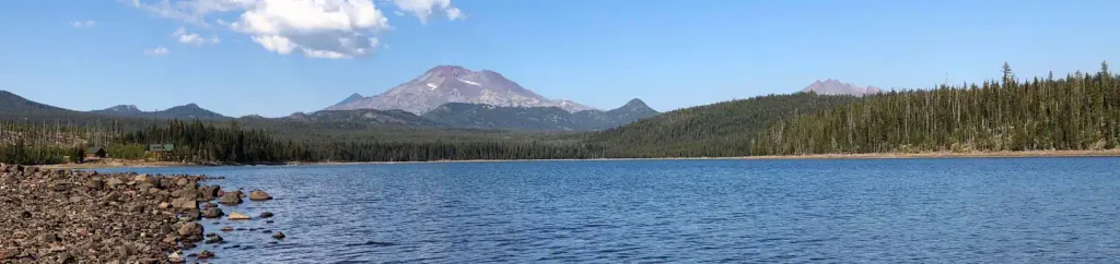 Elk Lake CampgroundCampingPhoto: Recreation.gov (RIDB) / public domain0.9 mi
- Horse Lake TrailHiking0.9 mi
- PointCamping1.4 mi
 Elk LakeHikingPhoto: David Doan, CC BY-SA 3.0 (via Wikimedia Commons)1.6 mi
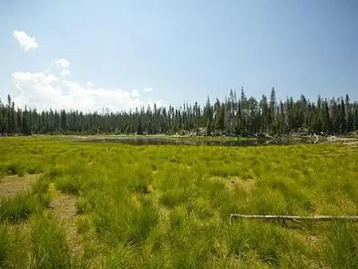 Little Fawn CampgroundCampingPhoto: Recreation.gov (RIDB) / public domain2 mi
- Hosmer LakeLake fishing2.4 mi
 Horse CreekCanoeingPhoto: James B. Norman and Murray Stone, Photographers, Public domain (via Wikimedia Commons)8.7 mi
Source: Roamze catalog (indexable pages within 10 miles, PostGIS distance)
- Horse Lake Trail #2Hiking · ~1 min drivePhoto: maprik, CC BY 2.0 (via Flickr)
- Six LakesHiking · ~4 min drivePhoto: David Doan, CC BY-SA 3.0 (via Wikimedia Commons)
 Quinn CreekHiking · ~4 min drivePhoto: David Doan, CC BY-SA 3.0 (via Wikimedia Commons)
- Horse Creek Trail #3514Hiking · ~4 min drive
- Quinn SpringsHiking · ~4 min drivePhoto: David Doan, CC BY-SA 3.0 (via Wikimedia Commons)
- Katsuk PondHiking · ~4 min drivePhoto: David Doan, CC BY-SA 3.0 (via Wikimedia Commons)
 AppaloosaHiking · ~7 min drivePhoto: Forest Service Pacific Northwest Region, Public Domain Mark (via Flickr)
- QUINN CREEKHiking · ~5 min drivePhoto: David Doan, CC BY-SA 3.0 (via Wikimedia Commons)
 South Sister ClimberHiking · ~8 min drivePhoto: Bonnie Moreland (free images), Public Domain Mark (via Flickr)
 Ray Atkeson MemorialHiking · ~8 min drivePhoto: Forest Service Pacific Northwest Region, Public Domain Mark (via Flickr)
Best time to visit Island Meadow Trail
Best months: May–September. Best months have typical highs of 55–85 °F, lows of 30 °F or warmer (32 °F where the station doesn't record snow), at most one snowy day and no more than 12 wet days.
Jan
40° / 21°
13 wet
Feb
43° / 22°
11 wet
Mar
48° / 26°
12 wet
Apr
54° / 30°
10 wet
May
63° / 36°
9 wet
Jun
71° / 42°
6 wet
Jul
83° / 47°
3 wet
Aug
82° / 46°
3 wet
Sep
75° / 38°
4 wet
Oct
62° / 31°
8 wet
Nov
46° / 26°
11 wet
Dec
38° / 21°
13 wet
Typical high / low (°F) and days with rain or snow, 1991–2020. Measured at Wickiup Dam, OR, 21.8 mi away at 4,358 ft. The station sits about 900 ft lower than this place, so expect it a little cooler here. This station doesn't record snowfall. Source: NOAA NCEI U.S. Climate Normals 1991–2020.

Map and trail data © OpenStreetMap contributors
