Flatiron Rock Trail
- 4.7 mi
- round trip
- 639 ft
- climb
- 3,744 ft
- high point
- Out and back
- route
- Apr–Oct
- best months
Flatiron Rock Trail is a 4.7-mile moderate hike in Oregon's Oregon Badlands Wilderness, on Bureau of Land Management land within the Prineville Deschutes Field Office. The trail is an out-and-back, about 9.4 miles long, with a total elevation gain of 639 feet and a high point of 3,744 feet. It starts at roughly 3,628 feet, and the steepest section comes at about 4.4 miles in, with a grade of 27 percent. The most comfortable months for a visit are typically June through September, when typical averages from a nearby weather station in Bend show highs in the mid-70s to low 80s and only two or three wet days a month. Winters are cold, with January highs around 43°F and several snow days each month. Horses are allowed, and the trail's natural surface suits them. Bikes are not. The trail is open year-round, and the trip takes about 3.5 hours. Homestead Trail lies just 0.1 mile away, and Ancient Juniper Trail is about half a mile off. Climbers can find Castle about 1.3 miles away, and Badlands Rock Trail is a similar distance.
Local outfitters
- Wanderlust Tours14 mi away
- ULLR Backcountry15 mi away
Not on Roamze yet. Their page has how to reach them.
- Homestead TrailHiking0.1 mi
- Ancient Juniper TrailHiking0.5 mi
 CastleRock climbingPhoto: Bureau of Land Management Oregon and Washington from Portland, America, Public domain (via Wikimedia Commons)1.3 mi
- Badlands Rock TrailHiking1.3 mi
- The Castle TrailHiking1.3 mi
- social trailHiking1.3 mi
 Dry River TrailHikingPhoto: Bureau of Land Management Oregon and Washington, Public domain (via Wikimedia Commons)1.5 mi
- The Drive InRock climbing2 mi
Source: Roamze catalog (indexable pages within 10 miles, PostGIS distance)
- Dry River TrailHiking · ~3 min drivePhoto: Bureau of Land Management Oregon and Washington, Public domain (via Wikimedia Commons)
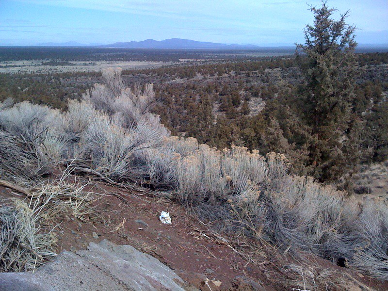 Escape from MoscowHiking · ~3 min drivePhoto: Sapphireblue, CC BY 2.0 (via Flickr)
 Tumulus TrailHiking · ~7 min drivePhoto: Bureau of Land Management Oregon and Washington, Public domain (via Wikimedia Commons)
- Swamp Wells Trail Number 61Hiking · ~19 min drive
- ParkwayHiking · ~3 min drivePhoto: Sapphireblue, CC BY 2.0 (via Flickr)
 Sand Lily TrailHiking · ~5 min drivePhoto: Bureau of Land Management Oregon and Washington, Public domain (via Wikimedia Commons)
- Oregon Desert TrailHiking · ~9 min drive
- Mazama Ash TrailHiking · ~5 min drivePhoto: Bureau of Land Management Oregon and Washington, Public domain (via Wikimedia Commons)
- Ancient Juniper TrailHiking · Next door
- Coyote LoopHiking · ~17 min drive
Best time to visit Flatiron Rock Trail
Best months: April–October. Best months have typical highs of 55–85 °F, lows of 30 °F or warmer (32 °F where the station doesn't record snow), at most one snowy day and no more than 12 wet days.
Jan
43° / 25°
9 wet · 4 snow
Feb
46° / 24°
7 wet · 3 snow
Mar
52° / 28°
6 wet · 1 snow
Apr
58° / 31°
6 wet · 1 snow
May
66° / 37°
5 wet
Jun
74° / 42°
4 wet
Jul
84° / 49°
2 wet
Aug
83° / 48°
2 wet
Sep
76° / 41°
2 wet
Oct
63° / 34°
4 wet
Nov
49° / 28°
7 wet · 2 snow
Dec
41° / 23°
8 wet · 4 snow
Typical high / low (°F) and days with rain or snow, 1991–2020. Measured at Bend, OR, 13.6 mi away at 3,660 ft. Source: NOAA NCEI U.S. Climate Normals 1991–2020.
