Calamut Way
- 4.5 mi
- round trip
- 1,961 ft
- climb
- 5,159 ft
- high point
- Out and back
- route
- Jun–Oct
- best months
Caution at last check
Agency alerts are in effect for this area; weather is good · USFS, OpenWeather · checked 23 h ago
Is Calamut Way open right now?
Alert in the area
The Forest Service lists 5 alerts for Diamond Lake Ranger District.
Fall Prescribed Burning
Agency alert covering Diamond Lake Ranger District · USFS · Diamond Lake Ranger District
Fall Prescribed Burning
Agency alert covering Umpqua National Forest · USFS · Umpqua National Forest
Poole Creek Campground Closed for the 2026 Season
Agency alert covering Umpqua National Forest · USFS · Umpqua National Forest
National Forest Service Road 28 Roadwork
Agency alert covering Umpqua National Forest · USFS · Umpqua National Forest
Blue-Green Algae Precaution for Diamond and Lemolo Lakes
Agency alert covering Umpqua National Forest · USFS · Umpqua National Forest
As of · Source: USFS · Diamond Lake Ranger District. Agencies don't list every closure — check before you go.
Calamut Way is a 4.5-mile out-and-back hike in Oregon's Umpqua National Forest, within the Diamond Lake Ranger District. It climbs from about 4,240 feet to 5,159 feet, with a total gain of about 1,960 feet. The route is rated moderate, and the steepest stretch comes at about 1.9 miles in, where the grade reaches 24%. The trail is natural-surfaced, and the Forest Service reports that it is not accessible. The trail is open from June 1 to November 15, and the trip is estimated to take about 2.5 hours. Bikes and horses are both allowed. Summer is the most comfortable time to go. Typical averages from a nearby weather station at Lemolo Lake show July and August highs around 79°F with only about four wet days a month, while winter brings highs in the upper 30s and frequent snow days. Calamut Lake is about a mile away, and Windigo Pass is about 1.7 miles off. Kelsay Valley Horse Camp and Kelsay Valley Forest Camp sit about 1.7 and 1.9 miles away.
Local outfitters
- Diamond Lake Resort14 mi away
- Shelter Cove Resort & Marina17 mi away
Not on Roamze yet. Their page has how to reach them.
Best time to go · Jun–Oct
Best time to visit Calamut Way
Best months: June–October. Best months have typical highs of 55–85 °F, lows of 30 °F or warmer (32 °F where the station doesn't record snow), at most one snowy day and no more than 12 wet days.
Jan
39° / 27°
17 wet · 10 snow
Feb
42° / 27°
15 wet · 9 snow
Mar
46° / 29°
17 wet · 9 snow
Apr
50° / 32°
17 wet · 5 snow
May
61° / 38°
14 wet · 1 snow
Jun
68° / 43°
9 wet
Jul
79° / 48°
4 wet
Aug
79° / 47°
4 wet
Sep
72° / 43°
6 wet
Oct
58° / 36°
12 wet · 1 snow
Nov
45° / 31°
16 wet · 6 snow
Dec
38° / 26°
18 wet · 11 snow
Typical high / low (°F) and days with rain or snow, 1991–2020. Measured at Lemolo Lake 3 Nnw, OR, 5.7 mi away at 4,077 ft. The station sits about 1,100 ft lower than this place, so expect it a little cooler here. Source: NOAA NCEI U.S. Climate Normals 1991–2020.
Keep exploring — more trails worth the drive
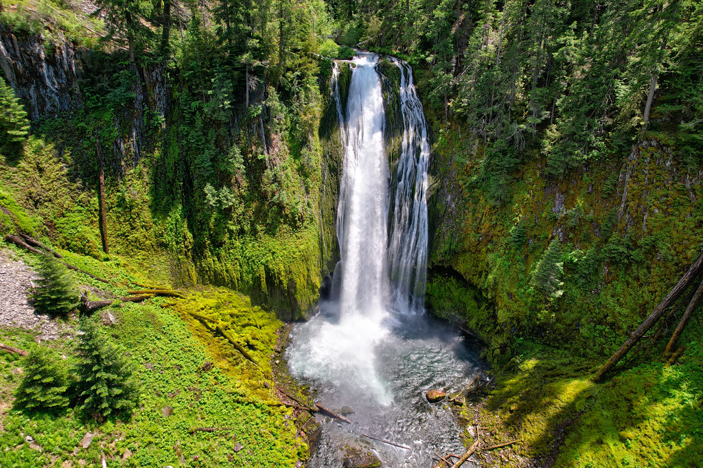 Photo: Forest Service Pacific Northwest Region, Public Domain Mark (via Flickr)
Lemolo Falls
~10 min drive
2.20-mile out-and-back trail in Oregon with 533 ft gain and 893 ft loss.
HIKE
CALAMUT LAKE
~2 min drive
3.16-mile out-and-back trail to Calamut Lake in Oregon with 752 ft elevation gain
HIKE
Windigo Pass
~3 min drive
12.00-mile out-and-back trail in Oregon with 1834 ft elevation gain.
HIKE
Waterbag Way Trail
~7 min drive
8.68-mile out-and-back trail in Oregon with 2,387 ft elevation gain and loss.
HIKE
Tenas Peak
~3 min drive
5.80-mile out-and-back trail to Tenas Peak in Oregon with 1,842 ft gain.
HIKE
Calamut Lake Trail
~3 min drive
3.22-mile out-and-back trail in Oregon with 664 ft elevation gain.
HIKE
North Umpqua Trail: Lemlo
~3 min drive
9.46-mile out-and-back trail in Oregon with 3,032 ft gain and 4,430 ft max elevation.
HIKE
North Umpqua Trail: Dread and Terror
~8 min drive
24.78-mile out-and-back trail in Oregon with 4,462 ft elevation gain
HIKE
KELSAY MTN. LOOP SNOMO
~4 min drive
3.62-mile out-and-back trail in Oregon with 1,001 ft elevation gain and loss.
HIKE
Indigo Lake Trail
~6 min drive
3.68-mile out-and-back trail in Oregon with 978 ft elevation gain

