Arch Cape to Cape Falcon Trail
 Photo: mjfmjfmjf, CC BY 2.0 (via Flickr)
- 4.1 mi
- round trip
- 3,116 ft
- climb
- 1,010 ft
- high point
- Out and back
- route
- Jun–Sep
- best months
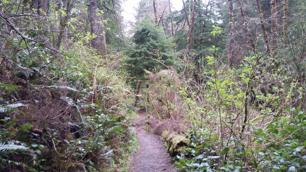
The Arch Cape to Cape Falcon Trail is a 4.1-mile hike in Oswald West State Park on the Oregon coast, managed by city land. It is an out-and-back route that starts at Arch Cape and ends at Cape Falcon, with a total round-trip distance of about 8.3 miles and a total elevation gain of about 3,100 feet. The trail is rated easy, but the climb is spread across the route. The steepest section comes at about 2.5 miles in, with a grade of about 27%, and the high point reaches about 1,010 feet. The low point is near 172 feet, so the trail crosses a wide range of elevation. Summer is the most comfortable time to go. Typical averages from a nearby weather station in Seaside show July and August highs around 65 to 66°F with only about seven wet days a month, while winter months bring highs in the low 50s and rain on most days. That station sits about 1,000 feet lower than the trail, so temperatures on the route run cooler. The Oregon Coast Trail passes about a mile away, and Short Sand Creek offers canoeing at about 1.4 miles. Mountain bikers can ride the Cape Falcon Trail and Kramer Memorial Trail, both within about 2 miles.
Local outfitters
- Snow Peak Campfield Long Beach38 mi away
- Hart's Camp39 mi away
Not on Roamze yet. Their page has how to reach them.
 Oregon Coast TrailHikingPhoto: mjfmjfmjf, CC BY 2.0 (via Flickr)1 mi
- Short Sand CreekCanoeing1.4 mi
- Cape Falcon TrailMountain biking1.7 mi
- Short Sand Beach TrailMountain biking1.8 mi
- Kramer Memorial TrailMountain biking1.9 mi
- Coal CreekCanoeing4.3 mi
- West Fork Ecola CreekCanoeing4.4 mi
- Cannon BeachRock climbing5.1 mi
Source: Roamze catalog (indexable pages within 10 miles, PostGIS distance)
- Oregon Coast TrailHiking · ~2 min drivePhoto: mjfmjfmjf, CC BY 2.0 (via Flickr)
 Cape Falcon TrailHiking · ~3 min drivePhoto: Bobjgalindo, CC BY-SA 4.0 (via Wikimedia Commons)
 Lewis and Clark Discovery Trail - Oregon Coast TrailHiking · ~22 min drivePhoto: cifraser1, CC BY 2.0 (via Flickr)
 Salmonberry TrailHiking · ~26 min drivePhoto: gary_leavens, CC BY-SA 2.0 (via Flickr)
 South Neah-Kah-Nie Mountain TrailHiking · ~5 min drivePhoto: Sam Beebe/Ecotrust, CC BY-SA 3.0 (via Wikimedia Commons)
- Short Sand Beach TrailHiking · ~3 min drivePhoto: Bobjgalindo, CC BY-SA 4.0 (via Wikimedia Commons)
- Diamond Mill RidgeHiking · ~33 min drive
- Headwaters TrailHiking · ~6 min drivePhoto: Sam Beebe/Ecotrust, CC BY-SA 3.0 (via Wikimedia Commons)
 Elk Run TrailHiking · ~11 min drivePhoto: dogplusplus, CC BY 2.0 (via Flickr)
- Deer Fence TrailHiking · ~38 min drive
Best time to visit Arch Cape to Cape Falcon Trail
Best months: June–September. Best months have typical highs of 55–85 °F, lows of 30 °F or warmer (32 °F where the station doesn't record snow), at most one snowy day and no more than 12 wet days.
Jan
52° / 39°
21 wet
Feb
53° / 38°
18 wet
Mar
54° / 40°
20 wet
Apr
56° / 42°
17 wet
May
60° / 46°
14 wet
Jun
62° / 50°
11 wet
Jul
65° / 53°
7 wet
Aug
66° / 53°
7 wet
Sep
67° / 50°
9 wet
Oct
62° / 46°
15 wet
Nov
55° / 42°
20 wet
Dec
51° / 38°
22 wet
Typical high / low (°F) and days with rain or snow, 1991–2020. Measured at Seaside, OR, 13.8 mi away at 10 ft. The station sits about 1,000 ft lower than this place, so expect it a little cooler here. Source: NOAA NCEI U.S. Climate Normals 1991–2020.

Map and trail data © OpenStreetMap contributors
