Lewis and Clark Discovery Trail - Oregon Coast Trail
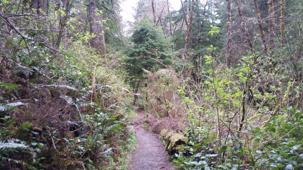 Photo: cifraser1, CC BY 2.0 (via Flickr)
- 3.7 mi
- round trip
- 2,591 ft
- climb
- 1,217 ft
- high point
- Out and back
- route
- Jun–Sep
- best months
The Lewis and Clark Discovery Trail section of the Oregon Coast Trail is a 7.4-mile out-and-back hike that rises from the low of 230 feet to a high of 1,217 feet, with a total elevation gain of 2,591 feet. The route is front-loaded, with the steepest stretch at about 0.76 miles in, where the grade reaches 42 percent. The trail starts about 2 miles from Seaside, Oregon, and is rated hard. Summer is the most comfortable time to go. Typical averages from a nearby weather station in Seaside show July and August highs around 65 to 66°F with only about seven wet days a month, while winter months bring highs in the low 50s and rain on 20 or more days. That station sits well below the trail, so temperatures on the higher ground run cooler. The trip takes about four hours. Wetland Walk is 1.7 miles away, and the Oregon Coast Trail and Indian Beach Trail are each about 3.2 miles off. Cannon Beach, a climbing area, is roughly 7.8 miles away.
Local outfitters
- Snow Peak Campfield Long Beach26 mi away
- Ocean Park Camp & Retreat Center37 mi away
Not on Roamze yet. Their page has how to reach them.
Conditions and forecast on Clark's Mountain
Daily highs and lows, wind and the chance of precipitation at the summit and route start for the next 7 days, from the Open-Meteo model.
- Wetland WalkHiking1.7 mi
- Oregon Coast TrailHiking3.2 mi
 Indian Beach TrailHikingPhoto: PennyLennox, CC BY 3.0 (via Wikimedia Commons)3.2 mi
 Ridge PathHikingPhoto: Sam Beebe, CC BY 2.0 (via Flickr)3.7 mi
- Cannon BeachRock climbing7.8 mi
- South Fork Necanicum RiverCanoeing8.5 mi
- West Fork Ecola CreekCanoeing8.8 mi
 Necanicum RiverCanoeingPhoto: M.O. Stevens, CC BY-SA 3.0 (via Wikimedia Commons)9.3 mi
Source: Roamze catalog (indexable pages within 10 miles, PostGIS distance)
 Clatsop Loop Trail - Oregon Coast TrailHiking · ~4 min drivePhoto: mjfmjfmjf, CC BY 2.0 (via Flickr)
- Ridge PathHiking · ~6 min drivePhoto: Sam Beebe, CC BY 2.0 (via Flickr)
 Arch Cape to Cape Falcon TrailHiking · ~22 min drivePhoto: mjfmjfmjf, CC BY 2.0 (via Flickr)
- Clatsop Loop TrailHiking · ~5 min drivePhoto: PennyLennox, CC BY 3.0 (via Wikimedia Commons)
 Ridge PathHiking · ~8 min drivePhoto: stevelyon, CC BY-SA 2.0 (via Flickr)
 Salmonberry TrailHiking · ~48 min drivePhoto: gary_leavens, CC BY-SA 2.0 (via Flickr)
- Indian Beach TrailHiking · ~5 min drivePhoto: PennyLennox, CC BY 3.0 (via Wikimedia Commons)
 Cape Falcon TrailHiking · ~25 min drivePhoto: Bobjgalindo, CC BY-SA 4.0 (via Wikimedia Commons)
 Crescent Beach TrailHiking · ~7 min drivePhoto: eugene_o, CC BY 2.0 (via Flickr)
- Short Sand Beach TrailHiking · ~25 min drivePhoto: Bobjgalindo, CC BY-SA 4.0 (via Wikimedia Commons)
Best time to visit Lewis and Clark Discovery Trail - Oregon Coast Trail
Best months: June–September. Best months have typical highs of 55–85 °F, lows of 30 °F or warmer (32 °F where the station doesn't record snow), at most one snowy day and no more than 12 wet days.
Jan
52° / 39°
21 wet
Feb
53° / 38°
18 wet
Mar
54° / 40°
20 wet
Apr
56° / 42°
17 wet
May
60° / 46°
14 wet
Jun
62° / 50°
11 wet
Jul
65° / 53°
7 wet
Aug
66° / 53°
7 wet
Sep
67° / 50°
9 wet
Oct
62° / 46°
15 wet
Nov
55° / 42°
20 wet
Dec
51° / 38°
22 wet
Typical high / low (°F) and days with rain or snow, 1991–2020. Measured at Seaside, OR, 1.7 mi away at 10 ft. The station sits about 1,200 ft lower than this place, so expect it a little cooler here. Source: NOAA NCEI U.S. Climate Normals 1991–2020.
Route details
- Distance
- 3.7 mi round trip
- Climbing
- About 2,591 ft
- Summit
- 1,168 ft
- Difficulty
- Hard
- Time
- About 2 hours
Questions about this route
How long is the Lewis and Clark Discovery Trail - Oregon Coast Trail on Clark's Mountain?
About 3.7 mi round trip.
How much elevation gain is on the Lewis and Clark Discovery Trail - Oregon Coast Trail?
About 2,591 ft of climbing round trip.
How hard is the Lewis and Clark Discovery Trail - Oregon Coast Trail?
It is rated hard.
How long does the Lewis and Clark Discovery Trail - Oregon Coast Trail take?
About 2 hours round trip.
Map and trail data © OpenStreetMap contributors
