Angora Peak Trail
- 4.0 mi
- one way
- 2,129 ft
- climb
- 2,662 ft
- high point
- Point to point
- route
Angora Peak Trail is a 4-mile moderate hike in northern Oregon, about 3.5 miles from the town of Arch Cape. The trail starts near the top, at roughly 2,640 feet, and climbs to a high point of about 2,660 feet before descending with a total loss of about 3,235 feet. The steepest stretch comes around mile 2.1, where the grade reaches about 38%. For a longer outing, the Arch Cape to Cape Falcon Trail lies about 1.9 miles away, and the Oregon Coast Trail passes within about 2 miles. Paddlers can reach Short Sand Creek, about 1.6 miles off, or Coal Creek, about 2.4 miles away.
Local outfitters
- Snow Peak Campfield Long Beach39 mi away
- Hart's Camp40 mi away
Not on Roamze yet. Their page has how to reach them.
Keep exploring — more trails worth the drive
 Photo: mjfmjfmjf, CC BY 2.0 (via Flickr)
Arch Cape to Cape Falcon Trail
~3 min drive
8.26-mile out-and-back hike from Arch Cape to Cape Falcon in Oregon with 3,116 ft elevation gain
 Photo: mjfmjfmjf, CC BY 2.0 (via Flickr)
Oregon Coast Trail
~4 min drive
2.54-mile out-and-back trail on Oregon's coast with 1,345 ft elevation gain
 Photo: Bobjgalindo, CC BY-SA 4.0 (via Wikimedia Commons)
Short Sand Beach Trail
~5 min drive
0.68-mile out-and-back trail at Short Sand Beach in Oregon with 138 ft of elevation gain.
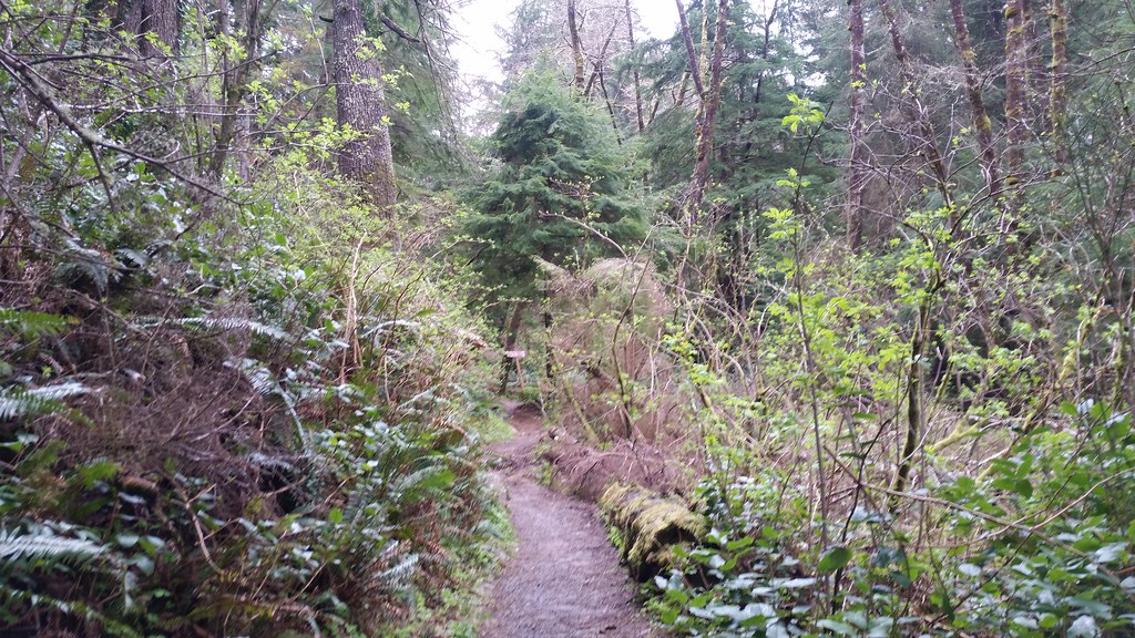 Photo: cifraser1, CC BY 2.0 (via Flickr)
Lewis and Clark Discovery Trail - Oregon Coast Trail
~22 min drive
7.44-mile out-and-back trail on Oregon Coast with 2,591 ft elevation gain
 Photo: gary_leavens, CC BY-SA 2.0 (via Flickr)
Salmonberry Trail
~26 min drive
Epic 83.84-mile point-to-point wilderness trek through Oregon's coastal range.
 Photo: Sam Beebe/Ecotrust, CC BY-SA 3.0 (via Wikimedia Commons)
South Neah-Kah-Nie Mountain Trail
~6 min drive
2.76-mile out-and-back hike in Oregon with 1,754 ft elevation gain
Photo: Bobjgalindo, CC BY-SA 4.0 (via Wikimedia Commons)Cape Falcon Trail
~5 min drive
0.96-mile out-and-back trail at Cape Falcon, Oregon with 361 ft of elevation gain.
HIKE
Diamond Mill Ridge
~31 min drive
5.24-mile out-and-back trail in Oregon with 2,871 ft elevation gain
 Photo: Mafue, CC BY-SA 2.0 (via Flickr)
Wilson River Trail
~38 min drive
33.52-mile out-and-back trail in Oregon with 6,739 ft elevation gain/loss
Photo: Sam Beebe/Ecotrust, CC BY-SA 3.0 (via Wikimedia Commons)Headwaters Trail
~6 min drive
3.44-mile out-and-back trail in Oregon with 1,019 ft elevation gain.

Route details
- Distance
- 4.0 mi
- Climbing
- About 2,129 ft
- Summit
- 2,673 ft
- Difficulty
- Moderate
- Time
- About 2 hours
Questions about this route
How long is the Angora Peak Trail on Angora Peak?
About 4.0 mi.
How much elevation gain is on the Angora Peak Trail?
About 2,129 ft of climbing round trip.
How hard is the Angora Peak Trail?
It is rated moderate.
How long does the Angora Peak Trail take?
About 2 hours round trip.
Conditions and forecast on Angora Peak
Daily highs and lows, wind and the chance of precipitation at the summit and route start for the next 7 days, from the Open-Meteo model.
Map and trail data © OpenStreetMap contributors
