Bessie Shelter Horse Camp
- May–Sep
- best months
Is Bessie Shelter Horse Camp open right now?
Alert in the area
The Forest Service lists an alert for High Cascades Ranger District.
Fish Lake Boat Ramp Closure
Agency alert covering High Cascades Ranger District · Order 06-10-24-26-02 · USFS · High Cascades Ranger District
As of · Source: USFS · High Cascades Ranger District. Agencies don't list every closure — check before you go.
- At 4,963 ft
- High Cascades Ranger DistrictRogue River-Siskiyou National Forests
Bessie Shelter Horse Camp is a campground in Oregon at about 4,963 feet. It is managed by the U.S. Forest Service.
Local outfitters
- Diamond Lake Resort28 mi away
- Holiday RV Park42 mi away
Not on Roamze yet. Their page has how to reach them.
- Tom and JerryHiking0.1 mi
- Bessie ShelterCamping0.1 mi
- Mudjekeewis TrailHiking2.3 mi
- Mudjekeewis MountainSummit2.4 mi
- Middle Fork Rogue RiverCanoeing2.9 mi
- Red Blanket CreekCanoeing3 mi
- Red Blanket FallsWaterfall4.2 mi
- Stuart FallsWaterfall5.1 mi
Source: Roamze catalog (indexable pages within 10 miles, PostGIS distance)
- Jim Creek Group CampgroundCamping · ~23 min drive
- Imnaha Cabin Recreation SiteHut camping · ~7 min drive
- Fourmile Lake CampgroundCamping · ~34 min drive
- Bessie ShelterCamping · Next door
- South Fork CampgroundCamping · ~14 min drive
- Lower South Fork CampgroundCamping · ~14 min drive
- Lodgepole Guard StationCamping · ~14 min drive
- Huckleberry City CampgroundCamping · ~15 min drive
- Mill Creek CampgroundCamping · ~16 min drive
- Mill Creek Campground USFSCamping · ~16 min drive
Also worth it near here
- Red Blanket FallsWaterfall · ~7 min drive
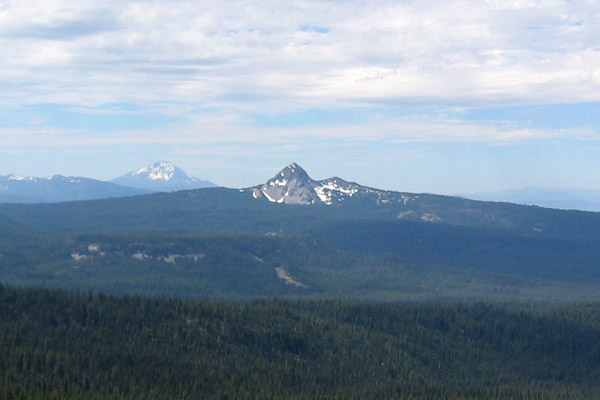 Union PeakSummit · ~11 min drivePhoto: Jude Giampaolo Burntnickel at en.wikipedia, Public domain (via Wikimedia Commons)
 Lake IvernHiking · ~13 min drivePhoto: cm195902, CC BY 2.0 (via Flickr)
- Mill CreekCanoeing · ~15 min drive
- Sevenmile MarshLake fishing · ~15 min drive
Best time to visit Bessie Shelter Horse Camp
Best months: May–September. Best months have typical highs of 55–85 °F, lows of 30 °F or warmer (32 °F where the station doesn't record snow), at most one snowy day and no more than 12 wet days.
Jan
39° / 19°
13 wet · 6 snow
Feb
44° / 22°
11 wet · 5 snow
Mar
50° / 25°
11 wet · 4 snow
Apr
57° / 28°
10 wet · 2 snow
May
66° / 33°
8 wet
Jun
75° / 37°
4 wet
Jul
85° / 42°
3 wet
Aug
84° / 41°
2 wet
Sep
77° / 34°
4 wet
Oct
64° / 27°
7 wet
Nov
48° / 24°
12 wet · 3 snow
Dec
39° / 19°
14 wet · 7 snow
Typical high / low (°F) and days with rain or snow, 1991–2020. Measured at Chiloquin 12 Nw (Fort Klamath), OR, 15.7 mi away at 4,180 ft. The station sits about 800 ft lower than this place, so expect it a little cooler here. Source: NOAA NCEI U.S. Climate Normals 1991–2020.
Closures we've recorded since August 2026
Stage 2 Public Use Fire Restrictions (Forest-wide)
Rogue River-Siskiyou National Forests · Order dated September 4, 2026; seen Sep 3, 2026 → lifted Oct 28, 2026 · Forest Service
Stage 3 Public Use Fire Restrictions (Forest-wide)
Rogue River-Siskiyou National Forests · Order dated July 17, 2026; seen Aug 23, 2026 → lifted Sep 3, 2026 · Forest Service
Map and trail data © OpenStreetMap contributors
