River Trail
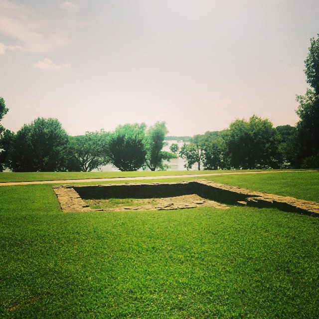 Photo: Farther Along, CC BY 2.0 (via Flickr)
- 0.5 mi
- round trip
- 22 ft
- climb
- Out and back
- route
- Easy
- difficulty
- Feb–May, Oct–Nov
- best months
Clear at last check
Weather is good · OpenWeather · checked 22 h ago
Is River Trail open right now?
No closures listed
The National Park Service lists no closures for Fort Smith National Historic Site.
As of · Source: NPS · Fort Smith National Historic Site. Agencies don't list every closure — check before you go.
River Trail is a short out-and-back hike in Oklahoma managed by the National Park Service. The trail is 0.96 miles long with 22 feet of elevation gain.
 Butterfield Hiking TrailHiking · ~50 min drivePhoto: adam*b, CC BY 2.0 (via Flickr)
 Ozark Highlands TrailHiking · ~59 min drivePhoto: adam*b, CC BY 2.0 (via Flickr)
- WEST OUTER LOOPHiking · ~40 min drive
- White Rock-Shores Lake WestHiking · ~55 min drive
- White Rock Mtn Rim LoopHiking · ~58 min drivePhoto: adam*b, CC BY 2.0 (via Flickr)
- BRADFORD EASY LOOPHiking · ~42 min drive
- BRADFORD EAST OUTER LOOPHiking · ~42 min drive
- Hole in the Ground Mtn. TrailHiking · ~1h 11m drive
- White Rock Mountain Rim TrailHiking · ~58 min drivePhoto: adam*b, CC BY 2.0 (via Flickr)
- WEST OUTER LOOP SHORTCUT MHiking · ~44 min drive
Also worth it near here
Best time to visit River Trail
Best months: February–May and October–November. Best months have typical highs of 55–85 °F, lows of 30 °F or warmer (32 °F where the station doesn't record snow), at most one snowy day and no more than 12 wet days.
Jan
51° / 30°
8 wet · 1 snow
Feb
57° / 33°
8 wet · 1 snow
Mar
66° / 42°
10 wet
Apr
75° / 50°
10 wet
May
81° / 60°
11 wet
Jun
89° / 68°
9 wet
Jul
94° / 72°
7 wet
Aug
94° / 71°
7 wet
Sep
87° / 63°
7 wet
Oct
76° / 51°
8 wet
Nov
63° / 40°
8 wet
Dec
53° / 32°
8 wet
Typical high / low (°F) and days with rain or snow, 1991–2020. Measured at Ft Smith Rgnl Ap, AR, 5.4 mi away at 449 ft. We don't have this place's elevation, so higher spots nearby can run cooler. Source: NOAA NCEI U.S. Climate Normals 1991–2020.

