Tiorati Plateau
Campground
Campground · 4.9 mi from the trail
 Photo: The original uploader was Daniel Case at English Wikipedia., CC BY-SA 3.0 (via Wikimedia Commons)
Closure in the area
There's a closure order in Appalachian National Scenic Trail. It doesn't name Bear Mountain, so check the source for the area it covers.
List of trail closures post-Hurricane Helene
Park closure covering Appalachian National Scenic Trail · NPS · Appalachian National Scenic Trail
Black Bears Frequenting the McAfee Knob Area in Virginia
Park alert covering Appalachian National Scenic Trail · NPS · Appalachian National Scenic Trail
As of · Source: NPS · Appalachian National Scenic Trail. Agencies don't list every closure — check before you go.
Bear Mountain is a summit of 1,288 feet in New York, about 2 miles from the town of Fort Montgomery. It sits within the Appalachian National Scenic Trail corridor, which makes it a natural stop for anyone exploring the trail's route through this part of the state. Late spring and early fall are the most comfortable times to visit. Typical averages from a nearby weather station at West Point show May highs around 72°F and September highs around 76°F, while July peaks near 85°F and winter highs stay in the 30s and 40s. The Major Welch Trail starts just 0.1 mile away, and the Doodletown Bridle Path and Cornell Mine Trail are each about 0.7 mile off. Climbers can find Blue Mountain Park roughly 5.5 miles away.
Tiorati Plateau
Campground
 If it rainsDaniel Case, CC BY-SA 3.0 · Wikimedia Commons
American Revolutionary War fort near West Point on the Hudson River
Places © OpenStreetMap contributors, Places © Overture Maps Foundation · Photos: Daniel Case, CC BY-SA 3.0 (commons)
More in New WindsorDaily highs and lows, wind and the chance of precipitation at the summit and route start for the next 7 days, from the Open-Meteo model.
Elevation from USGS 3D Elevation Program terrain data (about 10 m resolution).
1,288 ft (393 m).
One: Major Welch Trail.
 Major Welch TrailHikingPhoto: paramsach, CC BY 2.0 (via Flickr)0.1 miDoodletown Bridle PathHikingPhoto: paramsach, CC BY 2.0 (via Flickr)0.7 mi
 Cornell Mine TrailHikingPhoto: Schezar, CC BY 2.0 (via Flickr)0.7 mi
 Moodna CreekCanoeingPhoto: Daniel Case, CC BY-SA 3.0 (via Wikimedia Commons)9.5 mi
Source: Roamze catalog (indexable pages within 10 miles, PostGIS distance)
 Sugarloaf HillSummit · ~8 min drivePhoto: Juliancolton, CC0 (via Wikimedia Commons)
 Crows NestSummit · ~11 min drivePhoto: Ahodges7, CC BY-SA 3.0 (via Wikimedia Commons)
 Schunnemunk MountainSummit · ~14 min drivePhoto: The original uploader was Daniel Case at English Wikipedia., CC BY-SA 3.0 (via Wikimedia Commons)
 Storm King MountainSummit · ~14 min drivePhoto: The original uploader was Daniel Case at English Wikipedia., CC BY-SA 3.0 (via Wikimedia Commons)
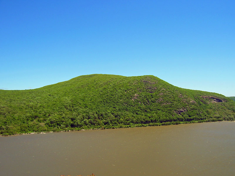 Bull HillSummit · ~15 min drivePhoto: Daniel Case, CC BY-SA 3.0 (via Wikimedia Commons)
Best months: April–October. Best months have typical highs of 55–85 °F, lows of 30 °F or warmer (32 °F where the station doesn't record snow), at most one snowy day and no more than 12 wet days.
Jan
36° / 21°
10 wet · 3 snow
Feb
39° / 22°
8 wet · 3 snow
Mar
47° / 30°
10 wet · 2 snow
Apr
60° / 41°
10 wet
May
72° / 51°
12 wet
Jun
80° / 60°
11 wet
Jul
85° / 65°
10 wet
Aug
83° / 64°
9 wet
Sep
76° / 57°
8 wet
Oct
63° / 46°
10 wet
Nov
51° / 36°
9 wet
Dec
41° / 27°
10 wet · 2 snow
Typical high / low (°F) and days with rain or snow, 1991–2020. Measured at West Point, NY, 5.8 mi away at 320 ft. The station sits about 1,000 ft lower than this place, so expect it a little cooler here. Source: NOAA NCEI U.S. Climate Normals 1991–2020.
