Association A
Campground
Campground · 0.3 mi from the trail
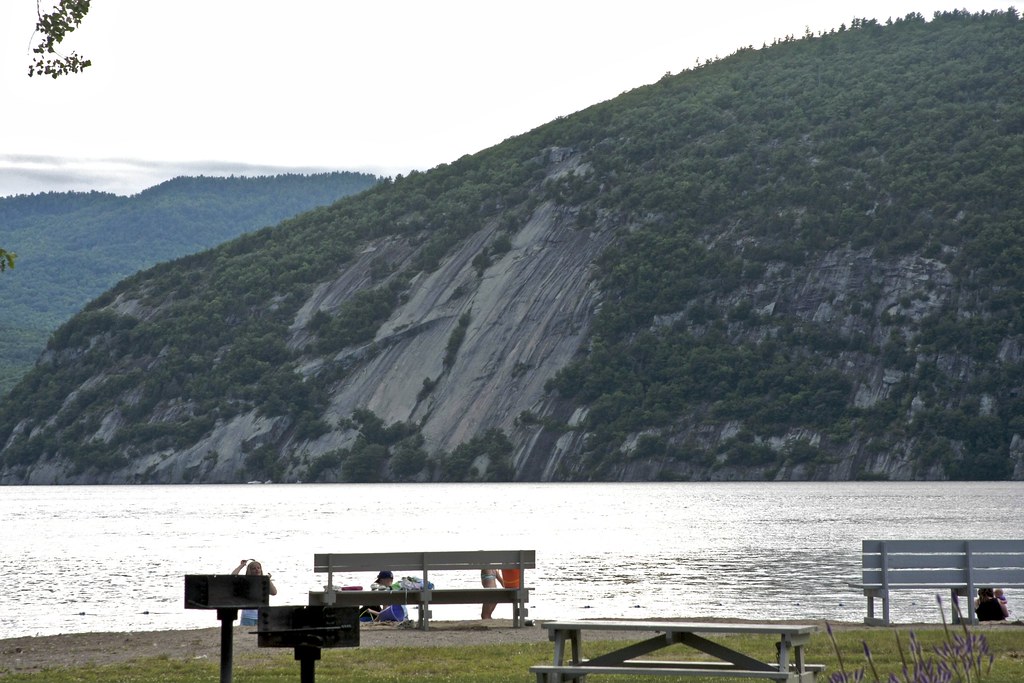
Rogers Slide is a climbing area in New York's Lake George Wild Forest, managed by the State Department of Conservation. It sits close to two other climbing spots, Rogers Rock and Cove Boulders, both about 0.3 miles away, so it works well as a cluster of crags to explore in a single visit. Summer is the most comfortable time to climb. Typical averages from a nearby weather station in Cornwall, Vermont, put July highs around 80°F with lows near 60°F, and snow is common from December through February. The area has 12 routes, most of them trad with a few sport options. The grades run from 5.5 to 5.8+, with Screaming Matrix at 5.7 and Kings and Desperate Men at 5.8. The Grand Game was first climbed by Tom and Erin Rosecrans. Cook Mountain is about 2 miles away, and the La Chute paddling spot is roughly 3.3 miles off.
Association A
Campground
Schroon Lake view
Viewpoint
Places © OpenStreetMap contributors, Places © Overture Maps Foundation
More in Schroon Lake Rogers RockRock climbingPhoto: Steve Starer, CC BY 2.0 (via Flickr)0.3 miCove BouldersRock climbingPhoto: Steve Starer, CC BY 2.0 (via Flickr)0.3 mi
 Cook MountainHikingPhoto: crimfants, CC BY-SA 2.0 (via Flickr)2 mi
 La ChuteCanoeingPhoto: Katie Armstrong, Public domain (via Wikimedia Commons)3.3 mi
Source: Roamze catalog (indexable pages within 10 miles, PostGIS distance)
Rogers RockRock climbing · Next doorPhoto: Steve Starer, CC BY 2.0 (via Flickr)Campground WallRock climbing · Next doorPhoto: Steve Starer, CC BY 2.0 (via Flickr)Cove BouldersRock climbing · Next doorPhoto: Steve Starer, CC BY 2.0 (via Flickr) Lake Dunmore/Falls of LanaRock climbing · ~37 min drivePhoto: Boston Public Library, CC BY 2.0 (via Wikimedia Commons)Main CragRock climbing · ~37 min drivePhoto: Boston Public Library, CC BY 2.0 (via Wikimedia Commons)
Also worth it near here
Best months: May–October. Best months have typical highs of 55–85 °F, lows of 30 °F or warmer (32 °F where the station doesn't record snow), at most one snowy day and no more than 12 wet days.
Jan
27° / 9°
11 wet · 8 snow
Feb
30° / 10°
9 wet · 7 snow
Mar
40° / 20°
9 wet · 4 snow
Apr
54° / 33°
10 wet · 1 snow
May
67° / 45°
11 wet
Jun
75° / 54°
12 wet
Jul
80° / 60°
12 wet
Aug
79° / 57°
10 wet
Sep
71° / 49°
9 wet
Oct
57° / 38°
12 wet
Nov
44° / 28°
11 wet · 2 snow
Dec
33° / 18°
12 wet · 6 snow
Typical high / low (°F) and days with rain or snow, 1991–2020. Measured at Cornwall, VT, 16.9 mi away at 345 ft. Source: NOAA NCEI U.S. Climate Normals 1991–2020.

