Graymoor Hiker Campsite
Campground
Campground · 4.0 mi from the trail
 Photo: William J Sisti from Morristown, NJ, USA, CC BY-SA 2.0 (via Wikimedia Commons)
Closure in the area
There's a closure order in Appalachian National Scenic Trail. It doesn't name Twin Forts, so check the source for the area it covers.
List of trail closures post-Hurricane Helene
Park closure covering Appalachian National Scenic Trail · NPS · Appalachian National Scenic Trail
Black Bears Frequenting the McAfee Knob Area in Virginia
Park alert covering Appalachian National Scenic Trail · NPS · Appalachian National Scenic Trail
As of · Source: NPS · Appalachian National Scenic Trail. Agencies don't list every closure — check before you go.
Twin Forts is a short, easy hike in Bear Mountain State Park in New York, about half a mile from the Appalachian National Scenic Trail. The land is managed by State Park and Recreation, and the route is an out-and-back that covers about a mile with a total climb of 413 feet. The trail is rated easy, and the steepest part comes at about a third of the way in, where the grade reaches 18 percent. Bikes and horses are not allowed. For comfortable weather, aim for late spring or early fall. Typical averages from a nearby weather station at West Point put May highs around 72°F and September highs around 76°F, with July the warmest month at about 85°F. Several other trails start close by, including the 1777 West Trail about 0.3 miles away and the Dock Trail at 0.4 miles. Climbers can head to Blue Mountain Park, about 5 miles off, and paddlers to Moodna Creek, roughly 10 miles away.
Graymoor Hiker Campsite
Campground
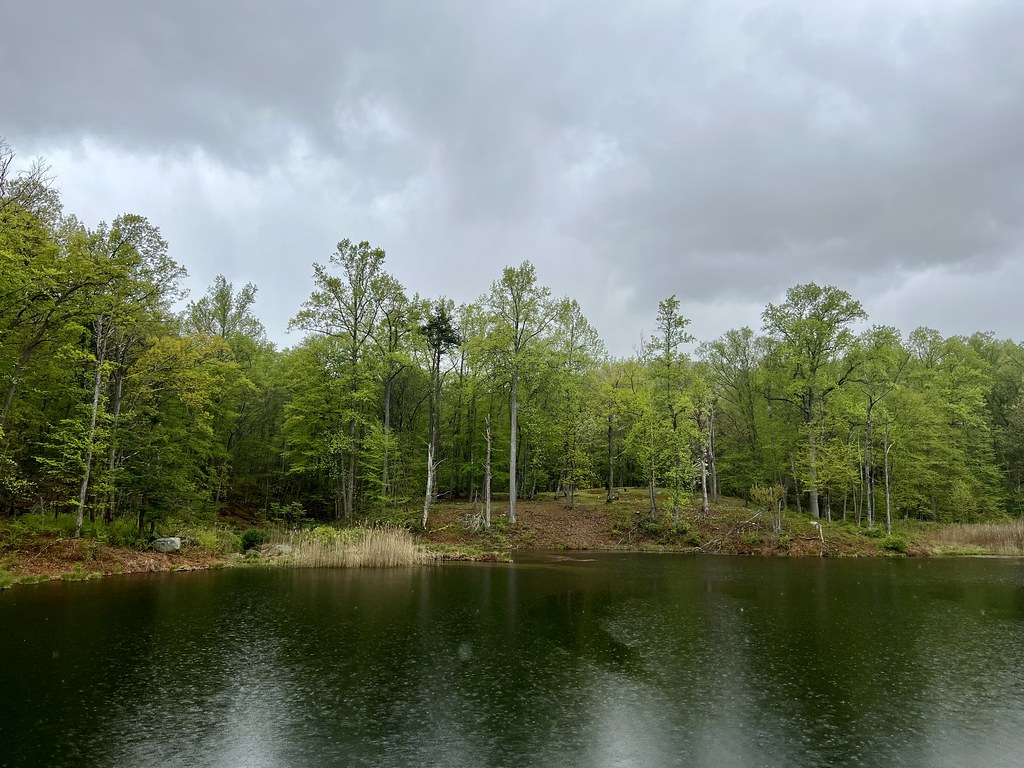
 If it rainsDaniel Case, CC BY-SA 3.0 · Wikimedia Commons
American Revolutionary War fort near West Point on the Hudson River
Places © OpenStreetMap contributors, Places © Overture Maps Foundation · Photos: Daniel Case, CC BY-SA 3.0 (commons)
More in New WindsorNot on Roamze yet. Their page has how to reach them.
1777 West TrailHikingPhoto: William J Sisti from Morristown, NJ, USA, CC BY-SA 2.0 (via Wikimedia Commons)0.3 mi Cornell Mine TrailHikingPhoto: Schezar, CC BY 2.0 (via Flickr)0.5 mi
 Storm King MountainRock climbingPhoto: Steven-L-Johnson, CC BY 2.0 (via Flickr)7.7 mi
 Moodna CreekCanoeingPhoto: Daniel Case, CC BY-SA 3.0 (via Wikimedia Commons)9.7 mi
 Croton RiverCanoeingPhoto: PointsofNoReturn, CC BY-SA 4.0 (via Wikimedia Commons)10 mi
Source: Roamze catalog (indexable pages within 10 miles, PostGIS distance)
1777 West TrailHiking · Next doorPhoto: William J Sisti from Morristown, NJ, USA, CC BY-SA 2.0 (via Wikimedia Commons) Brooks Pond TrailHiking · ~1 min drivePhoto: William J Sisti from Morristown, NJ, USA, CC BY-SA 2.0 (via Wikimedia Commons)Cornell Mine TrailHiking · Next doorPhoto: Schezar, CC BY 2.0 (via Flickr)Brooks Lake TrailHiking · ~1 min drivePhoto: William J Sisti from Morristown, NJ, USA, CC BY-SA 2.0 (via Wikimedia Commons)
 Camp Smith TrailHiking · ~2 min drivePhoto: mlcastle, CC BY-SA 2.0 (via Flickr)
 Doodletown Bridle PathHiking · ~2 min drivePhoto: paramsach, CC BY 2.0 (via Flickr)Major Welch TrailHiking · ~2 min drivePhoto: paramsach, CC BY 2.0 (via Flickr)
 Doodletown RoadHiking · ~3 min drivePhoto: christinejwarner, CC BY 2.0 (via Flickr)1777 W TrailHiking · ~3 min drivePhoto: paramsach, CC BY 2.0 (via Flickr)
Best months: April–October. Best months have typical highs of 55–85 °F, lows of 30 °F or warmer (32 °F where the station doesn't record snow), at most one snowy day and no more than 12 wet days.
Jan
36° / 21°
10 wet · 3 snow
Feb
39° / 22°
8 wet · 3 snow
Mar
47° / 30°
10 wet · 2 snow
Apr
60° / 41°
10 wet
May
72° / 51°
12 wet
Jun
80° / 60°
11 wet
Jul
85° / 65°
10 wet
Aug
83° / 64°
9 wet
Sep
76° / 57°
8 wet
Oct
63° / 46°
10 wet
Nov
51° / 36°
9 wet
Dec
41° / 27°
10 wet · 2 snow
Typical high / low (°F) and days with rain or snow, 1991–2020. Measured at West Point, NY, 5 mi away at 320 ft. Source: NOAA NCEI U.S. Climate Normals 1991–2020.

