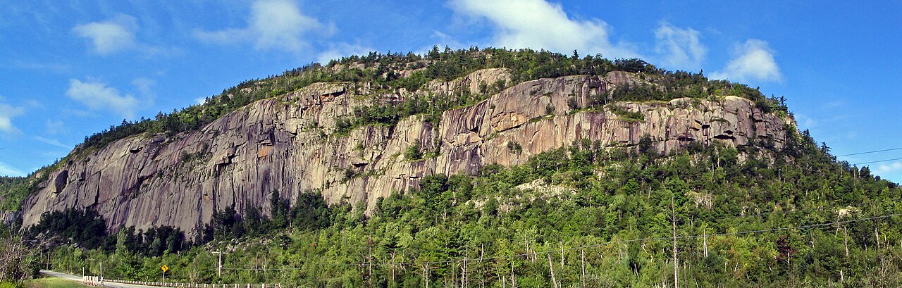
Poke-O-Moonshine Campground
Campground
Campground · 2.6 mi from the trail
Sugarloaf Trail is a moderate out-and-back hike in New York, about 3.7 miles from the town of Reber. The route is roughly 2.1 miles long, with a total elevation gain of 930 feet, and it reaches a high point of 1,468 feet. The climb is steepest around the 0.68-mile mark, where the grade reaches about 29 percent. Summer is the most comfortable time to go. Typical averages from a nearby weather station at Willsboro show July highs around 80°F with lows near 61°F, while that station sits well below the trail, so temperatures on the summit run cooler. The hike takes about an hour. Rattlesnake Mountain Trail is 1.4 miles away, and the Poke-O Slab and Poke-O-Moonshine Main Face climbing areas are both within about 3 miles. The Lake Champlain Blueway Trail, a paddling route, is about 7.8 miles off.
Poke-O-Moonshine Campground
Campground
 If it rainsStorylanding, CC0 · Wikimedia Commons
Places © OpenStreetMap contributors · Photos: Storylanding, CC0 (commons)
More in South BurlingtonNot on Roamze yet. Their page has how to reach them.
Best months: May–October. Best months have typical highs of 55–85 °F, lows of 30 °F or warmer (32 °F where the station doesn't record snow), at most one snowy day and no more than 12 wet days.
Jan
29° / 11°
Feb
31° / 12°
Mar
39° / 22°
Apr
54° / 34°
May
66° / 46°
Jun
76° / 56°
Jul
80° / 61°
Aug
79° / 59°
Sep
71° / 52°
Oct
58° / 41°
Nov
46° / 31°
Dec
35° / 21°
Typical high / low (°F) and days with rain or snow, 1991–2020. Measured at Willsboro 1 N, NY, 4.3 mi away at 180 ft. The station sits about 1,300 ft lower than this place, so expect it a little cooler here. This station doesn't record snowfall. Source: NOAA NCEI U.S. Climate Normals 1991–2020.
 Photo: andyarthur, CC BY 2.0 (via Flickr)
Observer's Trail
~5 min drive
2.06-mile out-and-back hike in New York with 157 ft gain and 1,365 ft loss.
 Photo: SlapTheWorld, Public Domain Dedication (CC0) (via Flickr)
Village Trail (Yellow Triangle)
~7 min drive
0.62-mile out-and-back trail in New York with 114 ft elevation gain
 Photo: TheNickster, CC BY-SA 2.0 (via Flickr)
Barn Rock Trail
~21 min drive
1.40-mile out-and-back hike in New York with 369 ft elevation gain.
HIKE
Boquet Mountain Trail
~9 min drive
5.44-mile out-and-back hike in New York with 1,156 ft elevation gain
Photo: SlapTheWorld, Public Domain Dedication (CC0) (via Flickr)River Trail (Blue Circle Trail)
~7 min drive
1.56-mile out-and-back trail in New York with 477 ft of elevation gain
HIKE
Mount Inez Trail
~15 min drive
2.98-mile out-and-back hike in New York with 1,089 ft gain/loss
HIKE
Champlain Valley Trail (Keeseville to Plattsburgh)
~15 min drive
14.09-mile point-to-point trail in New York with 603 ft gain.
Photo: SlapTheWorld, Public Domain Dedication (CC0) (via Flickr)Tim's Trail (Pink Square)
~7 min drive
1.02-mile loop trail in New York with 150 ft elevation gain
HIKE
(unmaintained trail)
~21 min drive
2.96-mile out-and-back trail in New York with 1,603 ft elevation gain.
HIKE
Rattlesnake Mountain Trail
~2 min drive
2.68-mile out-and-back hike in New York with 832 ft elevation gain
About 1.1 mi round trip.
About 930 ft of climbing round trip.
It is rated moderate.
About 1 hour round trip.
Daily highs and lows, wind and the chance of precipitation at the summit and route start for the next 7 days, from the Open-Meteo model.
Map and trail data © OpenStreetMap contributors