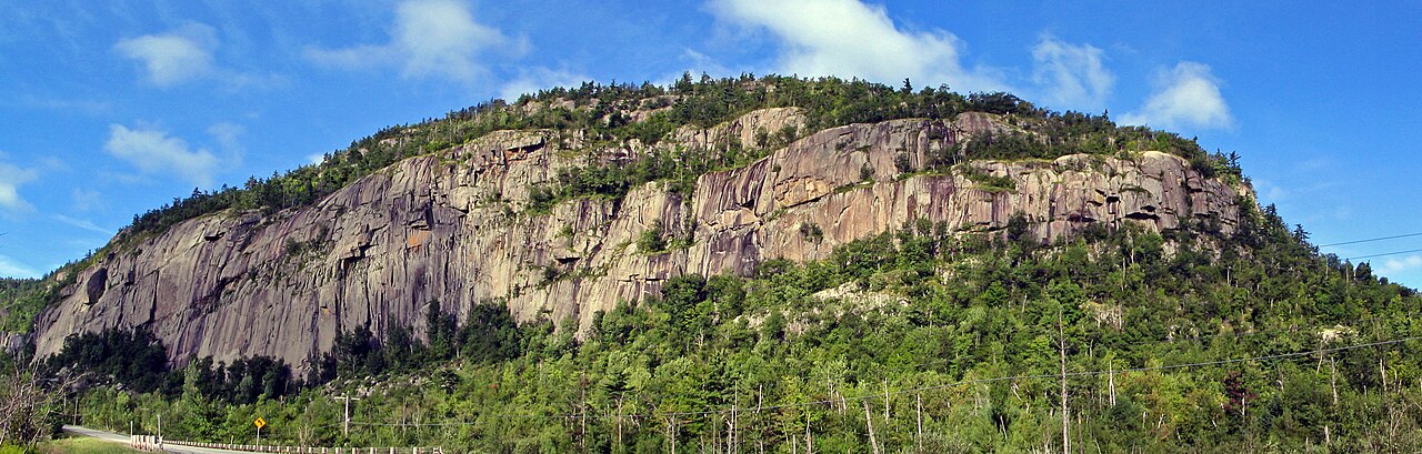
Poke-O-Moonshine Campground
Campground
Campground · 0.4 mi from the trail
 Photo: andyarthur, CC BY 2.0 (via Flickr)
Observer's Trail is a hard hike in New York's Taylor Pond Wild Forest, managed by the State Department of Conservation. The route is an out-and-back that climbs from a low of about 756 feet to a high of 1,964 feet, with a total elevation gain of 2,552 feet over a round trip of about 4.1 miles. The steepest stretch comes early, around 0.5 miles in, with a grade of about 24 percent. Summer is the most comfortable time to go. Typical averages from a nearby weather station at Lake Placid show July highs around 74°F with lows near 54°F, while winter highs stay in the 20s. The hike takes about 2.5 hours. The trail sits close to several climbing areas, including Poke-O Slab about half a mile away and Poke-O-Moonshine Main Face and Poke-O-Moonshine Second Tier, each about 0.7 miles off. For more hiking, Sugarloaf Trail lies about 2.9 miles away.
Poke-O-Moonshine Campground
Campground
 If it rainsStorylanding, CC0 · Wikimedia Commons
Places © OpenStreetMap contributors · Photos: Storylanding, CC0 (commons)
More in South BurlingtonNot on Roamze yet. Their page has how to reach them.
No month here meets our mild-weather rule. Best months have typical highs of 55–85 °F, lows of 30 °F or warmer (32 °F where the station doesn't record snow), at most one snowy day and no more than 12 wet days.
Jan
23° / 6°
18 wet
Feb
27° / 8°
14 wet
Mar
36° / 16°
14 wet
Apr
49° / 29°
14 wet
May
62° / 40°
15 wet
Jun
70° / 49°
14 wet
Jul
74° / 54°
14 wet
Aug
73° / 52°
13 wet
Sep
66° / 45°
13 wet
Oct
52° / 35°
15 wet
Nov
40° / 25°
16 wet
Dec
28° / 14°
18 wet
Typical high / low (°F) and days with rain or snow, 1991–2020. Measured at Lake Placid 2 S, NY, 24.2 mi away at 1,888 ft. This station doesn't record snowfall. Source: NOAA NCEI U.S. Climate Normals 1991–2020.
 Photo: SlapTheWorld, Public Domain Dedication (CC0) (via Flickr)
Village Trail (Yellow Triangle)
~11 min drive
0.62-mile out-and-back trail in New York with 114 ft elevation gain
HIKE
Sugarloaf Trail
~5 min drive
1.05-mile out-and-back hike in New York with 838 ft gain.
HIKE
Champlain Valley Trail (Keeseville to Plattsburgh)
~13 min drive
14.09-mile point-to-point trail in New York with 603 ft gain.
Photo: SlapTheWorld, Public Domain Dedication (CC0) (via Flickr)River Trail (Blue Circle Trail)
~12 min drive
1.56-mile out-and-back trail in New York with 477 ft of elevation gain
HIKE
Mount Inez Trail
~16 min drive
2.98-mile out-and-back hike in New York with 1,089 ft gain/loss
HIKE
Boquet Mountain Trail
~14 min drive
5.44-mile out-and-back hike in New York with 1,156 ft elevation gain
Photo: SlapTheWorld, Public Domain Dedication (CC0) (via Flickr)Tim's Trail (Pink Square)
~12 min drive
1.02-mile loop trail in New York with 150 ft elevation gain
HIKE
Ausable Acres Trails (Private)
~19 min drive
4.45-mile out-and-back trail through Ausable Acres private property.
HIKE
Benny's Trail
~5 min drive
3.82-mile out-and-back hike in New York with 723 ft elevation gain
HIKE
(unmaintained trail)
~20 min drive
2.96-mile out-and-back trail in New York with 1,603 ft elevation gain.
Map and trail data © OpenStreetMap contributors