Graymoor Hiker Campsite
Campground
Campground · 2.1 mi from the trail
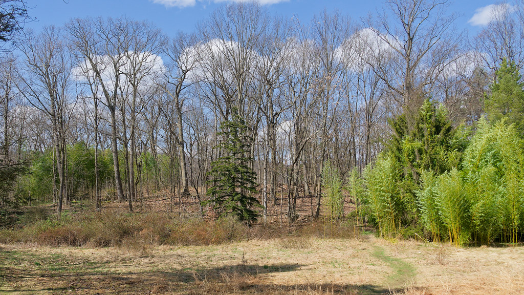 Photo: mlcastle, CC BY-SA 2.0 (via Flickr)
Castle Rock Trail is a short, easy hike in New York's Castle Rock Unique Area, managed by the State Department of Conservation. The trail is about half a mile long, with a total elevation gain of 96 feet, and it is a point-to-point route rather than a loop. The climb is gentle, with the steepest stretch at about a quarter mile in, where the grade reaches 9 percent. Late spring and early fall are the most comfortable times to go. Typical averages from a nearby weather station at West Point show May highs around 72°F and September highs around 76°F, while July averages about 85°F and January highs sit near 36°F. The trail makes an easy addition to a day of exploring the surrounding area. Sugarloaf Trail is about 0.3 miles away, Glenclyffe Loop about 0.4 miles, and Arden Point Trail about 0.5 miles. Storm King Mountain, a climbing area, lies about 5 miles off.
Graymoor Hiker Campsite
Campground
 If it rainsThe original uploader was Daniel Case at English Wikipedia ., CC BY-SA 3.0 · Wikimedia Commons
Sands Ring Homestead Museum
Museum
Places © OpenStreetMap contributors, Places © Overture Maps Foundation · Photos: The original uploader was Daniel Case at English Wikipedia ., CC BY-SA 3.0 (commons)
More in New WindsorNot on Roamze yet. Their page has how to reach them.
 Sugarloaf TrailHikingPhoto: mlcastle, CC BY-SA 2.0 (via Flickr)0.3 mi
 Glenclyffe LoopHikingPhoto: mlcastle — CC BY-SA 2.0 (via Flickr)0.4 mi
 Arden Point TrailHikingPhoto: mlcastle, CC BY-SA 2.0 (via Flickr)0.5 mi
 White RockHikingPhoto: Raziel Janeway, CC BY-SA 3.0 (via Wikimedia Commons)1 mi
 Storm King MountainRock climbingPhoto: Steven-L-Johnson, CC BY 2.0 (via Flickr)5 mi
 Moodna CreekCanoeingPhoto: Daniel Case, CC BY-SA 3.0 (via Wikimedia Commons)9.4 mi
Source: Roamze catalog (indexable pages within 10 miles, PostGIS distance)
Sugarloaf TrailHiking · Next doorPhoto: mlcastle, CC BY-SA 2.0 (via Flickr)Glenclyffe LoopHiking · Next doorPhoto: mlcastle — CC BY-SA 2.0 (via Flickr) Camp Smith TrailHiking · ~6 min drivePhoto: mlcastle, CC BY-SA 2.0 (via Flickr)Arden Point TrailHiking · Next doorPhoto: mlcastle, CC BY-SA 2.0 (via Flickr)
 1777 West TrailHiking · ~7 min drivePhoto: William J Sisti from Morristown, NJ, USA, CC BY-SA 2.0 (via Wikimedia Commons)White RockHiking · ~2 min drivePhoto: Raziel Janeway, CC BY-SA 3.0 (via Wikimedia Commons)
 Cornell Mine TrailHiking · ~8 min drivePhoto: Schezar, CC BY 2.0 (via Flickr)
 North Redoubt TrailHiking · ~2 min drivePhoto: New York Public Library, No restrictions (via Wikimedia Commons)
 White-Green trail (guess)Hiking · ~8 min drivePhoto: johnaac, CC BY 3.0 (via Wikimedia Commons)
Best months: April–October. Best months have typical highs of 55–85 °F, lows of 30 °F or warmer (32 °F where the station doesn't record snow), at most one snowy day and no more than 12 wet days.
Jan
36° / 21°
10 wet · 3 snow
Feb
39° / 22°
8 wet · 3 snow
Mar
47° / 30°
10 wet · 2 snow
Apr
60° / 41°
10 wet
May
72° / 51°
12 wet
Jun
80° / 60°
11 wet
Jul
85° / 65°
10 wet
Aug
83° / 64°
9 wet
Sep
76° / 57°
8 wet
Oct
63° / 46°
10 wet
Nov
51° / 36°
9 wet
Dec
41° / 27°
10 wet · 2 snow
Typical high / low (°F) and days with rain or snow, 1991–2020. Measured at West Point, NY, 1.6 mi away at 320 ft. Source: NOAA NCEI U.S. Climate Normals 1991–2020.
Map and trail data © OpenStreetMap contributors

