Broken Nose
- 1.1 mi
- round trip
- 50 ft
- climb
- 7,983 ft
- high point
- Out and back
- route
- May–Sep
- best months
Is Broken Nose open right now?
No closures listed
The Forest Service lists no closures for Cibola National Forest.
As of · Source: USFS · Cibola National Forest. Agencies don't list every closure — check before you go.
Broken Nose is an easy, short out-and-back hike in the Mount Taylor Ranger District of Cibola National Forest in New Mexico. The trail is 1.1 miles long, with a low point of about 7,921 feet and a high of about 7,983 feet, so the total climb is only about 50 feet. That makes it an easy way to stretch your legs on a day of exploring the surrounding trails. The Forest Service manages the land, and the trail is open year round. Bikes are allowed, and the surface is natural, so it works for a walk or a ride. Spring and fall are the most comfortable times to go. Typical averages from a nearby weather station show May highs around 70°F and October highs around 67°F, while July and August run warmer, in the low 80s, and winter highs sit in the mid-40s. Several other hikes lie close by. Stanley Polich is about 0.6 miles away and Lost Lake Rim about 0.8 miles. McGaffey Campground, roughly 2.2 miles off, is the closest place to camp.
Local outfitters
- El Morro RV Park & Cabins27 mi away
Not on Roamze yet. Their page has how to reach them.
Best time to go · May–Sep
Best time to visit Broken Nose
Best months: May–September. Best months have typical highs of 55–85 °F, lows of 30 °F or warmer (32 °F where the station doesn't record snow), at most one snowy day and no more than 12 wet days.
Jan
44° / 12°
5 wet
Feb
46° / 15°
5 wet
Mar
53° / 22°
5 wet
Apr
60° / 27°
4 wet
May
70° / 34°
3 wet
Jun
82° / 42°
3 wet
Jul
84° / 49°
8 wet
Aug
81° / 48°
9 wet
Sep
77° / 42°
6 wet
Oct
67° / 30°
4 wet
Nov
54° / 20°
4 wet
Dec
44° / 12°
4 wet
Typical high / low (°F) and days with rain or snow, 1991–2020. Measured at Mcgaffey 5 Se, NM, 7.2 mi away at 8,000 ft. This station doesn't record snowfall. Source: NOAA NCEI U.S. Climate Normals 1991–2020.
Keep exploring — more trails worth the drive
 Photo: dconvertini, CC BY-SA 2.0 (via Flickr)
Pyramid Rock Trail
~20 min drive
3.44-mile out-and-back hike in New Mexico with 966 ft of elevation gain
HIKE
Lost Lake Rim
~1 min drive
11.36-mile out-and-back trail at Lost Lake Rim in New Mexico
HIKE
Smokin Handlebar
~3 min drive
3.98-mile out-and-back trail in New Mexico with 94 ft of elevation gain.
 Photo: kalestews, CC BY 2.0 (via Flickr)
Church Rock Loop
~21 min drive
0.80-mile loop with 156 ft elevation gain in New Mexico
HIKE
Plush
~2 min drive
5.05-mile out-and-back trail in New Mexico with 244 ft elevation gain.
HIKE
Strawberry Canyon
~4 min drive
4.31-mile out-and-back trail in Strawberry Canyon, New Mexico with 613 ft gain.
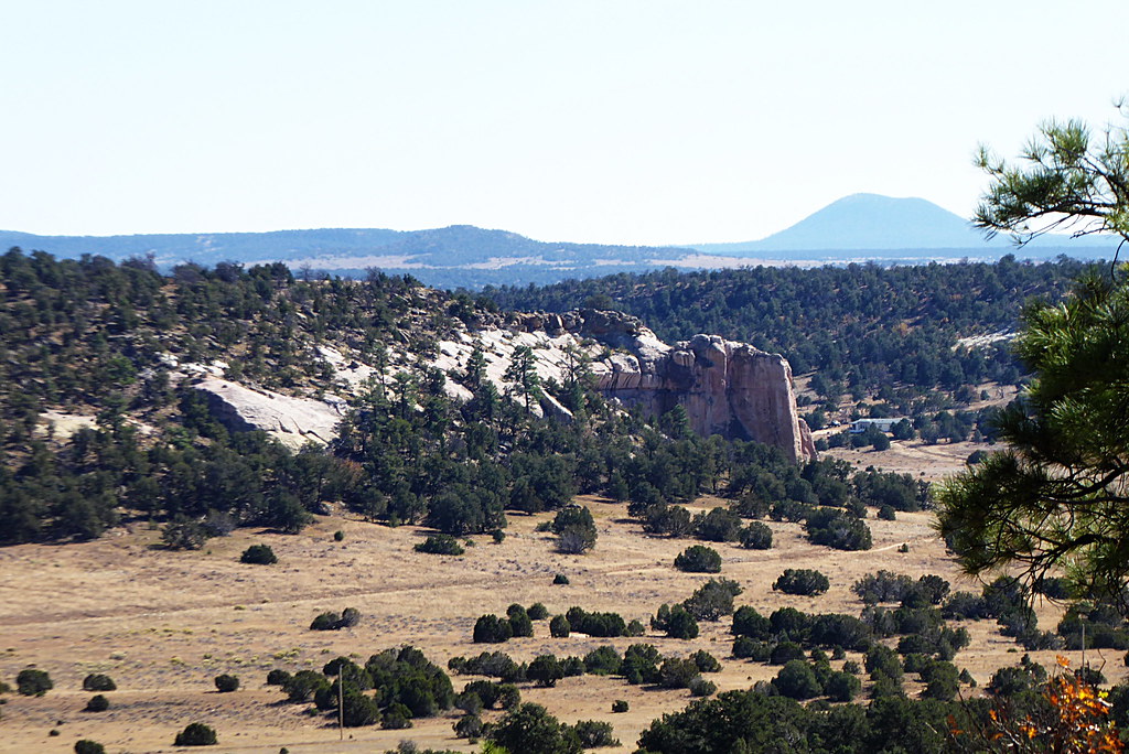 Photo: volkerschmidt2, Public Domain Dedication (CC0) (via Flickr)
Inscription Rock Trail Loop
~45 min drive
1.22-mile out-and-back trail in New Mexico with 107 ft elevation gain.
HIKE
Quasimodo
~3 min drive
7.15-mile out-and-back trail in New Mexico with 362 ft gain.
HIKE
Torreon
~4 min drive
4.26-mile out-and-back trail in New Mexico with 352 ft gain.
Photo: volkerschmidt2, Public Domain Dedication (CC0) (via Flickr)Mesa Top Trail Loop
~45 min drive
2.98-mile out-and-back trail in New Mexico with 367 ft elevation gain.
