Pyramid Rock Trail
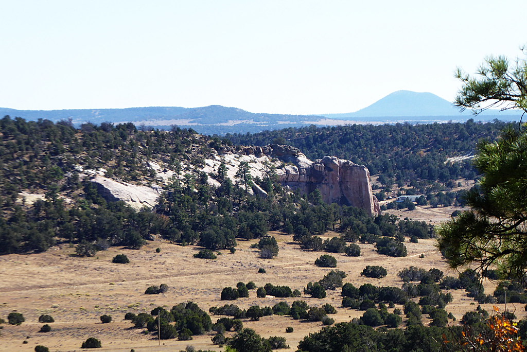
 Photo: dconvertini, CC BY-SA 2.0 (via Flickr)
- 1.7 mi
- round trip
- 966 ft
- climb
- 7,360 ft
- high point
- Out and back
- route
- Apr–Jun, Aug–Oct
- best months
Pyramid Rock Trail is an easy, rolling out-and-back hike in northwestern New Mexico, set within the Navajo Region Fire and Aviation Management unit. The trail is 3.4 miles long, starting and ending at about 6,712 feet, with a high point of 7,360 feet. The climb totals 966 feet, and the steepest stretch comes around the 1.4-mile mark, where the grade reaches 19%. The most comfortable months are typically May and September. At a nearby weather station in Gallup, which sits about 780 feet lower, typical averages run from highs near 74°F and lows around 40°F in May to highs near 79°F and lows around 47°F in September. Winter is cold, with typical January highs around 44°F and lows near 16°F. The hike takes about 1.5 hours. Church Rock Loop is 0.7 miles away, and the Gallup Area climbing area is 0.9 miles off. The Hogback Trail and Water Tank Trail are both within about 4 miles.
Local outfitters
- El Morro RV Park & Cabins38 mi away
Not on Roamze yet. Their page has how to reach them.
 Church Rock LoopHikingPhoto: kalestews, CC BY 2.0 (via Flickr)0.7 mi
- Gallup AreaRock climbingPhoto: kalestews, CC BY 2.0 (via Flickr)0.9 mi
- Hogback TrailHiking3.7 mi
- Water Tank TrailHiking3.9 mi
- Todd's BouldersRock climbing4.8 mi
- North Hogback TrailHiking5 mi
- The Barn YardRock climbing5.1 mi
- Hillside TrailHiking6.5 mi
Source: Roamze catalog (indexable pages within 10 miles, PostGIS distance)
- Church Rock LoopHiking · ~1 min drivePhoto: kalestews, CC BY 2.0 (via Flickr)
- Milk RanchHiking · ~14 min drive
- Northeastern portion of High Desert Trail SystemHiking · ~15 min drive
 Inscription Rock Trail LoopHiking · ~1h 5m drivePhoto: volkerschmidt2, Public Domain Dedication (CC0) (via Flickr)
- Purple HazeHiking · ~14 min drive
- Burma Rd TrailHiking · ~17 min drive
- Mesa Top Trail LoopHiking · ~1h 5m drivePhoto: volkerschmidt2, Public Domain Dedication (CC0) (via Flickr)
- SawmillHiking · ~17 min drive
- Large loop of the High Desert Trail SystemHiking · ~18 min drive
- Hogback TrailHiking · ~6 min drive
Best time to visit Pyramid Rock Trail
Best months: April–June and August–October. Best months have typical highs of 55–85 °F, lows of 30 °F or warmer (32 °F where the station doesn't record snow), at most one snowy day and no more than 12 wet days.
Jan
44° / 16°
6 wet · 4 snow
Feb
48° / 20°
5 wet · 3 snow
Mar
57° / 24°
4 wet · 2 snow
Apr
65° / 32°
4 wet · 1 snow
May
74° / 40°
4 wet
Jun
85° / 49°
3 wet
Jul
87° / 57°
9 wet
Aug
84° / 55°
10 wet
Sep
79° / 47°
7 wet
Oct
68° / 34°
5 wet
Nov
55° / 24°
4 wet · 1 snow
Dec
44° / 16°
6 wet · 3 snow
Typical high / low (°F) and days with rain or snow, 1991–2020. Measured at Gallup Sand & Gravel, NM, 5.3 mi away at 6,577 ft. The station sits about 800 ft lower than this place, so expect it a little cooler here. Source: NOAA NCEI U.S. Climate Normals 1991–2020.
Map and trail data © OpenStreetMap contributors
