Blue Trail
 Photo: Gary Miotla, CC BY 3.0 (via Wikimedia Commons)
- 0.9 mi
- loop
- 13 ft
- climb
- 110 ft
- high point
- Loop
- route
- Apr, Jun
- best months
Blue Trail is a 0.9-mile loop on city land in New Jersey, close to the Red Trail, Orange Trail and Brown Trail. The route is short and easy, with only about 13 feet of elevation gain over a flat course. It is a gentle walk that fits easily into a longer day of exploring the surrounding trails. The loop starts at about 95 feet and reaches a high point of 110 feet, with a slight drop of about 42 feet back to the starting level. The steepest part comes early, at roughly 5%, on the first 0.2 miles of the route. For comfortable weather, late spring and early fall work well. Typical averages from a nearby weather station in New Brunswick show May highs around 72°F and September highs around 78°F, with July peaking near 87°F. The trail is open year-round and takes about half an hour to complete. The closest neighbors are the Red Trail at 0.4 miles and the Orange Trail at 0.5 miles. Climbers can head to Roaring Rocks, about 5.5 miles away, and paddlers will find the Delaware & Raritan Canal Water Trail about 8 miles off.
Local outfitters
- Pier 13 Hoboken38 mi away
- Bartram's Garden47 mi away
Not on Roamze yet. Their page has how to reach them.
- Red TrailHikingPhoto: Gary Miotla, CC BY 3.0 (via Wikimedia Commons)0.4 mi
- Orange TrailHikingPhoto: Gary Miotla, CC BY 3.0 (via Wikimedia Commons)0.5 mi
 Brown TrailHikingPhoto: joe.ross, CC BY-SA 2.0 (via Flickr)0.6 mi
- Yellow TrailHikingPhoto: joe.ross, CC BY-SA 2.0 (via Flickr)0.7 mi
- Roaring RocksRock climbing5.5 mi
- SouthfieldRock climbing5.6 mi
- Sourland Mountain PreserveRock climbing5.6 mi
- Delaware & Raritan Canal Water TrailCanoeing7.9 mi
Source: Roamze catalog (indexable pages within 10 miles, PostGIS distance)
- Red TrailHiking · Next doorPhoto: Gary Miotla, CC BY 3.0 (via Wikimedia Commons)
- Yellow TrailHiking · ~1 min drivePhoto: joe.ross, CC BY-SA 2.0 (via Flickr)
- Orange TrailHiking · Next doorPhoto: Gary Miotla, CC BY 3.0 (via Wikimedia Commons)
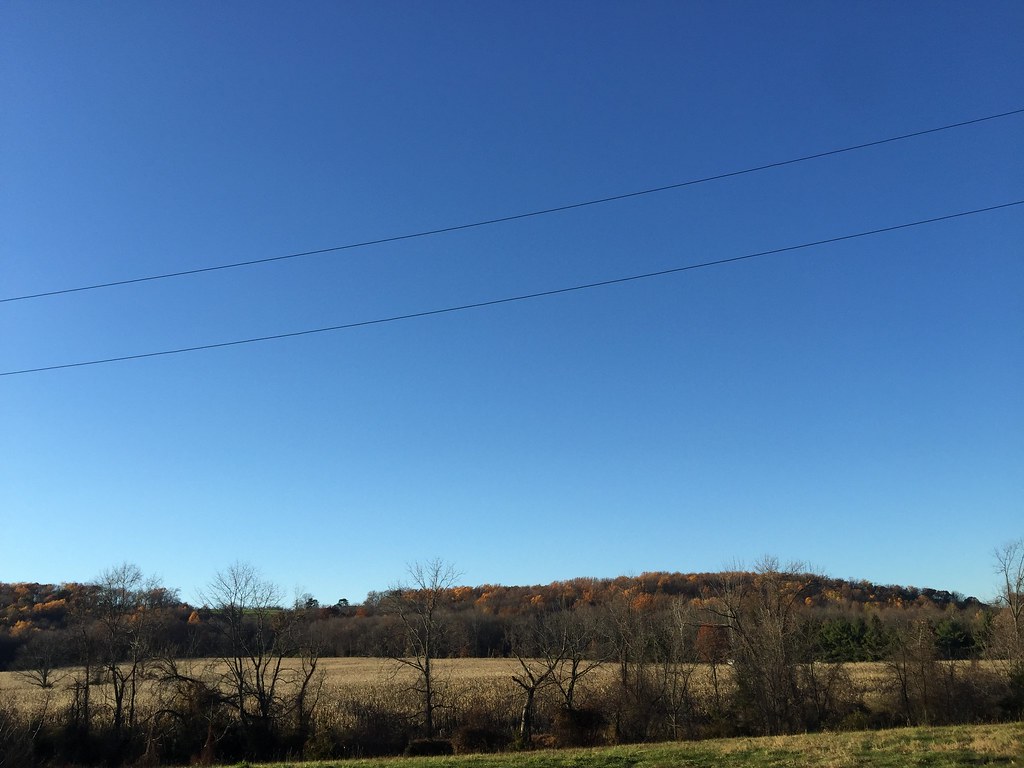 Public PathwayHiking · ~9 min drivePhoto: joe.ross, CC BY-SA 2.0 (via Flickr)
- Brown TrailHiking · ~1 min drivePhoto: joe.ross, CC BY-SA 2.0 (via Flickr)
 Blackwells TrailHiking · ~6 min drivePhoto: kjarrett, CC BY 2.0 (via Flickr)
- Creek TrailHiking · ~6 min drivePhoto: kjarrett, CC BY 2.0 (via Flickr)
- Cedar TrailHiking · ~7 min drivePhoto: kjarrett, CC BY 2.0 (via Flickr)
 RedHiking · ~8 min drivePhoto: Gary Miotla, CC BY 3.0 (via Wikimedia Commons)
 Twisty TrailHiking · ~8 min drivePhoto: Tainanian, CC BY 2.0 (via Flickr)
Best time to visit Blue Trail
Best months: April, June and August–November. Best months have typical highs of 55–85 °F, lows of 30 °F or warmer (32 °F where the station doesn't record snow), at most one snowy day and no more than 12 wet days.
Jan
40° / 23°
11 wet · 4 snow
Feb
43° / 24°
10 wet · 4 snow
Mar
51° / 31°
11 wet · 2 snow
Apr
63° / 41°
12 wet
May
72° / 51°
13 wet
Jun
81° / 60°
11 wet
Jul
87° / 66°
11 wet
Aug
85° / 64°
10 wet
Sep
78° / 57°
9 wet
Oct
67° / 44°
10 wet
Nov
55° / 35°
9 wet
Dec
45° / 28°
10 wet · 2 snow
Typical high / low (°F) and days with rain or snow, 1991–2020. Measured at New Brunswick 3 Se, NJ, 10.2 mi away at 111 ft. Source: NOAA NCEI U.S. Climate Normals 1991–2020.

Map and trail data © OpenStreetMap contributors
