Elbow Pond
Campground
Campground · 2.7 mi from the trail
Closure in the area
There's a closure order in White Mountain National Forest. It doesn't name Al Merrill Loop, so check the source for the area it covers (2 listed).
Wild River Fire - Androscoggin Ranger District
Agency closure covering White Mountain National Forest · USFS · White Mountain National Forest
Rattlesnake Fire – Pemigewasset Ranger District
Agency closure covering White Mountain National Forest · USFS · White Mountain National Forest
Town Hall Road Camping and Fire Restrictions
Agency alert covering White Mountain National Forest · USFS · White Mountain National Forest
Lincoln Woods Trail Closure
Agency alert covering White Mountain National Forest · USFS · White Mountain National Forest
Forest Roads Status
Agency alert covering White Mountain National Forest · USFS · White Mountain National Forest
As of · Source: USFS · White Mountain National Forest. Agencies don't list every closure — check before you go.
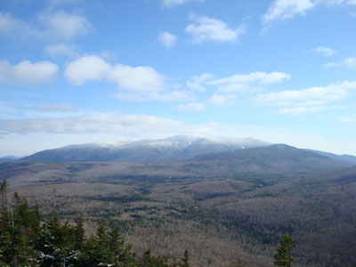
Al Merrill Loop is a ski touring route in the Pemigewasset Ranger District of White Mountain National Forest in New Hampshire. The out-and-back trip covers about 3.9 miles, with a one-way climb of 508 feet from a starting elevation of about 3,020 feet to a high point of about 3,511 feet. The steepest stretch comes at about 1.5 miles in, with a grade of about 15 percent. The route is rated moderate. It works well as a short outing in the forest's high country, with several other trails and a campground within a few miles. Gorge Brook Trail and Hurricane Trail both lie about 0.7 miles away, and Asquam Ridge Trail is about 1.1 miles off. For an overnight base, Elbow Pond campground is about 2.7 miles away.
Elbow Pond
Campground
Calamity Jane's
Restaurant
 If it rainsKen Gallager, CC BY-SA 4.0 · Wikimedia Commons
Places © OpenStreetMap contributors · Photos: Ken Gallager, CC BY-SA 4.0 (commons)
More in Bradford Pemigewasset RiverCanoeingPhoto: Public domain (via Wikimedia Commons)9.2 mi
Source: Roamze catalog (indexable pages within 10 miles, PostGIS distance)
 Loon Mountain ResortDownhill skiing · ~16 min drivePhoto: Public domain (via Wikimedia Commons)
 Cannon MountainDownhill skiing · ~23 min drivePhoto: Ericshawwhite, CC BY-SA 3.0 (via Wikimedia Commons)
Map and trail data © OpenStreetMap contributors