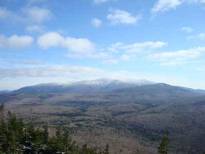
Beaver Brook Shelter
Campground
Campground · 1.8 mi from the trail
Closure in the area
There's a closure order in White Mountain National Forest. It doesn't name Asquam Ridge Trail, so check the source for the area it covers (2 listed).
Wild River Fire - Androscoggin Ranger District
Agency closure covering White Mountain National Forest · USFS · White Mountain National Forest
Rattlesnake Fire – Pemigewasset Ranger District
Agency closure covering White Mountain National Forest · USFS · White Mountain National Forest
Town Hall Road Camping and Fire Restrictions
Agency alert covering White Mountain National Forest · USFS · White Mountain National Forest
Lincoln Woods Trail Closure
Agency alert covering White Mountain National Forest · USFS · White Mountain National Forest
Forest Roads Status
Agency alert covering White Mountain National Forest · USFS · White Mountain National Forest
As of · Source: USFS · White Mountain National Forest. Agencies don't list every closure — check before you go.
Asquam Ridge Trail is a 7.12-mile out-and-back hike in New Hampshire with 2,112 feet of elevation gain and loss, reaching a maximum elevation of 4,169 feet.
Beaver Brook Shelter
Campground
 If it rainsKen Gallager, CC BY-SA 4.0 · Wikimedia Commons
Places © OpenStreetMap contributors · Photos: Ken Gallager, CC BY-SA 4.0 (commons)
More in BradfordDaily highs and lows, wind and the chance of precipitation at the summit and route start for the next 7 days, from the Open-Meteo model.
 Pemigewasset RiverCanoeingPhoto: Public domain (via Wikimedia Commons)8.4 mi
Source: Roamze catalog (indexable pages within 10 miles, PostGIS distance)
 Gorge Brook TrailHiking · ~3 min drivePhoto: jbylund, CC BY-SA 2.0 (via Flickr)
 Weasel TrailHiking · ~9 min drivePhoto: USDA Forest Service, Northern Research Station, Public Domain Mark (via Flickr)
 Glover Brook TrailHiking · ~10 min drivePhoto: Cliff from Arlington, Virginia, USA, CC BY 2.0 (via Wikimedia Commons)Carriage RoadHiking · ~3 min drivePhoto: jbylund, CC BY-SA 2.0 (via Flickr)
 Gordon Pond TrailHiking · ~9 min drivePhoto: Ktr101, CC BY-SA 2.0 (via Flickr)
 Indian Head TrailHiking · ~13 min drivePhoto: Gary Brownell, CC BY-SA 2.0 (via Flickr)
About 3.6 mi round trip.
About 2,112 ft of climbing round trip.
It is rated moderate.
About 1.5 hours round trip.
Map and trail data © OpenStreetMap contributors