South Central
South Central in Nevada has 7 sport climbing routes across 7 difficulty grades.
 Photo: Ken Lund, CC BY-SA 2.0 (via Flickr)
- 7 routes
- 5.6 – 5.12c
- Sport
Is South Central open right now?
Closure in the area
There's a closure order in Humboldt-Toiyabe National Forest. It doesn't name South Central, so check the source for the area it covers.
Elephant Fire Closure
Agency closure covering Humboldt-Toiyabe National Forest · Order 04-17-26-01-04 · USFS · Humboldt-Toiyabe National Forest
Stage 1 Fire Restrictions, Spring Mountains National Recreation Area
Agency alert covering Spring Mountains National Recreation Area · Order 04-17-05-26-02 · USFS · Spring Mountains National Recreation Area
Area, Road, and Trail Closures (Spring Mountains National Recreation Area)
Agency alert covering Humboldt-Toiyabe National Forest · Order 04-17-25-04 · USFS · Humboldt-Toiyabe National Forest
Year-Round Fire Restrictions (Spring Mountains National Recreation Area)
Agency alert covering Humboldt-Toiyabe National Forest · Order 04-17-24-01 · USFS · Humboldt-Toiyabe National Forest
Vehicle Snow Chain Requirements during Inclement Weather (Spring Mountains National Recreation Area)
Agency alert covering Humboldt-Toiyabe National Forest · Order 04-17-23-01 · USFS · Humboldt-Toiyabe National Forest
As of · Source: USFS · Humboldt-Toiyabe National Forest. Agencies don't list every closure — check before you go.
Best time to visit South Central
Best months: May–October. Best months have typical highs of 55–85 °F, lows of 30 °F or warmer (32 °F where the station doesn't record snow), at most one snowy day and no more than 12 wet days.
Jan
44° / 22°
6 wet
Feb
44° / 22°
6 wet
Mar
49° / 26°
6 wet
Apr
55° / 30°
4 wet
May
63° / 37°
4 wet
Jun
74° / 46°
2 wet
Jul
79° / 52°
5 wet
Aug
78° / 52°
6 wet
Sep
72° / 44°
4 wet
Oct
62° / 35°
3 wet
Nov
51° / 27°
4 wet
Dec
44° / 21°
5 wet
Typical high / low (°F) and days with rain or snow, 1991–2020. Measured at Mt Charleston Fire Stn, NV, 1.2 mi away at 7,460 ft. The station sits about 800 ft lower than this place, so expect it a little cooler here. This station doesn't record snowfall. Source: NOAA NCEI U.S. Climate Normals 1991–2020.
South Central is a climbing area in Nevada's Mt. Charleston Wilderness, within the Spring Mountains National Recreation Area of the Humboldt-Toiyabe National Forest. The Forest Service manages the surrounding land, and the area sits within a cluster of climbing spots, with The Hood and The Souls Cave just 0.1 mile away. The climbing here is all sport, and the routes run from 5.6 up to 5.12c. The median grade is 5.12a. Some of the named routes are Blue Man at 5.6, Bloodline at 5.12b and Deluge at 5.12c. Summer is the most comfortable time to climb. Typical averages from a nearby weather station run to highs around 79°F in July with lows near 52°F, while winter highs sit in the mid-40s. Mary Jane Falls is about half a mile away, and the Charleston Peak Trail South Loop and Cathedral Rock Picnic Area are both roughly 1.4 miles off.
Keep exploring — more climbs worth the drive
 Photo: Ken Lund, CC BY-SA 2.0 (via Flickr)
The Souls Cave
~0 min drive
Souls Cave, The in Nevada has 7 sport climbing routes on 3 difficulty grades.
Photo: Ken Lund, CC BY-SA 2.0 (via Flickr)The Compton Cave
~0 min drive
Compton Cave in Nevada has 17 sport climbing routes across 12 difficulty grades.
 Photo: Ken Lund, CC BY-SA 2.0 (via Flickr)
Pine Tree Ledge
~0 min drive
Pine Tree Ledge in Nevada has 7 sport climbing routes.
Photo: Ken Lund, CC BY-SA 2.0 (via Flickr)Central Slab Area
~1 min drive
12 sport climbing routes on slab rock at Central Slab Area, Nevada.
Photo: Ken Lund, CC BY-SA 2.0 (via Flickr)The Imagination Wall
~2 min drive
Imagination Wall in Nevada has 8 climbing routes with sport and trad options.
Photo: Ken Lund, CC BY-SA 2.0 (via Flickr)Sesame Street
~2 min drive
Sesame Street in Nevada has 8 sport climbing routes across 5 difficulty grades.
Photo: Ken Lund, CC BY-SA 2.0 (via Flickr)Universal Wall - Left
~2 min drive
Universal Wall - Left in Nevada has 13 routes across 10 grades, offering sport and trad climbing.
 Photo: Ken Lund, CC BY-SA 2.0 (via Flickr)
Kyle Canyon
~2 min drive
Kyle Canyon in Nevada has 3 sport climbing routes.
Photo: Ken Lund, CC BY-SA 2.0 (via Flickr)Walden
~2 min drive
Walden is a Nevada climbing area with 5 sport routes across 4 difficulty grades.
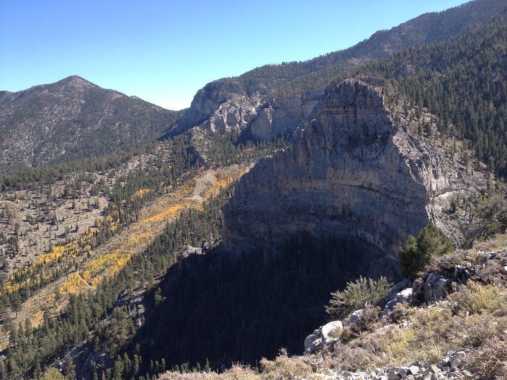 Photo: christie_verbose, CC BY 2.0 (via Flickr)
The Church Pew
~2 min drive
Church Pew, The in Nevada has 10 sport climbing routes across 6 grades.


