Concours Parts & Accessories
Campground
Campground · 2.8 mi from the trail
Riverview Trail is a short, easy out-and-back hike in Nevada, about a mile from the community of Pinyon Hills. The trail is roughly 3.2 miles long, with a low point of 4,593 feet and a high of 4,621 feet. It is a flat route, with only about 85 feet of elevation gain and loss over the full trip, and the steepest section comes early on, around 0.06 miles in, with a grade of about 2%. Late spring and early fall are the most comfortable times to go. Typical averages from a nearby weather station in Carson City show May highs around 70°F and September highs around 81°F, while July and August average about 90°F. The trip takes about an hour. The trail is close to several other routes, including Mexican Ditch Trail, about 0.2 miles away, and Eagle Valley Trail, about 0.4 miles away. Prison Hill, a climbing area, lies about 1.8 miles off, and Washoe Lake State Park Campground is about 6.4 miles away.
Concours Parts & Accessories
Campground
Places © OpenStreetMap contributors
More in Sunnyside-Tahoe CityNot on Roamze yet. Their page has how to reach them.
Best months: March–June and September–October. Best months have typical highs of 55–85 °F, lows of 30 °F or warmer (32 °F where the station doesn't record snow), at most one snowy day and no more than 12 wet days.
Jan
45° / 24°
6 wet · 2 snow
Feb
50° / 27°
6 wet · 1 snow
Mar
56° / 32°
5 wet · 1 snow
Apr
62° / 36°
3 wet
May
70° / 43°
3 wet
Jun
81° / 49°
2 wet
Jul
90° / 55°
1 wet
Aug
88° / 53°
1 wet
Sep
81° / 46°
1 wet
Oct
68° / 36°
2 wet
Nov
55° / 28°
3 wet · 1 snow
Dec
45° / 24°
5 wet · 1 snow
Typical high / low (°F) and days with rain or snow, 1991–2020. Measured at Carson City, NV, 3.5 mi away at 4,761 ft. Source: NOAA NCEI U.S. Climate Normals 1991–2020.
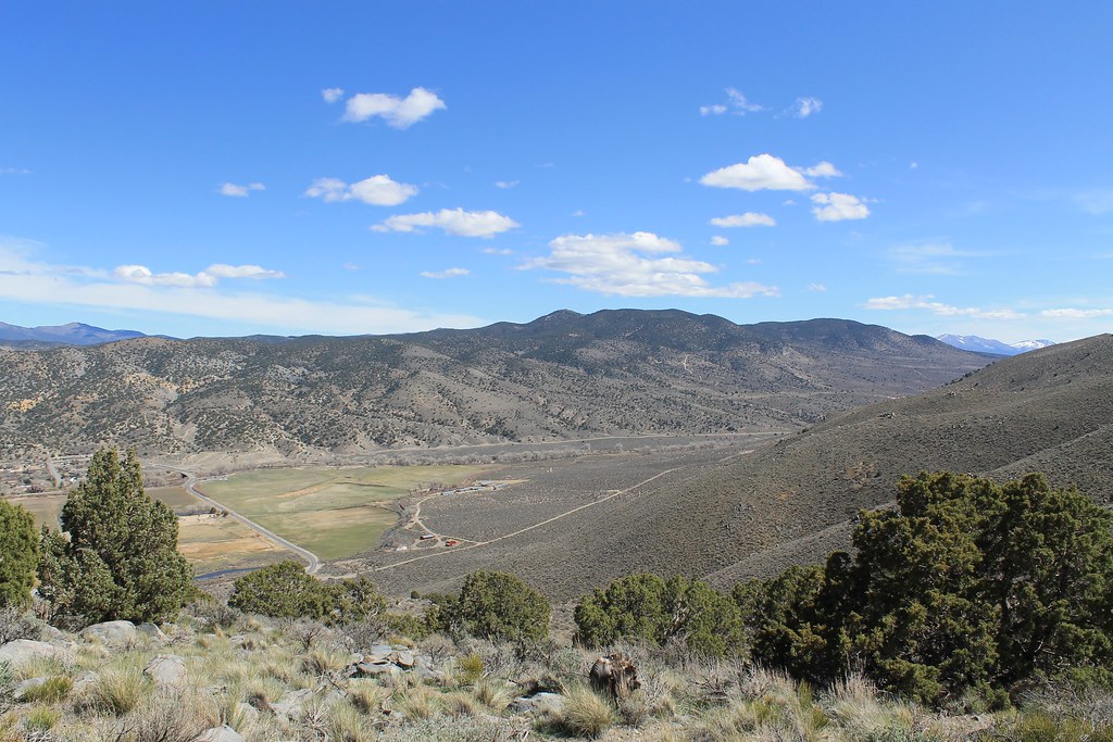 Photo: Nouhailler, CC BY-SA 2.0 (via Flickr)
Bitterbrush Loop
~1 min drive
0.41-mile loop in Nevada with 116 ft elevation gain and loss.
 Photo: Nouhailler, CC BY-SA 2.0 (via Flickr)
Rocky Trail
~5 min drive
2.50-mile out-and-back hike in Nevada with 617 ft gain
 Photo: Wheeler Cowperthwaite, CC BY 2.0 (via Flickr)
Lincoln Bypass
~7 min drive
8.26-mile out-and-back trail in Nevada with 1,191 ft elevation gain.
Photo: Nouhailler, CC BY-SA 2.0 (via Flickr)Sagebrush Loop
~1 min drive
0.96-mile loop trail in Nevada with 123 ft elevation gain
 Photo: Nouhailler, CC BY-SA 2.0 (via Flickr)
Centennial Loop
~7 min drive
4.74-mile out-and-back trail in Nevada with 1,481 ft elevation gain and loss.
 Photo: jfdervin, CC BY-SA 2.0 (via Flickr)
Ash to Kings Trail
~10 min drive
14.20-mile out-and-back trail in Nevada with 546 ft elevation gain.
 Photo: jfdervin, CC BY-SA 2.0 (via Flickr)
Odyssey Trail
~3 min drive
1.18-mile out-and-back trail in Nevada with 535 ft elevation gain
 Photo: jfdervin, CC BY-SA 2.0 (via Flickr)
EZ Trail
~8 min drive
2.42-mile out-and-back hike in Nevada with 1,069 ft elevation gain
 Photo: jfdervin, CC BY-SA 2.0 (via Flickr)
Capital to Tahoe
~10 min drive
20.24-mile out-and-back trail in Nevada with 1,776 ft gain
Photo: Nouhailler, CC BY-SA 2.0 (via Flickr)Golf Course Outer Trail
~3 min drive
1.85-mile out-and-back trail in Nevada with 83 ft gain.
Map and trail data © OpenStreetMap contributors

