Jackrabbit Trail
- 1.0 mi
- round trip
- 577 ft
- climb
- 4,802 ft
- high point
- Out and back
- route
- Apr–Jun, Sep–Oct
- best months
Jackrabbit Trail is a short, easy hike on Bureau of Land Management land in the Sierra Front Field Office, about a mile from the town of Sparks, Nevada. The trail is an out-and-back, roughly 2 miles long, with a total climb of about 577 feet and a high point near 4,800 feet. The steepest stretch comes at about 0.86 miles in, with a grade of about 9 percent. Spring and fall are the most comfortable times to go. Typical averages from the nearby Spanish Springs weather station show May highs around 73°F and October highs around 69°F, while July and August average in the low 90s. The Zipper, a mountain biking route, sits just 0.1 mile away, and Spanish Springs Singletrack is about 0.3 mile off. Pah Rah Interpretive Trail is about 1.2 miles away, and Reno Bouldering is about 5.9 miles away.
Local outfitters
- Alpenglow Expeditions40 mi away
Not on Roamze yet. Their page has how to reach them.
- The ZipperMountain biking0.1 mi
- Spanish Springs SingletrackHiking0.3 mi
- Pah Rah Interpretive TrailHiking1.2 mi
 Sparks Marina Loop TrailHikingPhoto: Ken Lund from Reno, Nevada, USA, CC BY-SA 2.0 (via Wikimedia Commons)4.6 mi
- Reno BoulderingRock climbing5.9 mi
- Sun Valley Regional Park (Lizard Peak)Rock climbing7 mi
- Comstock QuarryRock climbing8.7 mi
- Redrum boulderRock climbing9.3 mi
Source: Roamze catalog (indexable pages within 10 miles, PostGIS distance)
- Sparks Marina Loop TrailHiking · ~8 min drivePhoto: Ken Lund from Reno, Nevada, USA, CC BY-SA 2.0 (via Wikimedia Commons)
 Highland LoopHiking · ~11 min drivePhoto: Mitch Barrie from Reno, NV, USA, CC BY-SA 2.0 (via Wikimedia Commons)
 Perimeter LoopHiking · ~12 min drivePhoto: Mitch Barrie from Reno, NV, USA, CC BY-SA 2.0 (via Wikimedia Commons)
- Highland LoopHiking · ~12 min drivePhoto: Mitch Barrie from Reno, NV, USA, CC BY-SA 2.0 (via Wikimedia Commons)
- Perimeter LoopHiking · ~13 min drivePhoto: Mitch Barrie from Reno, NV, USA, CC BY-SA 2.0 (via Wikimedia Commons)
- The ZipperHiking · Next door
- South Park LoopHiking · ~13 min drivePhoto: Mitch Barrie from Reno, NV, USA, CC BY-SA 2.0 (via Wikimedia Commons)
- Keystone CanyonHiking · ~17 min drive
 Tahoe-Pyramid TrailHiking · ~14 min drivePhoto: Ken Lund from Reno, Nevada, USA, CC BY-SA 2.0 (via Wikimedia Commons)
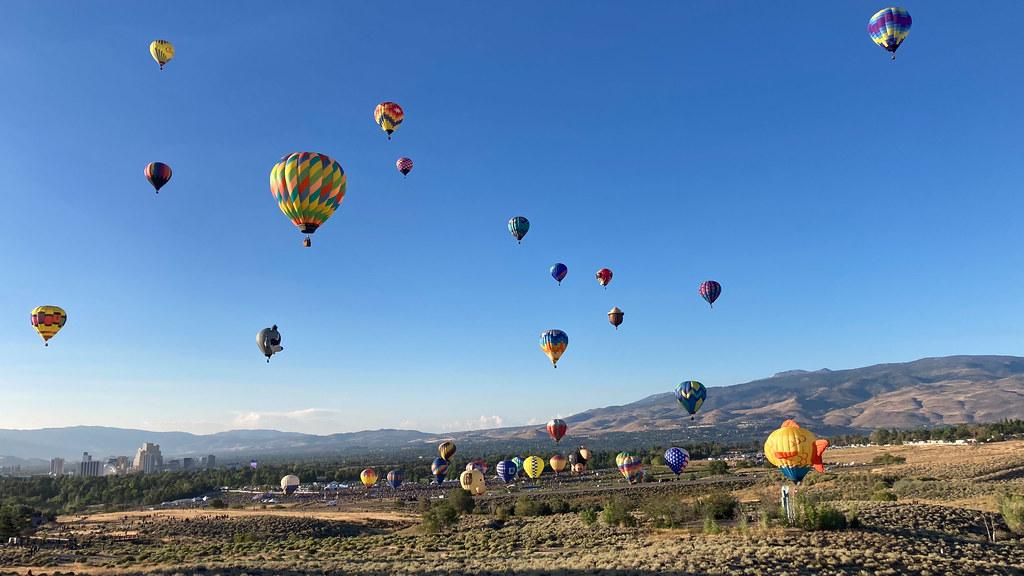 Nature TrailHiking · ~16 min drivePhoto: nonbinaryanalog, CC BY 2.0 (via Flickr)
Best time to visit Jackrabbit Trail
Best months: April–June and September–October. Best months have typical highs of 55–85 °F, lows of 30 °F or warmer (32 °F where the station doesn't record snow), at most one snowy day and no more than 12 wet days.
Jan
46° / 22°
Feb
51° / 24°
Mar
58° / 30°
Apr
64° / 34°
May
73° / 42°
Jun
83° / 49°
Jul
92° / 55°
Aug
91° / 53°
Sep
83° / 45°
Oct
69° / 35°
Nov
55° / 27°
Dec
45° / 22°
Typical high / low (°F) and days with rain or snow, 1991–2020. Measured at Spanish Springs, NV, 4.7 mi away at 4,489 ft. This station doesn't record snowfall. Source: NOAA NCEI U.S. Climate Normals 1991–2020.
Map and trail data © OpenStreetMap contributors
