Fletcher Canyon
 Photo: stevelyon, CC BY-SA 2.0 (via Flickr)
- 2.2 mi
- round trip
- 744 ft
- climb
- 7,696 ft
- high point
- Out and back
- route
- May–Oct
- best months
Is Fletcher Canyon open right now?
Closure in the area
There's a closure order in Humboldt-Toiyabe National Forest. It doesn't name Fletcher Canyon, so check the source for the area it covers.
Elephant Fire Closure
Agency closure covering Humboldt-Toiyabe National Forest · Order 04-17-26-01-04 · USFS · Humboldt-Toiyabe National Forest
Area, Road, and Trail Closures (Spring Mountains National Recreation Area)
Agency alert covering Humboldt-Toiyabe National Forest · Order 04-17-25-04 · USFS · Humboldt-Toiyabe National Forest
Year-Round Fire Restrictions (Spring Mountains National Recreation Area)
Agency alert covering Humboldt-Toiyabe National Forest · Order 04-17-24-01 · USFS · Humboldt-Toiyabe National Forest
Vehicle Snow Chain Requirements during Inclement Weather (Spring Mountains National Recreation Area)
Agency alert covering Humboldt-Toiyabe National Forest · Order 04-17-23-01 · USFS · Humboldt-Toiyabe National Forest
Rainbow Canyon Flood Diversion Structure Closure (Spring Mountains National Recreation Area)
Agency alert covering Humboldt-Toiyabe National Forest · Order 04-17-15-01 · USFS · Humboldt-Toiyabe National Forest
As of · Source: USFS · Humboldt-Toiyabe National Forest. Agencies don't list every closure — check before you go.
Fletcher Canyon is a 2.2-mile out-and-back hike in the Spring Mountains National Recreation Area, part of the Humboldt-Toiyabe National Forest in Nevada. The Forest Service manages the land, and the trail is a natural-surface route with a moderate rating. The hike gains about 744 feet, from a low point of 7,187 feet to a high of 7,696 feet. Summer is the most comfortable time to go. Typical averages from a nearby weather station at Mt Charleston show July highs around 79°F with lows near 52°F, while winter highs sit in the mid-40s. Eagle's Nest is just 0.1 mile away, and Kyle Canyon R.V. Group Campground and Fletcher View are both about 0.3 mile off. Pirate's Cove, a climbing area, is roughly 0.4 mile away.
Best time to go · May–Oct
Best time to visit Fletcher Canyon
Best months: May–October. Best months have typical highs of 55–85 °F, lows of 30 °F or warmer (32 °F where the station doesn't record snow), at most one snowy day and no more than 12 wet days.
Jan
44° / 22°
6 wet
Feb
44° / 22°
6 wet
Mar
49° / 26°
6 wet
Apr
55° / 30°
4 wet
May
63° / 37°
4 wet
Jun
74° / 46°
2 wet
Jul
79° / 52°
5 wet
Aug
78° / 52°
6 wet
Sep
72° / 44°
4 wet
Oct
62° / 35°
3 wet
Nov
51° / 27°
4 wet
Dec
44° / 21°
5 wet
Typical high / low (°F) and days with rain or snow, 1991–2020. Measured at Mt Charleston Fire Stn, NV, 1.7 mi away at 7,460 ft. This station doesn't record snowfall. Source: NOAA NCEI U.S. Climate Normals 1991–2020.
Keep exploring — more trails worth the drive
Photo: stevelyon, CC BY-SA 2.0 (via Flickr)Eagle's Nest
Next door
3.60-mile out-and-back trail in Nevada with 182 ft gain.
 Photo: Desert Landscape Conservation Cooperative, CC BY 2.0 (via Flickr)
Acastus Trail
~3 min drive
0.64-mile out-and-back trail in Nevada with 96 ft elevation gain.
 Photo: Ken Lund, CC BY-SA 2.0 (via Flickr)
Trail Canyon
~4 min drive
3.91-mile out-and-back trail in Nevada with 1,527 ft elevation gain.
Photo: stevelyon, CC BY-SA 2.0 (via Flickr)Stanley B Springs Trail
~2 min drive
2.46-mile out-and-back hike in Nevada with 1,122 ft elevation gain
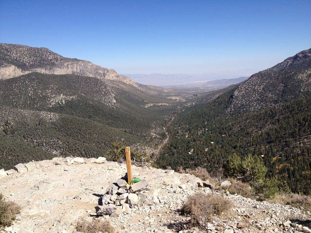 Photo: christie_verbose, CC BY 2.0 (via Flickr)
Cathedral Rock
~3 min drive
Easy loop trail featuring Cathedral Rock formations in Nevada.
 Photo: bahniuk, CC BY 3.0 (via Wikimedia Commons)
North Loop
~5 min drive
9.61-mile loop trail in Nevada with 2,725 ft elevation gain.
Photo: Desert Landscape Conservation Cooperative, CC BY 2.0 (via Flickr)Acastus
~3 min drive
3.40-mile out-and-back trail in Nevada with 285 ft gain.
Photo: bahniuk, CC BY 3.0 (via Wikimedia Commons)Trough Trail
~4 min drive
1.02-mile out-and-back hike in Nevada with 465 ft gain/loss.
 Photo: Ken Lund, CC BY-SA 2.0 (via Flickr)
Bristlecone
~7 min drive
10.20-mile out-and-back trail in Nevada with 590 ft elevation gain.
 Photo: redlicks, CC BY 3.0 (via Wikimedia Commons)
Wildhorse Canyon
~4 min drive
2.42-mile out-and-back trail in Nevada with 1,215 ft gain/loss
