Mount Rose Campground
Campground
Campground · 5.7 mi from the trail
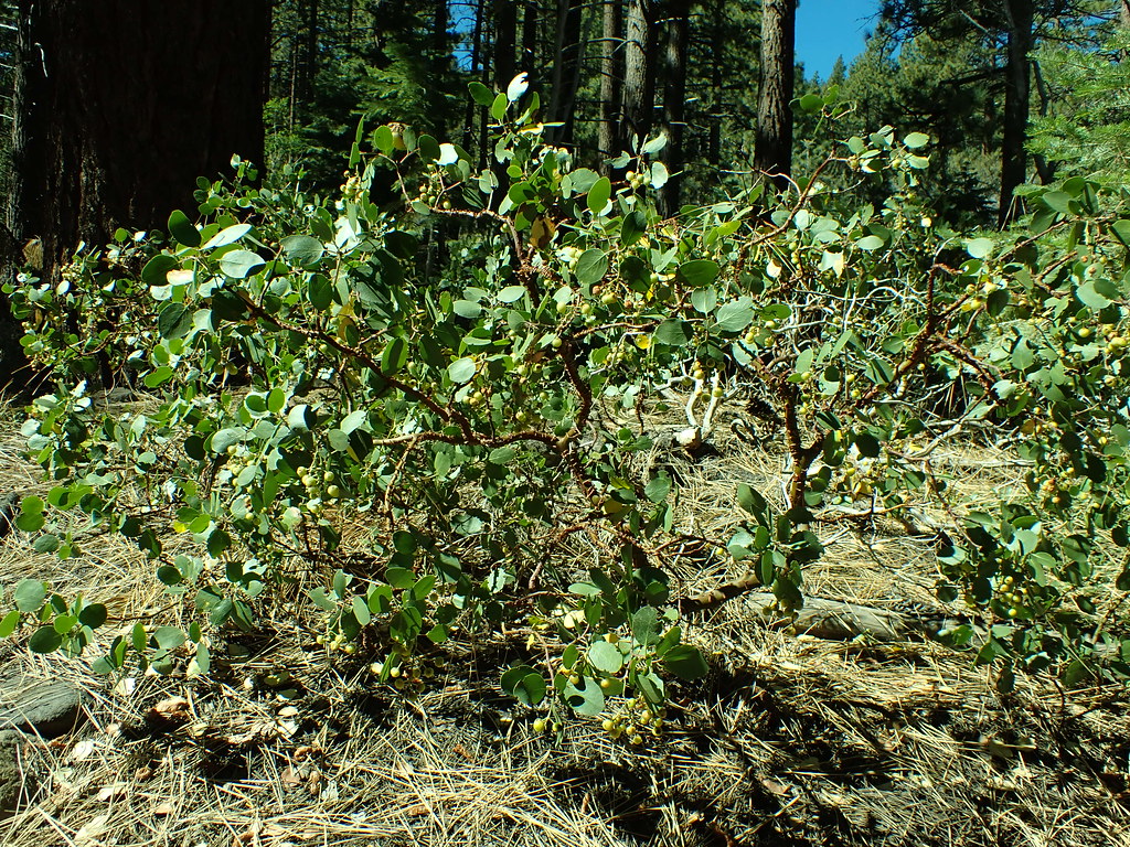 Photo: Matt Lavin, CC BY-SA 2.0 (via Flickr)
Closure in the area
There's a closure order in Carson Ranger District. It doesn't name Dry Pond, so check the source for the area it covers (3 listed).
Hawk Fire Closure (Carson Ranger District)
Agency closure covering Carson Ranger District · Order 04-17-26-01-08 · USFS · Carson Ranger District
Emergency Recreation Shooting Order (Carson Ranger District)
Agency closure covering Carson Ranger District · Order 04-17-26-01-05 · USFS · Carson Ranger District
Elephant Fire Closure
Agency closure covering Humboldt-Toiyabe National Forest · Order 04-17-26-01-04 · USFS · Humboldt-Toiyabe National Forest
Floriston Fire Closure
Agency alert covering Carson Ranger District · Order 17-26-24 · USFS · Carson Ranger District
Power line construction along SR 88, Alpine County, California (Carson Ranger District)
Agency alert covering Carson Ranger District · USFS · Carson Ranger District
As of · Source: USFS · Carson Ranger District. Agencies don't list every closure — check before you go.
Dry Pond is a 4.2-mile out-and-back hike on natural trail in Nevada's Humboldt-Toiyabe National Forest, within the Carson Ranger District. It is a moderate route with a 471-foot elevation gain, rising from 6,494 feet to 6,966 feet. The trail is accessible and allows horses and bikes, and the Forest Service lists it as accessible. It is open from about June 1 to October 15 each year. Summer is the most comfortable time to go. Typical averages from a nearby weather station in Incline Village, at a lower elevation, show July and August highs around 76°F with lows near 50°F. Winter is cold, with January highs around 41°F and lows near 24°F. Thomas Creek, a climbing area, is about 0.6 miles away, and the Upper Thomas Creek Trail is about 1.3 miles away. The Sierra Front Trail for mountain biking is about 1.4 miles off. Mt. Rose Campground is about 6 miles away.
Mount Rose Campground
Campground
The Lodge, A Coffee + Wine Bar
Bar
Fox Cultural Hall
Museum
Places © OpenStreetMap contributors
More in Sunnyside-Tahoe CityNot on Roamze yet. Their page has how to reach them.
Best months: May–October. Best months have typical highs of 55–85 °F, lows of 30 °F or warmer (32 °F where the station doesn't record snow), at most one snowy day and no more than 12 wet days.
Jan
41° / 24°
Feb
42° / 25°
Mar
45° / 27°
Apr
50° / 31°
May
59° / 37°
Jun
68° / 45°
Jul
76° / 50°
Aug
76° / 50°
Sep
71° / 45°
Oct
59° / 36°
Nov
50° / 30°
Dec
41° / 25°
Typical high / low (°F) and days with rain or snow, 1991–2020. Measured at Incline Village, NV, 10.9 mi away at 6,356 ft. The station sits about 600 ft lower than this place, so expect it a little cooler here. This station doesn't record snowfall. Source: NOAA NCEI U.S. Climate Normals 1991–2020.
 Photo: Ken Lund, CC BY-SA 2.0 (via Flickr)
Upper Thomas Creek Trail
~2 min drive
2.40-mile out-and-back hike in Nevada with 1,035 ft elevation gain.
 Photo: simonov, CC BY-SA 2.0 (via Flickr)
Sierra Front Trail
~2 min drive
7.04-mile out-and-back trail in Nevada with 6 ft of elevation gain.
 Photo: simonov, CC BY-SA 2.0 (via Flickr)
Thomas Creek
~3 min drive
8.76-mile out-and-back trail in Nevada with 3,066 ft elevation gain.
 Photo: simonov — CC BY-SA 2.0 (via Flickr)
Tamarack Lake Trail
~10 min drive
4.96-mile out-and-back hike to Tamarack Lake in Nevada.
HIKE
Lower Whites Creek Trail
~4 min drive
6.6-mile out-and-back hike in Nevada with 894 ft elevation gain and loss.
 Photo: simonov, CC BY-SA 2.0 (via Flickr)
Whites Creek
~2 min drive
2.30-mile out-and-back trail in Nevada with 600 ft elevation gain.
 Photo: Ryan Finnie, CC BY-SA 2.0 (via Flickr)
Brown's Creek Trail
~6 min drive
6.78-mile out-and-back hike in Nevada with 2,541 ft elevation gain and loss.
HIKE
Tahoe Rim Trail
~10 min drive
62.74-mile out-and-back trail in Nevada with 7,599 ft elevation gain
HIKE
High Fives Trail
~7 min drive
1.78-mile out-and-back trail in Nevada with 1,682 ft gain and 7,979 ft max elevation.
Photo: simonov, CC BY-SA 2.0 (via Flickr)Lower Thomas Creek Trail
~3 min drive
2.96-mile out-and-back trail in Nevada with 565 ft elevation gain


