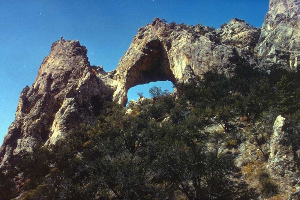
Osceola Arch
- 7,082 ft
- elevation
- Bureau of Land Management
- managed by
- Apr–Oct
- best months
Osceola Arch is a natural arch in White Pine County, Nevada, sitting at about 7,082 feet on land managed by the Bureau of Land Management's Bristlecone Field Office. The nearest town is Baker, about 17 miles away. The best time to visit is late spring through early fall. A nearby weather station at Great Basin National Park records typical averages of about 64°F highs in May and 73°F in September, with July warming to around 85°F, and its elevation is close to the arch's. The closest options for a longer outing are Osceola Road and Adt - Nevada - S - Seg 1, both about 2.5 miles away. The Osceola Ditch Trail lies about 6 miles off, and Cleve Creek Campground offers a place to stay about 9.5 miles away.
- Elevation
- 7,082 ft
- Land manager
- Bureau of Land Management
Elevation from USGS 3D Elevation Program terrain data (about 10 m resolution).
- Osceola RoadHiking2.5 mi
- Adt - Nevada - S - Seg 1Hiking2.5 mi
- Sac Pass LoopHiking5.1 mi
- Lucky Boy LoopHiking5.4 mi
- Mine Shaft LoopHiking5.9 mi
- Osceola Ditch TrailHiking6.3 mi
- Upper Strawberry TrailHiking7.1 mi
- Cleve Creek CampgroundCamping9.5 mi
Source: Roamze catalog (indexable pages within 10 miles, PostGIS distance)
Best time to visit Osceola Arch
Best months: April–October. Best months have typical highs of 55–85 °F, lows of 30 °F or warmer (32 °F where the station doesn't record snow), at most one snowy day and no more than 12 wet days.
Jan
40° / 20°
6 wet
Feb
41° / 21°
7 wet
Mar
48° / 27°
7 wet
Apr
55° / 32°
7 wet
May
64° / 40°
7 wet
Jun
76° / 49°
5 wet
Jul
85° / 58°
7 wet
Aug
83° / 56°
7 wet
Sep
73° / 48°
6 wet
Oct
60° / 36°
5 wet
Nov
48° / 26°
6 wet
Dec
40° / 20°
6 wet
Typical high / low (°F) and days with rain or snow, 1991–2020. Measured at Great Basin Np, NV, 12.8 mi away at 6,850 ft. This station doesn't record snowfall. Source: NOAA NCEI U.S. Climate Normals 1991–2020.