Ginny Mountain
- 4,701 ft
- summit
- 1
- way up
- Jul–Oct
- best months
Ginny Mountain is a summit in Montana, rising to 4,701 feet about 3 miles from East Missoula. It sits close to a cluster of trails, with the Ginny Mtn Trail and Crooked Trail both about 0.3 miles away, so it works well as a destination for a short outing or as a high point to pair with other routes in the area. Summer is the most comfortable time to go. Typical averages from a nearby weather station in Missoula show July and August highs around 84 to 85°F with lows near 50°F and only about seven wet days a month. That station sits roughly 1,300 feet below the summit, so temperatures on top run cooler. The Ginny Mtn Trail and the Crazy Canyon Cutoff A hike are both within a third of a mile. Mountain bikers can ride the Crooked Trail, and Pattee Canyon Picnic Area, about 4 miles away, offers a place to camp.
Conditions and forecast
Daily highs and lows, wind and the chance of precipitation at the summit and route start for the next 7 days, from the Open-Meteo model.
- Summit elevation
- 4,701 ft
Elevation from USGS 3D Elevation Program terrain data (about 10 m resolution).
Map © Mapbox © OpenStreetMap contributors Questions about Ginny Mountain
How tall is Ginny Mountain?
4,701 ft (1,433 m).
How many routes go to the summit of Ginny Mountain?
One: Ginny Mtn Trail.
- Mount Sentinel5,155 ft · Montana2 routes1.5 mi away
- University Mountain5,813 ft · Montana2 routes1.7 mi away
- Sheep Mountain7,646 ft · Montana1 route10 mi away
- Triangle Peak7,782 ft · Montana1 route18 mi away
- Albert Point6,001 ft · Montana1 route21 mi away
- Cinnamon Bear Point7,044 ft · Montana1 route21 mi away
- Ginny Mtn TrailHiking0.3 mi
- Crooked TrailMountain biking0.3 mi
- CRAZY CANYON CUTOFF AHiking0.3 mi
- Crooked CutoffHiking0.5 mi
- Crazy Canyon Cutoff DMountain biking0.6 mi
 Crazy Canyon Cutoff BMountain bikingPhoto: nklette, CC BY 3.0 (via Wikimedia Commons)0.7 mi
- Crazy Canyon Cutoff CMountain biking0.7 mi
 Pattee Canyon Picnic AreaCampingPhoto: Recreation.gov (RIDB) / public domain4.2 mi
Source: Roamze catalog (indexable pages within 10 miles, PostGIS distance)
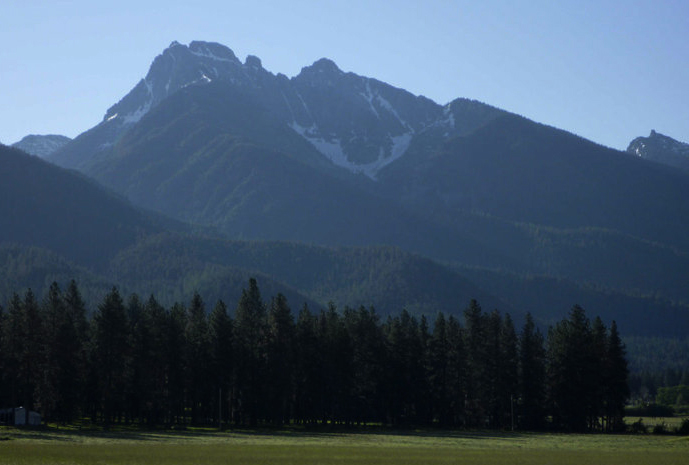 Mount CalowahcanSummit · ~1h 14m drivePhoto: Run shane run Shane Thomas McMillan, CC BY-SA 3.0 (via Wikimedia Commons)
 Gray Wolf PeakSummit · ~54 min drivePhoto: Thad Lowary, US Forest Service, Public domain (via Wikimedia Commons)
- Mount SentinelSummit · ~3 min drive
- University MountainSummit · ~3 min drive
- Sheep MountainSummit · ~18 min drive
- Triangle PeakSummit · ~31 min drive
- Petty MountainSummit · ~38 min drive
- West Fork ButteSummit · ~40 min drive
- Boles PointSummit · ~40 min drive
- Spink PointSummit · ~43 min drive
Also worth it near here
- Crazy Canyon Cutoff BMountain biking · ~1 min drivePhoto: nklette, CC BY 3.0 (via Wikimedia Commons)
 LARCH CAMP CUTOFF DHiking · ~2 min drivePhoto: Forest Service - Northern Region, Public Domain Mark (via Flickr)
- Pattee South -- Main LoopCross-country skiing · ~2 min drive
- Pattee Canyon Picnic AreaCamping · ~7 min drive
Best time to visit Ginny Mountain
Best months: July–October. Best months have typical highs of 55–85 °F, lows of 30 °F or warmer (32 °F where the station doesn't record snow), at most one snowy day and no more than 12 wet days.
Jan
34° / 20°
14 wet · 10 snow
Feb
39° / 22°
11 wet · 8 snow
Mar
49° / 27°
13 wet · 6 snow
Apr
57° / 33°
12 wet · 2 snow
May
67° / 41°
13 wet
Jun
73° / 47°
13 wet
Jul
85° / 52°
7 wet
Aug
84° / 51°
7 wet
Sep
73° / 44°
8 wet
Oct
56° / 34°
10 wet · 1 snow
Nov
41° / 26°
12 wet · 6 snow
Dec
33° / 20°
14 wet · 10 snow
Typical high / low (°F) and days with rain or snow, 1991–2020. Measured at Missoula 2 Ne, MT, 4.6 mi away at 3,420 ft. The station sits about 1,300 ft lower than this place, so expect it a little cooler here. Source: NOAA NCEI U.S. Climate Normals 1991–2020.
