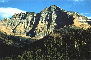
Bearhat Mountain
 Photo: GlacierNPS, Public domain (via Wikimedia Commons)
- 8,719 ft
- summit
Is Bearhat Mountain open right now?
Closure in the area
There's a closure order in Glacier National Park. It doesn't name Bearhat Mountain, so check the source for the area it covers.
Going-to-the-Sun Road Seasonal Closure
Park closure covering Glacier National Park · NPS · Glacier National Park
As of · Source: NPS · Glacier National Park. Agencies don't list every closure — check before you go.
Bearhat Mountain is a summit in Glacier National Park, in Flathead County, Montana. It rises to about 8,719 feet, and the nearest town is Red Rock Point, roughly 3 miles away. The mountain lies entirely within the national park, so park regulations govern any visit. Several established hikes sit close to the summit. Avalanche Lake Trail is about 1.4 miles away and Hidden Lake Trail about 1.9 miles. Trail of the Cedars and Avalanche Creek are both roughly 2.7 miles off, which makes them easy to pair with a trip into this part of the park.
Conditions and forecast
Daily highs and lows, wind and the chance of precipitation at the summit for the next 7 days, from the Open-Meteo model.
- Summit elevation
- 8,719 ft
Elevation from USGS 3D Elevation Program terrain data (about 10 m resolution).
We don't know of a mapped trail or route to the summit of Bearhat Mountain. Plan the approach with local maps, a guidebook or a local guide, and check conditions before you go.
Questions about Bearhat Mountain
How tall is Bearhat Mountain?
8,719 ft (2,658 m).
Is there a trail to the top of Bearhat Mountain?
We don't know of a mapped trail or route to the summit. Plan the approach with local maps, a guidebook or a local guide.
- Swiftcurrent Mountain8,438 ft · Montana1 route8.2 mi away
- Ousel Peak7,145 ft · Montana1 route15 mi away
 Mount Cleveland10,464 ft · Montana1 route18 mi awayPhoto: CC BY-SA 3.0 (via Wikimedia Commons)
- Glacier View Mountain6,116 ft · Montana1 route19 mi away
- Cyclone Peak6,036 ft · Montana1 route25 mi away
- Columbia Mountain7,228 ft · Montana1 route27 mi away
 Avalanche Fishing Trail1(TriCAD Edited)HikingPhoto: Greg Willis from Denver, CO, usa, CC BY-SA 2.0 (via Wikimedia Commons)1.4 mi
 Avalanche Fishing Trail2(TriCAD Edited)HikingPhoto: Cathy Cline, CC BY-SA 3.0 (via Wikimedia Commons)1.4 mi
- Avalanche Lake TrailHikingPhoto: Cathy Cline, CC BY-SA 3.0 (via Wikimedia Commons)1.4 mi
 Hidden Lake TrailHikingPhoto: Greg Willis from Denver, CO, usa, CC BY-SA 2.0 (via Wikimedia Commons)1.9 mi
 Trail of the CedarsHikingPhoto: Ken Lund, CC BY-SA 2.0 (via Flickr)2.7 mi
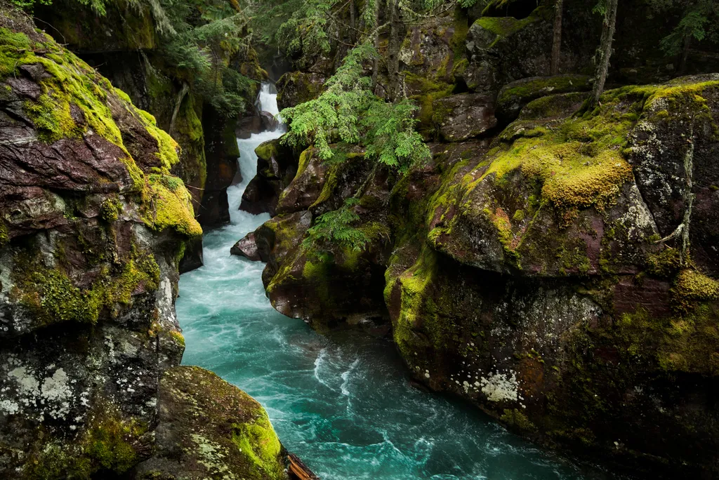 Avalanche CreekHikingPhoto: NPS / public domain2.7 mi
 Saint Mary RiverCanoeingPhoto: Royalbroil, CC BY-SA 3.0 (via Wikimedia Commons)4.9 mi
- Glacier National ParkRock climbing8.6 mi
Source: Roamze catalog (indexable pages within 10 miles, PostGIS distance)
 Reynolds MountainSummit · ~3 min drivePhoto: Public domain (via Wikimedia Commons)
 Little MatterhornSummit · ~4 min drivePhoto: NPS Natural Resources
NPS Photo/Jacob W. Frank, Public domain (via Wikimedia Commons)
 Mount BrownSummit · ~6 min drivePhoto: GlacierNPS, CC BY 2.0 (via Wikimedia Commons)
 Haystack ButteSummit · ~8 min drivePhoto: oliver.dodd, CC BY 2.0 (via Wikimedia Commons)
 Mount JacksonSummit · ~9 min drivePhoto: Acroterion, CC BY-SA 4.0 (via Wikimedia Commons)
 Mount GouldSummit · ~10 min drivePhoto: National Park Service, Public domain (via Wikimedia Commons)
 Stanton MountainSummit · ~10 min drivePhoto: GlacierNPS, Public domain (via Wikimedia Commons)
 Angel WingSummit · ~11 min drivePhoto: Jeff P from Berkeley, CA, USA, CC BY 2.0 (via Wikimedia Commons)
 Altyn PeakSummit · ~19 min drivePhoto: Traveler100, CC BY-SA 3.0 (via Wikimedia Commons)
 Triple Divide PeakSummit · ~22 min drivePhoto: Eggbones, CC BY-SA 4.0 (via Wikimedia Commons)
Also worth it near here
 Monument FallsWaterfall · ~2 min drivePhoto: GlacierNPS, Public domain (via Wikimedia Commons)
- Avalanche LakeLake fishing · ~2 min drive
- Avalanche Fishing Trail1(TriCAD Edited)Hiking · ~2 min drivePhoto: Greg Willis from Denver, CO, usa, CC BY-SA 2.0 (via Wikimedia Commons)
- Avalanche CampgroundCamping · ~4 min drive
