Uphill Access to Paradise
- 0.3 mi
- round trip
- 319 ft
- climb
- 5,246 ft
- high point
- Out and back
- route
- May–Sep
- best months
Is Uphill Access to Paradise open right now?
Alert in the area
The Forest Service lists an alert for Lolo National Forest.
East Fork Big Creek Road & Trail Closure- Superior Ranger District
Agency alert covering Lolo National Forest · Order 26-003- · USFS · Lolo National Forest
As of · Source: USFS · Lolo National Forest. Agencies don't list every closure — check before you go.
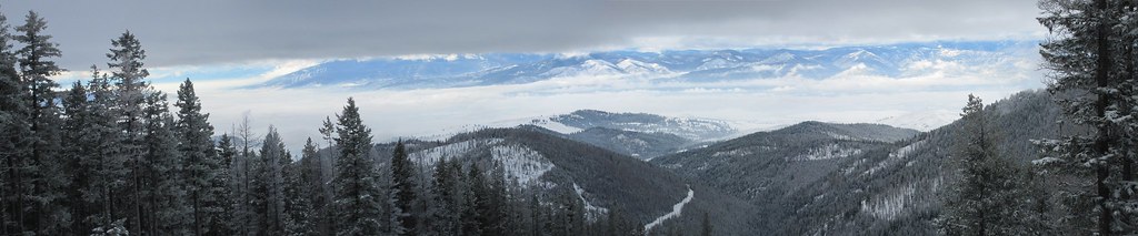
Uphill Access to Paradise is a short ski touring route in the Missoula Ranger District of Lolo National Forest in western Montana. The Forest Service manages the land, and the trail starts within a quarter mile of the high point of the route, making it a convenient out-and-back for anyone already in the area. The climb is front-loaded, with the steepest section coming about a fifth of the way in. It rises about 245 feet from the start to a high point of 5,246 feet, and the whole trip, a little over half a mile, ends at nearly the same elevation as it begins. That puts the route at the higher end of the surrounding terrain, with the low point of the climb sitting at about 4,972 feet. For timing, summer is the mildest stretch. Typical averages from a nearby weather station in Potomac show July and August highs around 82°F with lows near 40°F. That station sits roughly 1,500 feet lower than the route, so expect cooler temperatures up top. Winter is cold and snowy, with January highs near 30°F and snow on about six days. Snowbowl Mountain Bike is about a mile away, and Twin Lakes and Worden Lake lie within 4 miles. For climbing, the Northwest Region is about 6.5 miles off.
 Snowbowl Mountain BikeHikingPhoto: Evan-Lovely, CC BY-SA 2.0 (via Flickr)1.2 mi
- Grant Creek RavineHiking2.6 mi
- Snowbowl OverlookMountain biking3.3 mi
 Stuart PeakMountain bikingPhoto: nklette, CC BY 3.0 (via Wikimedia Commons)3.4 mi
- Twin LakesHiking3.4 mi
- FencelineMountain biking3.6 mi
- Worden LakeHiking3.7 mi
- Northwest RegionRock climbing6.5 mi
Source: Roamze catalog (indexable pages within 10 miles, PostGIS distance)
- Montana SnowbowlDownhill skiing · ~1 min drive
- Pattee South -- Main LoopCross-country skiing · ~23 min drive
- Mountain ViewCross-country skiing · ~46 min drive
- Rattlesnake TrailCross-country skiing · ~9 min drive
- Hill LoopCross-country skiing · ~22 min drive
- South Loop ConnectorCross-country skiing · ~23 min drive
- Rattlesnake TrailCross-country skiing · ~9 min drive
- Herringbone HillCross-country skiing · ~22 min drive
- South LoopCross-country skiing · ~23 min drive
- Rattlesnake TrailCross-country skiing · ~9 min drive
Best time to visit Uphill Access to Paradise
Best months: May–September. Best months have typical highs of 55–85 °F, lows of 30 °F or warmer (32 °F where the station doesn't record snow), at most one snowy day and no more than 12 wet days.
Jan
30° / 8°
8 wet · 6 snow
Feb
35° / 9°
6 wet · 5 snow
Mar
45° / 17°
6 wet · 3 snow
Apr
54° / 24°
6 wet · 1 snow
May
64° / 30°
8 wet
Jun
71° / 38°
9 wet
Jul
82° / 41°
6 wet
Aug
82° / 39°
4 wet
Sep
71° / 32°
5 wet
Oct
55° / 23°
7 wet · 1 snow
Nov
39° / 16°
8 wet · 3 snow
Dec
29° / 9°
8 wet · 6 snow
Typical high / low (°F) and days with rain or snow, 1991–2020. Measured at Potomac, MT, 22.6 mi away at 3,690 ft. The station sits about 1,600 ft lower than this place, so expect it a little cooler here. Source: NOAA NCEI U.S. Climate Normals 1991–2020.
Map and trail data © OpenStreetMap contributors
