Rattlesnake Trail
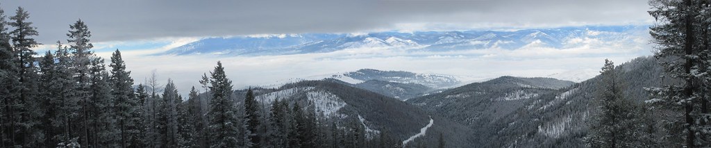
 Photo: nklette, CC BY 3.0 (via Wikimedia Commons)
- 3.1 mi
- distance
- 967 ft
- climb
Caution at last check
Agency alerts are in effect for this area; weather is good · USFS, OpenWeather · checked 19 h ago
Is Rattlesnake Trail open right now?
Alert in the area
The Forest Service lists an alert for Lolo National Forest.
East Fork Big Creek Road & Trail Closure- Superior Ranger District
Agency alert covering Lolo National Forest · Order 26-003- · USFS · Lolo National Forest
As of · Source: USFS · Lolo National Forest. Agencies don't list every closure — check before you go.
Rattlesnake Trail is a mountain biking route in the Rattlesnake Wilderness, part of the Missoula Ranger District of Lolo National Forest in western Montana. The Forest Service manages the land, and the nearest town is Schley, about 9 miles away. The trail is about 3 miles long, with a total climb of roughly 970 feet from a starting elevation of about 5,150 feet to a high point near 6,100 feet. The steepest stretch comes early on, with a grade of about 13%, and the route also includes a small descent of about 340 feet. Several other destinations sit close by. Rattlesnake Creek and Wrangle Creek are both hikes within a mile, and the Wrangel Creek Trail offers more mountain biking. Climbers can head to the Northwest Region, about a mile away.
Local outfitters
- Granite Peak RV Resort14 mi away
Not on Roamze yet. Their page has how to reach them.
Keep exploring — more rides worth the drive
 Photo: nklette, CC BY 3.0 (via Wikimedia Commons)
Porcupine Creek
~3 min drive
Porcupine Creek is a 3.39-mile trail in West Fork Gold Creek, Montana, gaining 2,182 ft.
RIDE
Fenceline
~14 min drive
3.7 mi · Easy
Photo: nklette, CC BY 3.0 (via Wikimedia Commons)Carter Lake
~3 min drive
Carter Lake is a 3.43-mile loop with 1,540 ft elevation gain in West Fork Gold Creek, Montana.
Photo: nklette, CC BY 3.0 (via Wikimedia Commons)Three Cougars
~6 min drive
Three Cougars is a 2.90-mile trail in West Fork Gold Creek, Montana, gaining 369 ft.
 Photo: nklette, CC BY 3.0 (via Wikimedia Commons)
Boulder Lake
~6 min drive
3.49-mile trail in West Fork Gold Creek, Montana with 1,209 ft of elevation gain
Photo: nklette, CC BY 3.0 (via Wikimedia Commons)Lower Gold Ridge (Archive)
~6 min drive
0.09-mile trail in West Fork Gold Creek, Montana, gaining 10 feet.
 Photo: nklette, CC BY 3.0 (via Wikimedia Commons)
Rattlesnake Creek
~9 min drive
14.11-mile trail at Rattlesnake Trailhead, Montana
 Photo: nklette, CC BY 3.0 (via Wikimedia Commons)
Stuart Peak
~12 min drive
7.34-mile trail in Rattlesnake Trailhead system, Montana, gaining 3,966 ft
 Photo: nklette, CC BY 3.0 (via Wikimedia Commons)
Sawmill Curry
~14 min drive
0.58-mile trail in Rattlesnake Trailhead, Montana, gaining 437 ft of elevation.
 Photo: nklette, CC BY 3.0 (via Wikimedia Commons)
Curry
~15 min drive
1.89-mile trail in Rattlesnake Trailhead system, 1,259 ft elevation gain
Map and trail data © OpenStreetMap contributors
