Spanish Creek
At a glance
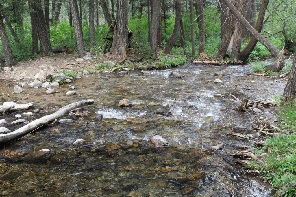
Spanish Creek is a 3-mile paddling stretch near Gallatin Gateway, Montana, about 8 miles from the town of Beacon Point. The creek flows year-round, with USGS models estimating an average flow of about 94 cubic feet per second and a gradient of about 71.8 feet per mile. Summer is the most comfortable time to paddle. Typical averages from a nearby weather station show July highs around 83°F with lows near 51°F, and September cools to highs around 72°F. That station sits about 640 feet lower than the creek, so temperatures on the creek run a little cooler. Several other outdoor spots lie within a few miles. Wilson Creek Divide Road and FS 649 are mountain biking routes about 3 miles away, and the Sheep Rock hike is about 3.5 miles off. Spanish Creek Cabin, about 5 miles away, offers a place to stay.
- distance
- 3.0 mi
- high point
- 5,416 ft
- best months
- May–Oct
Near: Beacon Point, Montana · 8 mi
Best time to visit Spanish Creek
Best months: May–October. Best months have typical highs of 55–85 °F, lows of 30 °F or warmer (32 °F where the station doesn't record snow), at most one snowy day and no more than 12 wet days.
Jan
34°
15°
6 wet
Feb
37°
17°
6 wet
Mar
47°
25°
8 wet
Apr
55°
31°
10 wet
May
64°
39°
12 wet
Jun
72°
45°
12 wet
Jul
83°
51°
8 wet
Aug
82°
50°
7 wet
Sep
72°
42°
7 wet
Oct
58°
33°
8 wet
Nov
43°
22°
7 wet
Dec
34°
15°
6 wet
Typical high / low (°F) and days with rain or snow, 1991–2020. Measured at Bozeman 6 W Exp Farm, MT, 14 mi away at 4,775 ft. The station sits about 600 ft lower than this place, so expect it a little cooler here. This station doesn't record snowfall. Source: NOAA NCEI U.S. Climate Normals 1991–2020.
Been here? Tell people how it was.
- Wilson Creek Divide RoadMountain biking3.1 mi
- FS 649Mountain biking3.2 mi
- Scorched EarthRock climbing3.5 mi
- Endless Summer WallRock climbing3.5 mi
 Sheep RockHikingPhoto: Forest Service - Northern Region, Public Domain Mark (via Flickr)3.5 mi
 Spanish Creek CabinCampingPhoto: Recreation.gov (RIDB) / public domain4.9 mi
- Spire RockCamping6 mi
- Gallatin RiverRiver fishing6.3 mi
 Gallatin RiverCanoeingPhoto: Jim from Lexington, KY, USA, CC BY-SA 2.0 (via Wikimedia Commons)~27 min drive
- Trapper SpringsTubing~26 min drive
- Canaday Boat LaunchBoat launch~27 min drive
 East Gallatin RiverCanoeingPhoto: Mike Cline, Public domain (via Wikimedia Commons)~34 min drive
- Warm Springs Day UseBoat launch~27 min drive
- Ennis Lake CircumnavigationCanoeing~33 min drive
- Fall Creek Day UseBoat launch~28 min drive
- O'Dell CreekCanoeing~41 min drive
- Hood Creek Boating SiteBoat launch~28 min drive
- North Meadow CreekCanoeing~43 min drive
Also worth it near here
- Wilson Creek Divide RoadMountain biking~5 min drive
- Scorched EarthRock climbing~6 min drive
- Indian RidgeHikingPhoto: Forest Service - Northern Region, Public Domain Mark (via Flickr)~7 min drive
 Storm CastleSummitPhoto: Mike Cline, CC BY-SA 4.0 (via Wikimedia Commons)~8 min drive
- Spanish Creek CabinCamping~8 min drive
Conditions and forecast
Daily highs and lows, wind and the chance of precipitation at Start for the next 7 days, from the Open-Meteo model.
Ask about this place
Questions about Spanish Creek: conditions, access, timing. Answers say when something isn't known.
Local outfitters
- Flying Pig Adventures43 mi away
Not on Roamze yet. Their page has how to reach them.
