Ward Creek
- 5.5 mi
- round trip
- 2,362 ft
- climb
- 6,397 ft
- high point
- Out and back
- route
- Jul–Sep
- best months
Caution today
Agency alerts are in effect for this area; weather is marginal · USFS, OpenWeather · checked 10 h ago
Is Ward Creek open right now?
Alert in the area
The Forest Service lists an alert for Lolo National Forest.
East Fork Big Creek Road & Trail Closure- Superior Ranger District
Agency alert covering Lolo National Forest · Order 26-003- · USFS · Lolo National Forest
As of · Source: USFS · Lolo National Forest. Agencies don't list every closure — check before you go.
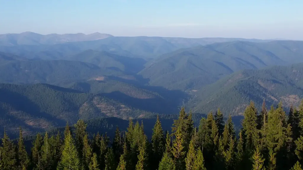
Ward Creek is a hard hike in the Superior Ranger District of Lolo National Forest in western Montana, managed by the Forest Service. The route is about 5.5 miles long, with a one-way climb of about 2,360 feet from a low point near 4,000 feet to a high point around 6,400 feet. Summer is the most comfortable time to go. Typical averages from a nearby weather station at a similar elevation show July and August highs around 70°F with only about six wet days a month, while winter highs stay in the upper 20s. The trail is natural-surface and allows both horses and bikes. Several other hikes sit within a few miles, including Up Up Ridge and Hub Hazel Lakes, and Up Up Lookout campground is about 3 miles away.
- Up Up RidgeHiking1.7 mi
- Square LakeHiking2.1 mi
- UP-UP / DEER CREEKHiking2.1 mi
- Hub Hazel LakesHiking2.3 mi
 Up Up LookoutCampingPhoto: Recreation.gov (RIDB) / public domain3.2 mi
- Deer Creek CampgroundCamping4.9 mi
- Cabin City CgCamping7 mi
- Twelvemile CreekCanoeing9.3 mi
Source: Roamze catalog (indexable pages within 10 miles, PostGIS distance)
 Crystal LakeHiking · ~7 min drivePhoto: Forest Service - Northern Region, Public Domain Mark (via Flickr)
- Up Up RidgeHiking · ~3 min drive
- Square LakeHiking · ~4 min drive
- UP-UP / DEER CREEKHiking · ~4 min drive
- Haggerty RidgeHiking · ~17 min drive
- Hub Hazel LakesHiking · ~4 min drive
- Clear LakeHiking · ~7 min drive
- BIG CREEK / RIVERS CREEKHiking · ~12 min drive
- Three Lakes DivideHiking · ~19 min drive
- Up Up CreekHiking · ~4 min drive
Best time to visit Ward Creek
Best months: July–September. Best months have typical highs of 55–85 °F, lows of 30 °F or warmer (32 °F where the station doesn't record snow), at most one snowy day and no more than 12 wet days.
Jan
28° / 19°
19 wet
Feb
28° / 19°
17 wet
Mar
34° / 22°
19 wet
Apr
40° / 27°
17 wet
May
50° / 36°
15 wet
Jun
58° / 42°
13 wet
Jul
70° / 52°
6 wet
Aug
69° / 51°
6 wet
Sep
59° / 44°
8 wet
Oct
44° / 32°
13 wet
Nov
32° / 23°
17 wet
Dec
27° / 18°
18 wet
Typical high / low (°F) and days with rain or snow, 1991–2020. Measured at Mullan Pass Vor/Dme, ID, 18.6 mi away at 6,028 ft. This station doesn't record snowfall. Source: NOAA NCEI U.S. Climate Normals 1991–2020.
Closures we've recorded since August 2026
Ward Creek Road Closure- Superior Ranger District
Lolo National Forest · Order dated December 16, 2025; seen Aug 23, 2026 → lifted Sep 10, 2026 · Forest Service
