Ural Creek
- 4.7 mi
- round trip
- 1,744 ft
- climb
- 4,431 ft
- high point
- Out and back
- route
- May–Sep
- best months
Is Ural Creek open right now?
Closure in the area
There's a closure order in Kootenai National Forest. It doesn't name Ural Creek, so check the source for the area it covers.
Kootenai Flood Event & Inaccessible Areas
Agency closure covering Kootenai National Forest · USFS · Kootenai National Forest
Updated Skillet Fire Area, Road, Trail Closure
Agency alert covering Kootenai National Forest · Order 01-10- · USFS · Kootenai National Forest
Upper Young Creek Road #7202 Closure
Agency alert covering Rexford Ranger District · Order 01-14-01-26-01 · USFS · Rexford Ranger District
As of · Source: USFS · Kootenai National Forest. Agencies don't list every closure — check before you go.
Ural Creek is a moderate out-and-back hike in the Rexford Ranger District of Montana's Kootenai National Forest, about 4.7 miles long with a one-way elevation gain of 1,744 feet. The trail starts at the Ural Creek TH 66 parking area and climbs from a low point of 2,685 feet to a high of 4,431 feet. The route is natural-surfaced and open to bikes, and the Forest Service manages the land. The trail is typically open from June 1 through October 31. Summer is the most comfortable time to go. Typical averages from a nearby weather station at Fortine, which sits about 1,400 feet lower, show July highs around 84°F with lows near 50°F, while September cools to highs around 72°F. Winter is cold, with January highs near 30°F. Ziegler Mountain and Tenmile are both about 2.9 miles away, and Rocky Gorge Campground is about 4 miles off. Barron Creek Boating Site, about 6 miles away, offers river fishing.
Local outfitters
- Indian Springs Montana24 mi away
- Kootenai River Campground31 mi away
Not on Roamze yet. Their page has how to reach them.
- ZIEGLER MOUNTAINHiking2.9 mi
- TenmileHiking2.9 mi
- East Branch Big CreekHiking3.8 mi
- Warex PeakHiking3.8 mi
- Rocky Gorge CampgroundCamping4 mi
- Barron Creek Boating SiteRiver fishing6.1 mi
- McGuire Mtn. Lookout RentalCamping6.4 mi
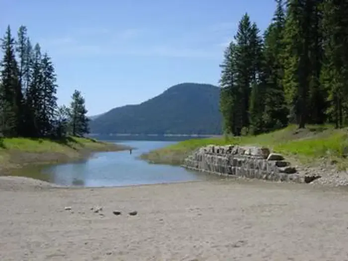 McGillivray Campground (MT)CampingPhoto: Recreation.gov (RIDB) / public domain8.3 mi
Source: Roamze catalog (indexable pages within 10 miles, PostGIS distance)
- ZIEGLER MOUNTAINHiking · ~5 min drive
- TenmileHiking · ~5 min drive
- Rocky Gorge Nature TrailHiking · ~7 min drive
- Peck GulchHiking · ~16 min drive
- East Branch Big CreekHiking · ~6 min drive
- Parsnip OverlookHiking · ~11 min drive
- Banfield RidgeHiking · ~16 min drive
- Warex PeakHiking · ~7 min drive
- PECK GULCH NATUREHiking · ~15 min drive
- South Fork FivemileHiking · ~18 min drive
Best time to visit Ural Creek
Best months: May–September. Best months have typical highs of 55–85 °F, lows of 30 °F or warmer (32 °F where the station doesn't record snow), at most one snowy day and no more than 12 wet days.
Jan
30° / 18°
9 wet
Feb
35° / 19°
7 wet
Mar
46° / 25°
7 wet
Apr
56° / 31°
7 wet
May
68° / 38°
9 wet
Jun
73° / 45°
10 wet
Jul
84° / 50°
6 wet
Aug
83° / 47°
5 wet
Sep
72° / 40°
6 wet
Oct
55° / 31°
7 wet
Nov
39° / 25°
10 wet
Dec
29° / 17°
10 wet
Typical high / low (°F) and days with rain or snow, 1991–2020. Measured at Fortine 1 N, MT, 20.8 mi away at 3,000 ft. The station sits about 1,400 ft lower than this place, so expect it a little cooler here. This station doesn't record snowfall. Source: NOAA NCEI U.S. Climate Normals 1991–2020.
