Spy Mtn.
- 9.1 mi
- round trip
- 988 ft
- climb
- 7,221 ft
- high point
- Out and back
- route
Is Spy Mtn. open right now?
Alert in the area
The Forest Service lists 5 alerts for Flathead National Forest.
Camp Creek Fire Updated Trail Closure
Agency alert covering Flathead National Forest · Order 01-10- · USFS · Flathead National Forest
FK&L Area Closed to Public Access Starting July 22, 2026
Agency alert covering Flathead National Forest · Order 01-10- · USFS · Flathead National Forest
Trail 800 Tally-Ashely Closure
Agency alert covering Flathead National Forest · Order 01-10- · USFS · Flathead National Forest
Ryan Creek Occupancy and Use Order
Agency alert covering Flathead National Forest · Order 1-10- · USFS · Flathead National Forest
Logan Creek Hoke Creek Closure
Agency alert covering Flathead National Forest · Order 01-10- · USFS · Flathead National Forest
As of · Source: USFS · Flathead National Forest. Agencies don't list every closure — check before you go.
Spy Mountain is a hard hike in the Great Bear Wilderness, part of the Spotted Bear Ranger District of Flathead National Forest in northwest Montana. The Forest Service manages the land, and the trail is a natural-surface out-and-back that runs about 9 miles round trip, with a one-way climb of roughly 990 feet from a low point of about 6,640 feet to a high of about 7,220 feet. The trail is not accessible, and bikes are not allowed. Horses are permitted, so it works for riders as well as hikers. Several other destinations sit within a few miles. Green Mountain Lookout is about 1.3 miles away, and Schafer Creek is about 1.5 miles away. Beaver Creek Campground is about 3.5 miles off, and the South Fork Flathead River offers paddling about 9.7 miles away.
Local outfitters
- North American RV Park & Yurt Village44 mi away
- Rocky Mountain Outfitter45 mi away
Not on Roamze yet. Their page has how to reach them.
Keep exploring — more trails worth the drive
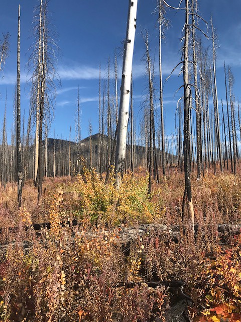 Photo: Forest Service - Northern Region, Public Domain Mark (via Flickr)
Webb Lake
~6 min drive
3.34-mile out-and-back trail to Webb Lake in Montana
 Photo: Forest Service - Northern Region, Public Domain Mark (via Flickr)
Lower Twin
~14 min drive
17.24-mile out-and-back trail in Montana with 2,172 ft elevation gain.
HIKE
TRAIL CREEK CONNECTOR
~5 min drive
2.06-mile out-and-back trail with 655 ft elevation gain and loss in Montana
Photo: Forest Service - Northern Region, Public Domain Mark (via Flickr)Crossover Mtn.
~13 min drive
3.92-mile out-and-back trail in Montana with 1,641 ft of elevation gain.
Photo: Forest Service - Northern Region, Public Domain Mark (via Flickr)Soldier Creek
~15 min drive
12.69-mile out-and-back trail in Montana with 1,128 ft gain.
HIKE
Dean Creek
~7 min drive
0.43-mile out-and-back trail at Dean Creek in Montana.
 Photo: Sam Beebe, CC BY 2.0 (via Flickr)
Porter Creek
~16 min drive
4.68-mile out-and-back trail in Montana with 1,359 ft elevation gain.
Photo: Sam Beebe, CC BY 2.0 (via Flickr)Lodgepole Mtn.
~16 min drive
15.88-mile out-and-back trail at Lodgepole Mtn in Montana with 438 ft of elevation gain.
HIKE
Red Creek
~12 min drive
2.13-mile out-and-back trail in Montana with 290 ft elevation gain.
HIKE
Green Mountain Lookout
~2 min drive
3.04-mile out-and-back trail to Green Mountain Lookout in Montana, 805 ft elevation gain.
Route details
- Distance
- 9.1 mi round trip
- Climbing
- About 988 ft
- Summit
- 7,104 ft
- Difficulty
- Hard
- Time
- About 3.5 hours
Season
Season: Year-round.
Questions about this route
How long is the Spy Mtn. on Spy Mountain?
About 9.1 mi round trip.
How much elevation gain is on the Spy Mtn.?
About 988 ft of climbing round trip.
How hard is the Spy Mtn.?
It is rated hard.
How long does the Spy Mtn. take?
About 3.5 hours round trip.
When is the best time for the Spy Mtn.?
Year-round.
Conditions and forecast on Spy Mountain
Daily highs and lows, wind and the chance of precipitation at the summit and route start for the next 7 days, from the Open-Meteo model.
