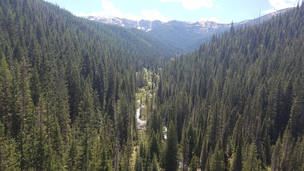
Saint Regis River
 Photo: Ken Gallager, CC BY-SA 4.0 (via Wikimedia Commons)
- 10.7 mi
- distance
- 4,178 ft
- high point
- May–Sep
- best months
Is Saint Regis River open right now?
Alert in the area
The Forest Service lists an alert for Lolo National Forest.
East Fork Big Creek Road & Trail Closure- Superior Ranger District
Agency alert covering Lolo National Forest · Order 26-003- · USFS · Lolo National Forest
As of · Source: USFS · Lolo National Forest. Agencies don't list every closure — check before you go.
The Saint Regis River is a paddling route in Montana's Lolo National Forest, within the Superior Ranger District and managed by the Forest Service. The trip is about 11 miles long, and the surrounding area offers a mix of hiking and camping close by. Summer is the most comfortable time to paddle. Typical averages from a nearby weather station show July highs around 84°F with lows near 43°F, while winter highs stay near freezing. That station sits about 1,000 feet lower than the river, so temperatures on the water run cooler. The RAINY/DOMINION LOOP hike starts just 0.3 miles away, and the Hiawatha Rail Trail is about 3 miles off. For an overnight stay, Shoshone Park Kitchen is roughly 7 miles away, and the North Fork Saint Joe River, another paddling option, is about 9 miles away.
Local outfitters
- CDA River RV35 mi away
- Lost Moose Campground40 mi away
Not on Roamze yet. Their page has how to reach them.
- RAINY/DOMINION LOOPHiking0.3 mi
- DOMINION CREEKHiking1 mi
- Hiawatha Rail TrailHiking3.2 mi
- DOMINION PEAKHiking3.6 mi
- TAFT SUMMIT/T-FALLSHiking3.8 mi
- Shoshone Park KitchenCamping7 mi
- Arid Peak LookoutCamping9 mi
- North Fork Saint Joe RiverCanoeing9.1 mi
Source: Roamze catalog (indexable pages within 10 miles, PostGIS distance)
- North Fork Saint Joe RiverCanoeing · ~16 min drive
- Prichard Bridge Boating SiteBoat launch · ~41 min drive
- Avery Creek CabinTubing · ~41 min drive
- Prospect CreekCanoeing · ~18 min drive
- Calder Boat LaunchBoat launch · ~51 min drive
- South Fork Coeur d'Alene RiverCanoeing · ~20 min drive
- North Shore Boat Ramp/Day UseBoat launch · ~52 min drive
- Prichard CreekCanoeing · ~31 min drive
- Freeman's EddyBoat launch · ~56 min drive
- Fishhook CreekCanoeing · ~33 min drive
Best time to visit Saint Regis River
Best months: May–September. Best months have typical highs of 55–85 °F, lows of 30 °F or warmer (32 °F where the station doesn't record snow), at most one snowy day and no more than 12 wet days.
Jan
31° / 17°
Feb
36° / 18°
Mar
44° / 23°
Apr
54° / 27°
May
65° / 34°
Jun
71° / 40°
Jul
84° / 43°
Aug
83° / 41°
Sep
72° / 35°
Oct
53° / 30°
Nov
38° / 24°
Dec
30° / 18°
Typical high / low (°F) and days with rain or snow, 1991–2020. Measured at Haugan 1 W, MT, 8.5 mi away at 3,160 ft. The station sits about 1,000 ft lower than this place, so expect it a little cooler here. This station doesn't record snowfall. Source: NOAA NCEI U.S. Climate Normals 1991–2020.