Hidden Lake
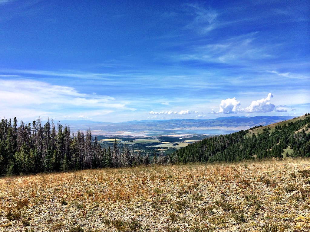 Photo: Forest Service - Northern Region, CC BY 2.0 (via Flickr)
- 9.9 mi
- round trip
- 1,046 ft
- climb
- 8,583 ft
- high point
- Out and back
- route
Is Hidden Lake open right now?
No closures listed
The Forest Service lists no closures for Helena-Lewis and Clark National Forest.
As of · Source: USFS · Helena-Lewis and Clark National Forest. Agencies don't list every closure — check before you go.
Hidden Lake is a hard hike in Montana's Helena-Lewis and Clark National Forest, within the Townsend Ranger District. The trail is a natural-surface out-and-back, about 9.9 miles long, with a total elevation gain of 1,046 feet. It runs from a low point of about 7,510 feet to a high point of about 8,583 feet, and the Forest Service manages the surrounding land. The route is open year round. Horses and bikes are both allowed, so it works for a range of travelers. Plan for a full day on foot, and consider pairing it with an overnight at one of the nearby campgrounds. The closest neighbor is the Little Camas Creek hike, half a mile away. West Big Belts Gfa - Duck Creek Cua and Gipsy Lake Campground both sit about 2 miles off. Climbers can find the Big Belt Mountains climbing area roughly 6.6 miles away.
Local outfitters
- MTBCity40 mi away
Not on Roamze yet. Their page has how to reach them.
Keep exploring — more trails worth the drive
Photo: Forest Service - Northern Region, CC BY 2.0 (via Flickr)LITTLE CAMAS CREEK
Next door
7.52-mile out-and-back trail in Montana with 1,913 ft elevation gain and loss.
 Photo: Forest Service - Northern Region, CC BY 2.0 (via Flickr)
Gipsy
~4 min drive
12.41-mile out-and-back trail in Montana with 908 ft elevation gain
Photo: Forest Service - Northern Region, CC BY 2.0 (via Flickr)Gipsy Lake Campground Loop
~4 min drive
0.85-mile out-and-back out-and-back at Gipsy Lake Campground in Montana with 91 ft of elevation gain.
HIKE
Needles
~7 min drive
Needles is a 4.41-mile out-and-back trail in Montana with 14 feet of elevation gain.
 Photo: Forest Service - Northern Region, CC BY 2.0 (via Flickr)
Holloway
~12 min drive
6.05-mile out-and-back trail in Montana with 2,736 ft elevation gain.
HIKE
Grace Lake
~6 min drive
1.98-mile out-and-back trail to Grace Lake in Montana with 672 ft of elevation gain.
HIKE
Pickfoot
~9 min drive
5.44-mile out-and-back trail in Montana with 32 ft gain and 1,528 ft loss.
HIKE
Belt Mountain Divide
~4 min drive
18.70-mile out-and-back trail on Belt Mountain Divide in Montana with 1,701 ft gain.
HIKE
Cayuse Spur
~28 min drive
2.08-mile out-and-back trail in Montana with 619 ft of elevation gain.
HIKE
West Fork Cabin Gulch
~14 min drive
5.60-mile out-and-back trail in Montana with 829 ft gain.

