East-Side Sun Trail
- 3.6 mi
- round trip
- 2,137 ft
- climb
- 5,507 ft
- high point
- Out and back
- route
- May–Sep
- best months
Is East-Side Sun Trail open right now?
Alert in the area
The Forest Service lists an alert for Rocky Mountain Ranger District.
Camp Creek Fire Trail Closure
Agency alert covering Rocky Mountain Ranger District · Order 01-10- · USFS · Rocky Mountain Ranger District
As of · Source: USFS · Rocky Mountain Ranger District. Agencies don't list every closure — check before you go.
East-Side Sun Trail is a 7.1-mile out-and-back hike in the Bob Marshall Wilderness, part of the Rocky Mountain Ranger District of the Helena-Lewis and Clark National Forest in Montana. The Forest Service manages the land, and the trail crosses wilderness boundaries, so plan on backcountry conditions. The route starts at about 5,236 feet and climbs steadily to a high point of 5,507 feet, with a total gain of 2,137 feet for the round trip. The steepest stretch comes at about 2.9 miles in, where the grade reaches 13%. The trail is rated moderate. Summer is the most comfortable time to go. Typical averages from the Gibson Dam weather station, about 15 miles away, show July highs near 79°F with lows around 45°F, and temperatures on the trail run cooler than that station's figures. Beartop Lookout and North Fk Sun both sit about 0.1 mile from the trail. Rock Creek is under a mile away, and the North Fork Sun River offers canoeing about 6 miles off.
Local outfitters
- Choteau Mountain View RV Campground35 mi away
Not on Roamze yet. Their page has how to reach them.
- Beartop LookoutHiking0.1 mi
- North Fk SunHiking0.1 mi
- Rock CreekHiking0.8 mi
- Gates Creek-Moose CreekHiking1 mi
- RED SHALE- LICK CREEKHiking1.1 mi
- North Fork Sun RiverCanoeing6.1 mi
- Mill Falls CgCamping8.7 mi
- Green Gulch Dispersed Camp CampgroundCamping9.3 mi
Source: Roamze catalog (indexable pages within 10 miles, PostGIS distance)
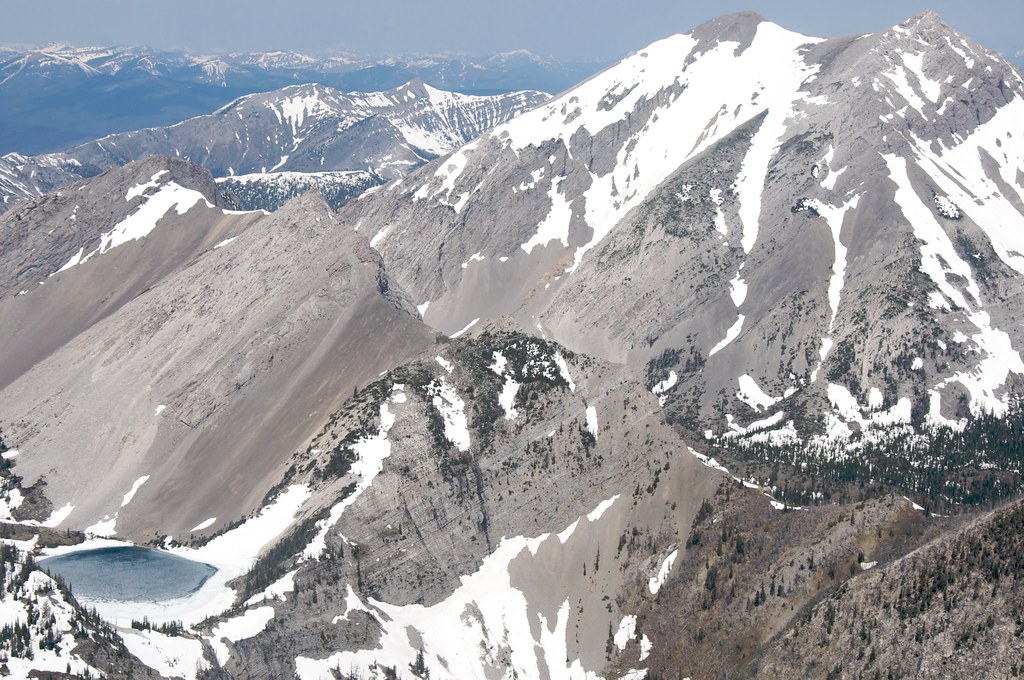 Our LakeHiking · ~13 min drivePhoto: Sam Beebe, CC BY 2.0 (via Flickr)
 Three SistersHiking · ~15 min drivePhoto: Sam Beebe, CC BY 2.0 (via Flickr)
- Rock CreekHiking · ~1 min drive
- RED SHALE- LICK CREEKHiking · ~2 min drive
- Headquarters CreekHiking · ~13 min drivePhoto: Sam Beebe, CC BY 2.0 (via Flickr)
- Dryden CreekHiking · ~3 min drive
- Sulphur CreekHiking · ~6 min drive
- North Fk SunHiking · Next door
- North Fork Sun CutacrossHiking · ~4 min drive
- CABIN CREEK ADMIN CONNECTORHiking · ~9 min drive
Best time to visit East-Side Sun Trail
Best months: May–September. Best months have typical highs of 55–85 °F, lows of 30 °F or warmer (32 °F where the station doesn't record snow), at most one snowy day and no more than 12 wet days.
Jan
36° / 12°
5 wet
Feb
36° / 12°
6 wet
Mar
42° / 18°
7 wet
Apr
50° / 25°
7 wet
May
59° / 33°
10 wet
Jun
67° / 39°
10 wet
Jul
79° / 45°
7 wet
Aug
78° / 43°
6 wet
Sep
67° / 36°
6 wet
Oct
54° / 29°
6 wet
Nov
42° / 20°
5 wet
Dec
35° / 13°
5 wet
Typical high / low (°F) and days with rain or snow, 1991–2020. Measured at Gibson Dam, MT, 14.7 mi away at 4,590 ft. The station sits about 900 ft lower than this place, so expect it a little cooler here. This station doesn't record snowfall. Source: NOAA NCEI U.S. Climate Normals 1991–2020.

Map and trail data © OpenStreetMap contributors
