East Big Belts Gfa - Birch Creek Basin Cua
- May–Sep
- best months
Caution at last check
Agency alerts are in effect for this area; weather is marginal · USFS, OpenWeather · checked 18 h ago
Is East Big Belts Gfa - Birch Creek Basin Cua open right now?
No closures listed
The Forest Service lists no closures for Helena-Lewis and Clark National Forest.
As of · Source: USFS · Helena-Lewis and Clark National Forest. Agencies don't list every closure — check before you go.
- At 6,406 ft
- Townsend Ranger DistrictHelena-Lewis and Clark National Forest
East Big Belts Gfa - Birch Creek Basin Cua is a Forest Service campground in the Townsend Ranger District of the Helena-Lewis and Clark National Forest in Montana. It sits within the larger East Big Belts Gfa and Birch Creek Basin Cua areas, and the Forest Service manages the land. The site is a compact base for exploring the surrounding trails and water. Gipsy Lake Campground and Thompson Guard Station are both within a quarter mile, and the Gipsy and Hidden Lake hikes start close by. That makes it easy to string together a few short outings in one visit. Summer is the most comfortable time to go. Typical averages from a nearby weather station at White Sulphur Springs show July highs around 82°F with lows near 48°F, and the station sits about 1,400 feet lower than the campground, so temperatures here run cooler. Paddlers can head to Big Birch Creek, about 4 miles away, and climbers will find the Big Belt Mountains roughly 8 miles off.
Local outfitters
- MTBCity42 mi away
Not on Roamze yet. Their page has how to reach them.
- Gipsy Lake CampgroundCamping0.1 mi
 GipsyHikingPhoto: Forest Service - Northern Region, CC BY 2.0 (via Flickr)0.1 mi
- Thompson Guard StationCamping0.2 mi
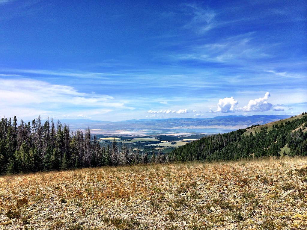 Hidden LakeHikingPhoto: Forest Service - Northern Region, CC BY 2.0 (via Flickr)2.2 mi
- LITTLE CAMAS CREEKHikingPhoto: Forest Service - Northern Region, CC BY 2.0 (via Flickr)2.4 mi
- Big Birch CreekCanoeing3.9 mi
- Big Belt MountainsRock climbing7.7 mi
- Camas CreekCanoeing9 mi
Source: Roamze catalog (indexable pages within 10 miles, PostGIS distance)
- Duck01Camping · Next door
- Thompson StaHut camping · ~2 min drive
- Duck03Camping · Next door
- Duck02Camping · Next door
- Snowbank Rd 139h1 006Camping · ~2 min drive
- Thompson01Camping · ~2 min drive
- Thompson03Camping · ~4 min drive
- Duck05Camping · ~4 min drive
- Duck04Camping · ~4 min drive
- Duck06Camping · ~4 min drive
Best time to visit East Big Belts Gfa - Birch Creek Basin Cua
Best months: May–September. Best months have typical highs of 55–85 °F, lows of 30 °F or warmer (32 °F where the station doesn't record snow), at most one snowy day and no more than 12 wet days.
Jan
33° / 13°
5 wet
Feb
35° / 13°
4 wet
Mar
45° / 21°
6 wet
Apr
53° / 27°
8 wet
May
63° / 35°
11 wet
Jun
71° / 42°
12 wet
Jul
82° / 48°
8 wet
Aug
81° / 47°
7 wet
Sep
71° / 39°
7 wet
Oct
56° / 29°
6 wet
Nov
42° / 20°
5 wet
Dec
33° / 13°
5 wet
Typical high / low (°F) and days with rain or snow, 1991–2020. Measured at White Sulphur Springs #2, MT, 15.1 mi away at 5,040 ft. The station sits about 1,400 ft lower than this place, so expect it a little cooler here. This station doesn't record snowfall. Source: NOAA NCEI U.S. Climate Normals 1991–2020.

