Marble Creek Campground
- Mar–Jun, Sep–Nov
- best months
Caution at last check
Agency alerts are in effect for this area; weather is good · USFS, OpenWeather · checked 18 h ago
Is Marble Creek Campground open right now?
Alert in the area
The Forest Service lists 10 alerts for Mark Twain National Forest.
Crane Lake Dam
Agency alert covering Mark Twain National Forest · USFS · Mark Twain National Forest
Delays on Forest Road 557
Agency alert covering Mark Twain National Forest · USFS · Mark Twain National Forest
Forest Order - Trail 119 Closure Extended (Chadwick Motorized Trail System)
Agency alert covering Mark Twain National Forest · USFS · Mark Twain National Forest
Weather Conditions
Agency alert covering Mark Twain National Forest · USFS · Mark Twain National Forest
Red Bridge Road - Bridge Closure
Agency alert covering Mark Twain National Forest · USFS · Mark Twain National Forest
As of · Source: USFS · Mark Twain National Forest. Agencies don't list every closure — check before you go.
- At 665 ft
- Potosi / Fredericktown Ranger DistrictMark Twain National Forest
Marble Creek, which travels through the National Forest for about 20 miles, is named for its colorful deposits of dolomite, which was mined and used as Taum Sauk Marble; many years ago. The mineral dolomite is the main component of the sedimentary rock that is also called dolomite. It is similar to the mineral calcite but contains magnesium as well as calcium. Just based on looks, the rock dolomite is often impossible to distinguish from limestone, which is composed mainly of calcite. Previously, a grist mill operated in the area operated until 1935. Remains of the grist mill dam and building are still visible today. The site is remote, with the nearest town about 20 minutes away and there is no cell service. This is a great campground to visit if you are looking for a quiet visit to the forest. This is also a great place for swimming and fishing. Campsites are shaded by the tall trees around the area.
Local outfitters
- Two Rivers Canoe Rental44 mi away
Not on Roamze yet. Their page has how to reach them.
- Ozark Trail - Marble CreekHiking1.6 mi
- Rock Pile Mountain WildernessHiking7.4 mi
- River RightRock climbing9 mi
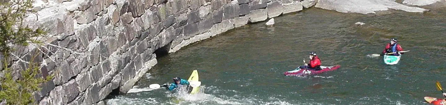 Silver MinesRiver fishing9 mi
- Silver Mines West TrailHiking9 mi
- Beaver SlideRock climbing9 mi
- Splitter Crack WallRock climbing9.1 mi
- Silver Mines East TrailHiking9.1 mi
Source: Roamze catalog (indexable pages within 10 miles, PostGIS distance)
- Silver MinesCamping · ~16 min drive
- Highway KCamping · ~26 min drive
- Bluff View(Clearwater Lake)Camping · ~40 min drive
- Greenville Recreation AreaCamping · ~42 min drive
- Piedmont ParkCamping · ~42 min drive
- River Road ParkCamping · ~43 min drive
- Webb Creek ParkCamping · ~44 min drive
- Sutton BluffCamping · ~44 min drive
- Cook SpringCamping · ~46 min drive
- Council Bluff (Wbr) CgCamping · ~49 min drive
Also worth it near here
- Ozark Trail - Marble CreekMountain biking · ~3 min drive
- Crane Lake Boating SiteBoat launch · ~9 min drive
 Saint Francis RiverCanoeing · ~19 min drivePhoto: NOAA employee, Public domain (via Wikimedia Commons)
 Russell MountainSummit · ~20 min drivePhoto: US Geologic Survey, Public domain (via Wikimedia Commons)
Best time to visit Marble Creek Campground
Best months: March–June and September–November. Best months have typical highs of 55–85 °F, lows of 30 °F or warmer (32 °F where the station doesn't record snow), at most one snowy day and no more than 12 wet days.
Jan
42° / 21°
8 wet · 1 snow
Feb
47° / 24°
8 wet · 2 snow
Mar
57° / 32°
9 wet · 1 snow
Apr
68° / 42°
10 wet
May
76° / 52°
11 wet
Jun
84° / 60°
8 wet
Jul
88° / 65°
8 wet
Aug
87° / 62°
8 wet
Sep
80° / 54°
7 wet
Oct
69° / 42°
8 wet
Nov
56° / 32°
8 wet
Dec
45° / 24°
9 wet · 1 snow
Typical high / low (°F) and days with rain or snow, 1991–2020. Measured at Fredericktown, MO, 15.4 mi away at 760 ft. Source: NOAA NCEI U.S. Climate Normals 1991–2020.
